MyTopo
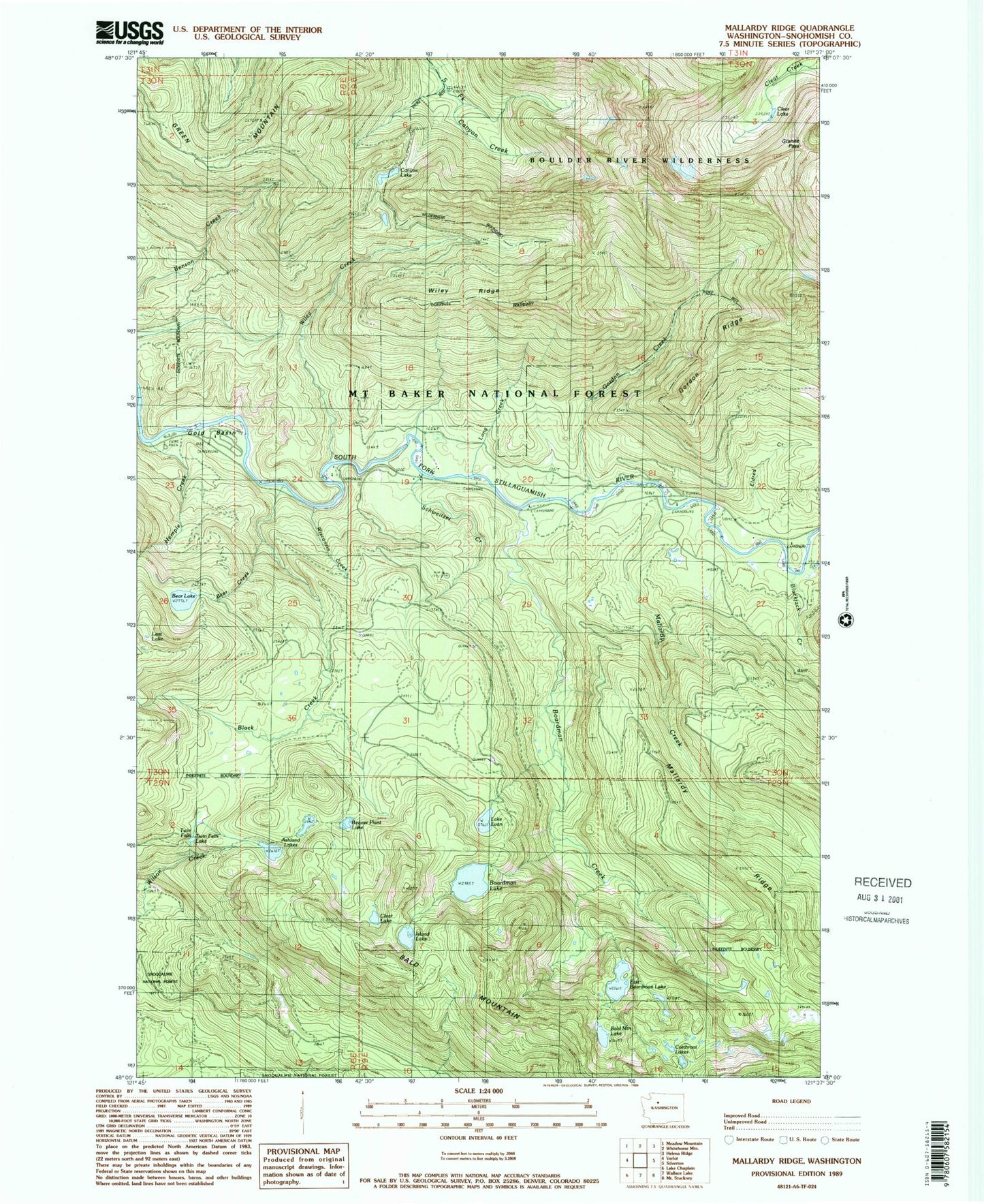
Classic USGS Mallardy Ridge Washington 7.5'x7.5' Topo Map
Couldn't load pickup availability
Historical USGS topographic quad map of Mallardy Ridge in the state of Washington. Typical map scale is 1:24,000, but may vary for certain years, if available. Print size: 24" x 27"
This quadrangle is in the following counties: Snohomish.
The map contains contour lines, roads, rivers, towns, and lakes. Printed on high-quality waterproof paper with UV fade-resistant inks, and shipped rolled.
Contains the following named places: Ashland Lakes, Bear Creek, Bear Lake, Black Creek, Blackjack Creek, Boardman Creek, Boardman Creek Camp, Boardman Lake, Canyon Lake, East Boardman Lake, Eldredge Creek, Lake Evan, Gold Basin, Gordon Creek, Gordon Ridge, Granite Pass, Green Mountain, Hempel Creek, Long Creek, Mallardy Creek, Mallardy Ridge, Red Bridge Campground, Sawyer Camp, Schweitzer Creek, Slide Camp, Sunnyside Camp, Wiley Creek, Wiley Creek Camp, Wiley Ridge, Wisconsin Creek, Snohomish County, River Bar Campground, Cutthroat Lakes, Long Creek Research Natural Area, Lost Lake, Beaver Plant Lake, Twin Falls Lake, Bald Mountain Lake, Twin Falls, Gold Basin Campground, Tulalip Mill Site, Gold Basin Recreation Area, Youth-on-Age, Bolt Camp, Clear Lake, Clear Lake, Hemple Creek Campground, Island Lake, Mountain Loop Highway Bridge