MyTopo
Classic USGS Mallory Swamp NW Florida 7.5'x7.5' Topo Map
Regular price
$16.95
Regular price
Sale price
$16.95
Unit price
per
Couldn't load pickup availability
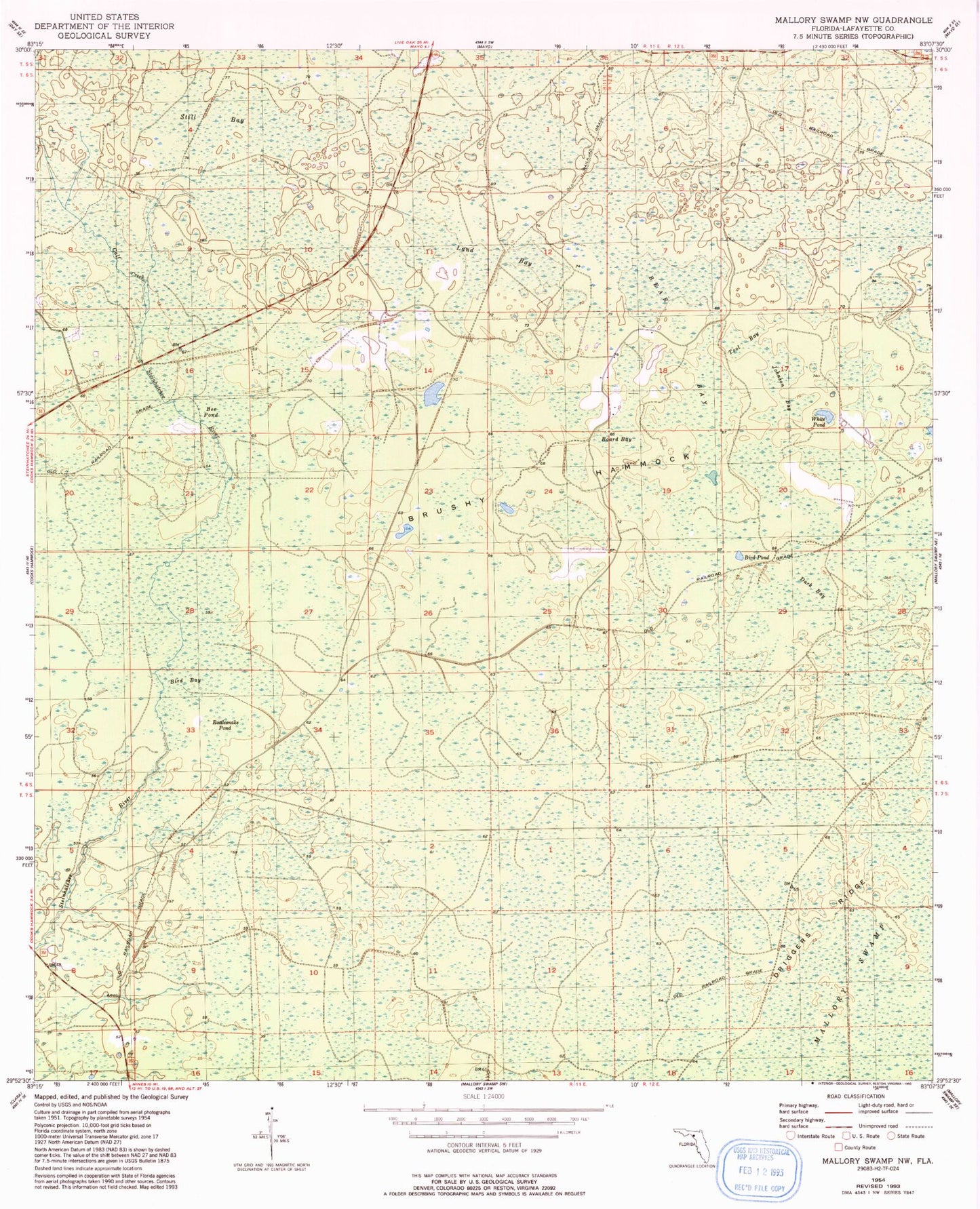
Historical USGS topographic quad map of Mallory Swamp NW in the state of Florida. Map scale may vary for some years, but is generally around 1:24,000. Print size is approximately 24" x 27"
This quadrangle is in the following counties: Lafayette.
The map contains contour lines, roads, rivers, towns, and lakes. Printed on high-quality waterproof paper with UV fade-resistant inks, and shipped rolled.
Contains the following named places: Bear Bay, Bee Pond, Bird Bay, Bird Pond, Board Bay, Brushy Hammock, Calf Creek, Dark Bay, Driggers Ridge, Easter Hole Camp, Johnson Bay, Lafayette County, Land Bay, Mayo Division, Rattlesnake Pond, Still Bay, Tool Bay, White Pond