
MyTopo
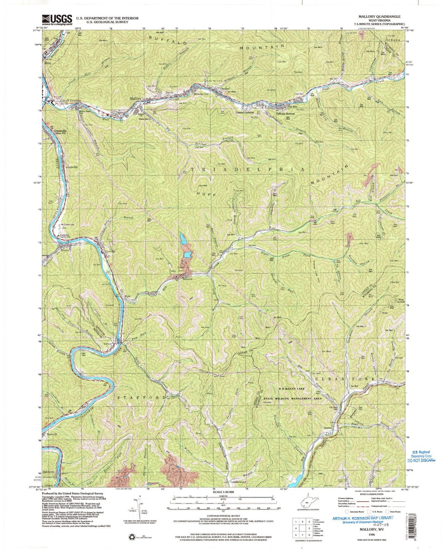
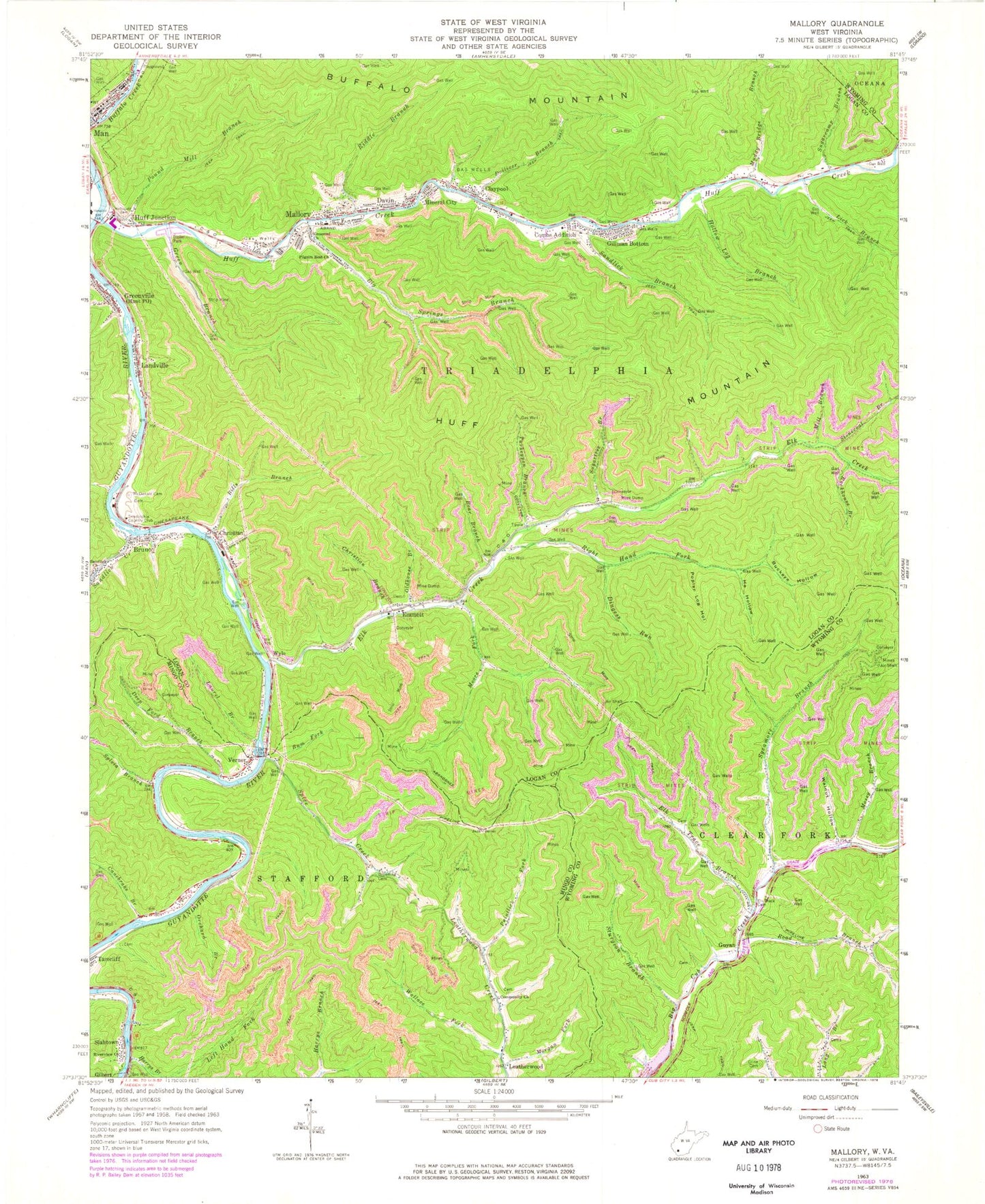
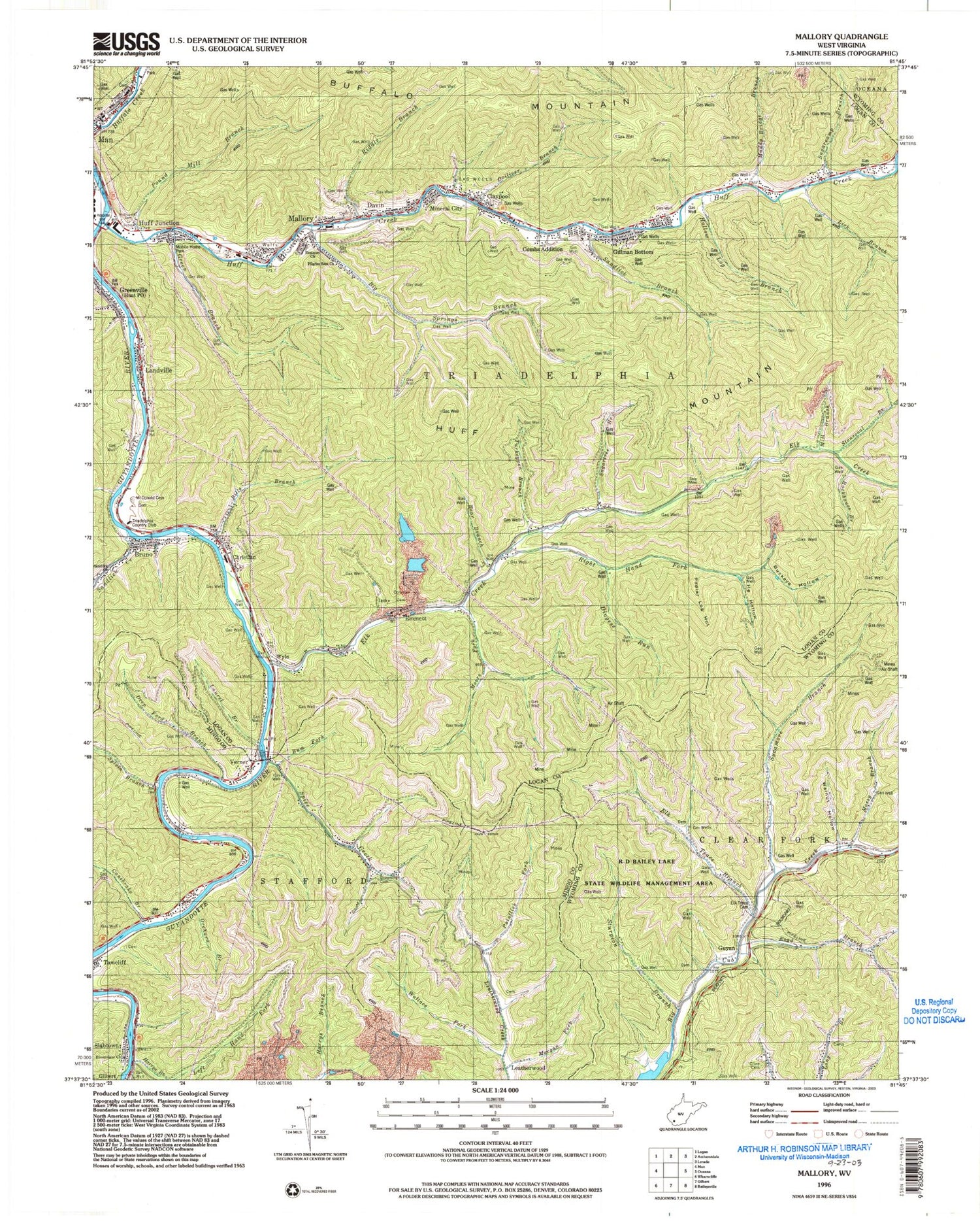
Classic USGS Mallory West Virginia 7.5'x7.5' Topo Map
Couldn't load pickup availability
Historical USGS topographic quad map of Mallory in the state of West Virginia. Typical map scale is 1:24,000, but may vary for certain years, if available. Print size: 24" x 27"
This quadrangle is in the following counties: Logan, Mingo, Wyoming.
The map contains contour lines, roads, rivers, towns, and lakes. Printed on high-quality waterproof paper with UV fade-resistant inks, and shipped rolled.
Contains the following named places: Bear Branch, Big Springs Branch, Bills Branch, Browning Cemetery, Buckeye Hollow, Bum Fork, Canebrake Branch, Christian, Christian Branch, Cline Cemetery, Combs Addition, Community Church, Deep Ford Branch, Dingess Run, Dolliver Branch, Elk Creek, Elk Trace Branch, Elk Trace Cemetery, Emanuel Church, Green Branch, Greenville, Harrys Branch, He Hollow, Hollow Log Branch, Huff Creek, Huff Junction, Laurel Branch, Lick Branch, McDonald Cemetery, McDonald Cemetery, Mill Branch, Moore Fork, Morgan Fork, Mossy Branch, Muddy Bridge Branch, Oldhouse Branch, Orchard Branch, Pilgrim Rest Church, Pointlick Fork, Poplar Log Hollow, Pound Mill Branch, Riddle Branch, Right Hand Fork Elk Creek, Riverview Church, Road Branch, Rockhouse Branch, Sandlick Branch, Sandlick Church, Sandlick Creek, Spice Creek, Stonecoal Branch, Sturgeon Branch, Sugarcamp Branch, Sugartree Branch, Sycamore Branch, Sylvia Branch, Turkeypen Branch, Verner, Wallace Fork, Walnut Hollow, Bruno, Claypool, Davin, Emmett, Gillman Bottom, Guyan, Landville, Mallory, Mineral City, Slabtown, Wylo, Triadelphia Country Club, Hunt Post Office, Verner Post Office, Bruno Post Office, Christian Elementary School (historical), Claypool Cemetery, Davin Post Office, Emmett Post Office, Mallory Elementary School (historical), Mallory Post Office, Man Appalachian Regional Hospital (historical), Man Junior High School (historical), Man Post Office, Mountain Mart Village Shopping Center, The Church of the Timber, Eastern District, Man Middle School, Mallory Census Designated Place, Man Elementary School, Man Volunteer Fire Department, Bruno Census Designated Place, Triadelphia Country Club Golf Course, William C Browning Bridge, Man Police Department, Greenville Census Designated Place