MyTopo
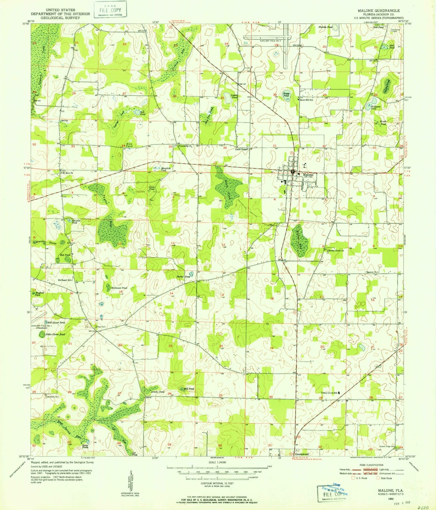
Classic USGS Malone Florida 7.5'x7.5' Topo Map
Couldn't load pickup availability
Historical USGS topographic quad map of Malone in the state of Florida. Map scale may vary for some years, but is generally around 1:24,000. Print size is approximately 24" x 27"
This quadrangle is in the following counties: Jackson.
The map contains contour lines, roads, rivers, towns, and lakes. Printed on high-quality waterproof paper with UV fade-resistant inks, and shipped rolled.
Contains the following named places: Acres Of Diamonds Airpark, Bascom Church, Baxter Bay, Baxter Bay Pond, Bell Pond, Bill Glover Pond, Boggy Pond, Brush Pond, Chipola Airpark, Collin Chapel, Coonrod Cemetery, Cypress Pond, Ellis, Ellis Church, Friendship Church, Goose Pond, Hall Pond, Harts Pond, Haw Pond, Hays Cemetery, Hog Pen Pond, Horse Ponds, J D Milton Farm Airport, Jackson Correctional Institution, Jericho Pond, Jordan Bay, Kid Pond, Knowles Drain, Knowles Pond, Logan Pond, Lot Pond, Lot Run, Malone, Malone Division, Malone High School, Malone Post Office, Mayhall Pond, McChapel Church, McChapel School, McDaniel Pond, McNeally Cemetery, Meredith Pond, Mill Pond, Mount Zion Church, Nellie Glover Pond, Nubbin Ridge Cemetery, Parker Pond, Rocky Grove Church, Snow Hill School, Taylor Bay, Town of Malone, Union Grove School, Williams Pond, ZIP Code: 32445