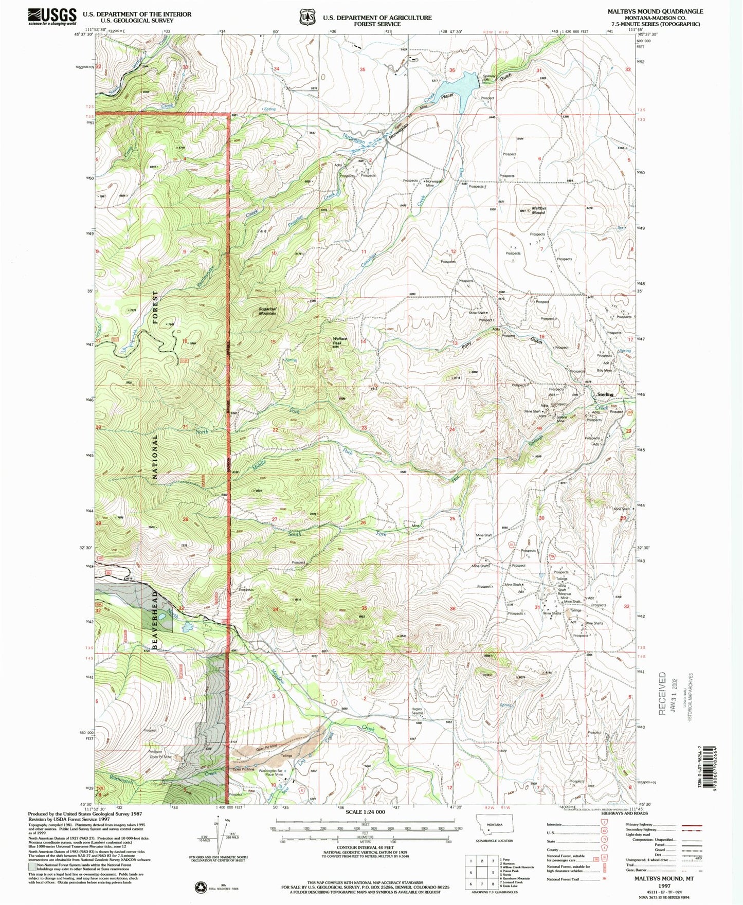
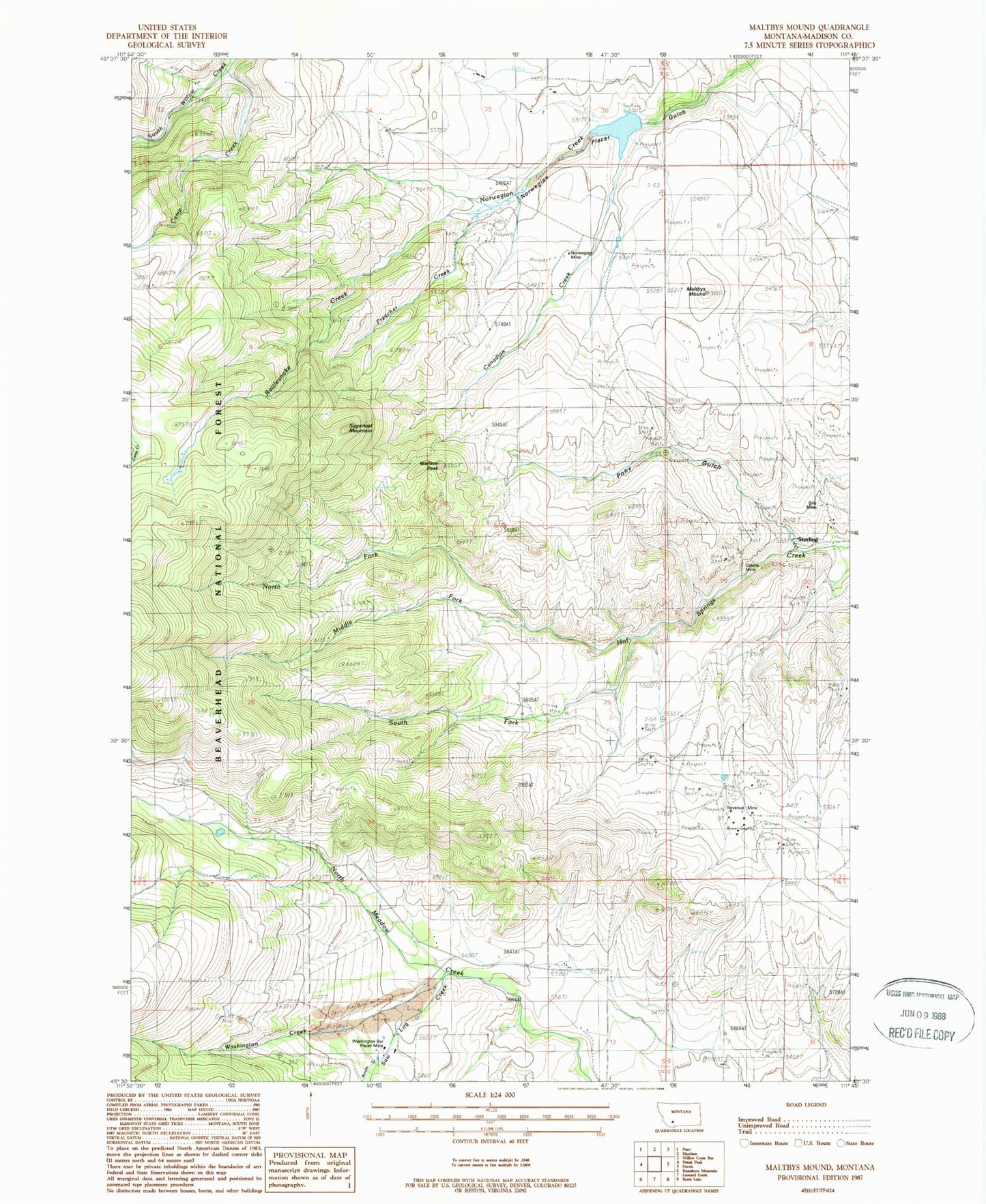
MyTopo
Classic USGS Maltbys Mound Montana 7.5'x7.5' Topo Map
Couldn't load pickup availability
Historical USGS topographic quad map of Maltbys Mound in the state of Montana. Map scale may vary for some years, but is generally around 1:24,000. Print size is approximately 24" x 27"
This quadrangle is in the following counties: Madison.
The map contains contour lines, roads, rivers, towns, and lakes. Printed on high-quality waterproof paper with UV fade-resistant inks, and shipped rolled.
Contains the following named places: 04S02W01CACC01 Well, Arctic/Monitor Mine, Arkansas Mine, Aurora Creek, Belle of Tennessee Mine, Billy Mine, Brooklyn/Black Prince Mine, Camp Creek, Canadian Creek, Columbus Mine, Cousin Jeny/Lomonica Mine, Emperor Mine, Galena Mine, Galena Minor Mine, Idaho Mine, Lehigh Group Mine, Lexington Mine, Maltbys Mound, Mary A Mine, Midasburg, Middle Fork Hot Springs Creek, NE NW Section 9 Mine, NE SE Section 31 Mine, NE SW Section 12 Mine, New York Belle Mine, North Fork Hot Springs Creek, North Meadow Creek Dam, Norwegian Mine, Norwegin Creek Dam, NW SW Section 25 Mine, NW SW Section 6 Mine, Pauline Mine, Pearl Mine, Polaris Mine, Pony Gulch, Pony Gulch Mine, Preacher Creek, Rattlesnake Creek, Revenue, Revenue Mine, Revenue Post Office, Revenue School, Saw Log Creek, SE NW Section 20 Mine, SE NW Section 29 Mine, South Fork Hot Springs Creek, Sterling, Sterling Post Office, Sterling School, Sugar Loaf Mountain, SW SE Section 25 Mine, Wallace Peak, Washington Bar Placer Mine, Washington Creek, Washington Creek Group Placer Mine