MyTopo
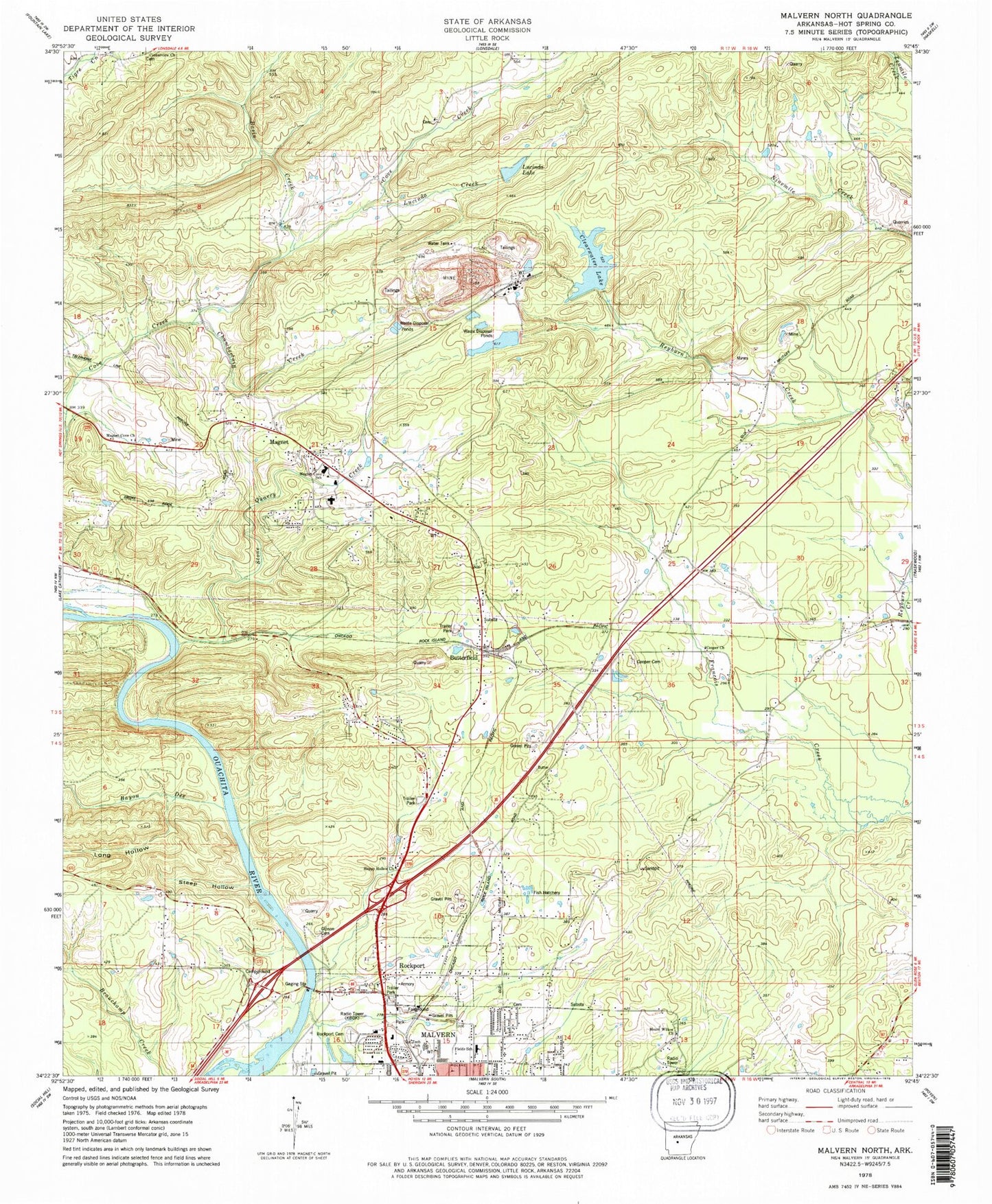
Classic USGS Malvern North Arkansas 7.5'x7.5' Topo Map
Couldn't load pickup availability
Historical USGS topographic quad map of Malvern North in the state of Arkansas. Map scale may vary for some years, but is generally around 1:24,000. Print size is approximately 24" x 27"
This quadrangle is in the following counties: Hot Spring.
The map contains contour lines, roads, rivers, towns, and lakes. Printed on high-quality waterproof paper with UV fade-resistant inks, and shipped rolled.
Contains the following named places: Basin Creek, Bayou de Chute, Butterfield, Butterfield Missionary Baptist Church, Chamberlain Creek, City of Rockport, Clearwater Lake, Clearwater Lake Dam, Cooper Assembly of God Church, Cooper Cemetery, Diamond Head Lower Lake Dam, Diamond Jo Quarry, F Jones Lake Dam, Fields Elementary School, Freewill Baptist Church, Gibson Cemetery, Glen Rose Volunteer Fire Department Military Road Station, Happy Hollow Church, Hot Spring County Industrial Park, Jones Lake, Kinzey Lake, Kinzey Lake Dam, KISI-FM (Malvern), Landmark Baptist Church, Long Hollow, Lower Lake, Lucinda Creek, Lucinda Lake, Magnet Cove, Magnet Cove Area Fire Department, Magnet Cove Baptist Church, Magnet Cove Census Designated Place, Magnet Cove Elementary School, Magnet Cove Elementary SChool, Magnet Cove High School, Magnet Cove United Methodist Church, Malvern Elementary School, Mount Willow Baptist Church, North Malvern Fire Station, Old Rockport Bridge, Ouachita Vocational Technical School, Rockport, Rockport Cemetery, Rockport Mount Willow Volunteer Fire Department, Rockport Police Department, Rockport School, Steep Hollow, Stone Quarry Creek, The Branch, Town of Magnet Cove, Township of Butterfield, Township of Fenter, Township of Magnet, Wilson Elementary School