MyTopo
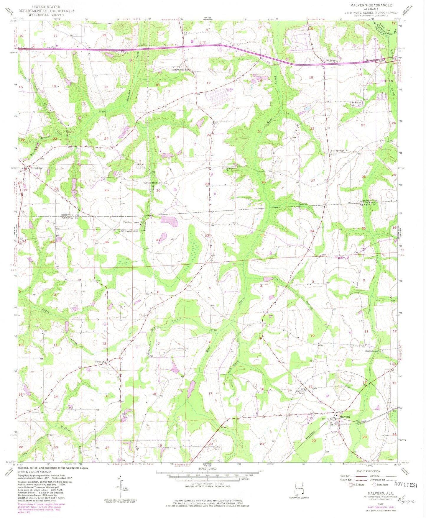
Classic USGS Malvern Alabama 7.5'x7.5' Topo Map
Couldn't load pickup availability
Historical USGS topographic quad map of Malvern in the state of Alabama. Map scale may vary for some years, but is generally around 1:24,000. Print size is approximately 24" x 27"
This quadrangle is in the following counties: Dale, Geneva, Houston.
The map contains contour lines, roads, rivers, towns, and lakes. Printed on high-quality waterproof paper with UV fade-resistant inks, and shipped rolled.
Contains the following named places: Bailey Crossroads, Bay Springs Baptist Church, Bay Springs Baptist Church Cemetery, Bay Springs Volunteer Fire Department, Bethlehem Church, Buzzard Bay Branch, Camelite Church, Community Church, Emmett Sellers Dam, Emmett Sellers Lake, Gilley Mill Creek, Goodwater Branch, Green Valley Church, Halls Mill, Hatband Creek, Hosea Mathis Dam, Hosea Mathis Lake, Jack Ward Branch, Malvern, Malvern Community Volunteer Fire Department, Malvern New Life Church, Malvern Post Office, Malvern School, Mount Olive Church, New Holy Temple Church of God, Newton Creek, Old Oak Grove Cemetery, Panther Creek Church, Pasco Davis Dam, Pilgrim Home Baptist Church, Pilgrim Home Church, Pilgrim Rest Baptist Church, Pilgrims Home Church, Pilgrims Rest Church, Piney Grove Assembly of God Church, Providence Cemetery, Purvis Cemetery, Saint Peter Church, Sardis Baptist Church, Sardis Church, Sasser Branch, Sasser School, Sawdust Church, Town of Malvern, Union Baptist Church, Union Cemetery, Wadford School, Wicksburg, Wicksburg Church, Wicksburg Volunteer Fire Department, Winslette Chapel Church