MyTopo
Classic USGS Mammoth Pool Dam California 7.5'x7.5' Topo Map
Couldn't load pickup availability
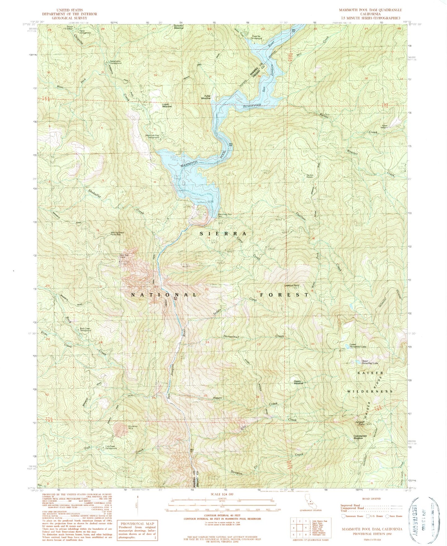
Historical USGS topographic quad map of Mammoth Pool Dam in the state of California. Map scale may vary for some years, but is generally around 1:24,000. Print size is approximately 24" x 27"
This quadrangle is in the following counties: Fresno, Madera.
The map contains contour lines, roads, rivers, towns, and lakes. Printed on high-quality waterproof paper with UV fade-resistant inks, and shipped rolled.
Contains the following named places: Aspen Creek, Aspen Meadow, Camp Creek, China Bar Campground, Chiquito Creek, Coarsegrass Meadow, Daulton Creek, Daulton Station, Douglas Fir Creek, Fish Creek, Fish Creek Campground, Fuller Meadow, Horsethief Creek, Jackass Creek, Jump Off Point, Kaiser Creek, Kaiser Creek Ford, Kaiser Helispot, Logan Meadow, Logan Meadow Campground, Lookout Point, Lower Horsethief Lake, Mammoth Pool Boat Launch, Mammoth Pool Campground, Mammoth Pool Dam, Mammoth Pool Reservoir, Mile High Curve, Mile High Vista Campground, Mile High Vista Picnic Area, Mill Creek, Placer Campground, Placer Forest Service Station, Placer Guard Station, Rock Creek, Rock Creek Campground, Saddle Creek, San Joaquin Mine, Shakeflat Creek, Slide Creek, Slot Creek, Sweetwater Campground, Upper Horsethief Lake, Wagners Mammoth Pool Resort, Weissman Mine, West Fork Chiquito Creek, West Fork Daulton Creek, West Kaiser Creek, Westfall Creek, Windy Point Boat Launch Campground