MyTopo
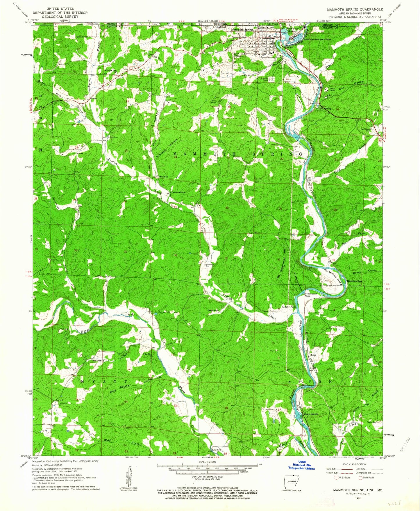
Classic USGS Mammoth Spring Arkansas 7.5'x7.5' Topo Map
Couldn't load pickup availability
Historical USGS topographic quad map of Mammoth Spring in the state of Arkansas. Typical map scale is 1:24,000, but may vary for certain years, if available. Print size: 24" x 27"
This quadrangle is in the following counties: Fulton, Oregon.
The map contains contour lines, roads, rivers, towns, and lakes. Printed on high-quality waterproof paper with UV fade-resistant inks, and shipped rolled.
Contains the following named places: Big Cottonwood Hollow, Big Creek, Blue Spring Hollow, Brush Creek, Cold Spring, Cottonwood Falls, Cottonwood Hollow, Davis Cemetery, Dewey School, Ellis Hollow, English Creek, Field Creek, Field Creek Cemetery, Hatfield Hollow, Horseshoe Bend, Little Gut Creek, Long Run Hollow, Love Cemetery, Mammoth Spring, Many Islands, McLemore Cemetery, Moten Church, Needles Eye, Pilot Church, Riverside Cemetery, Saddler Falls, Sycamore Creek, Taylor Cemetery, Trace Creek, Tunstil Branch, Warm Fork Spring River, Water Fork Branch, Welcome Hill Church, Whiteside Cemetery, Williams Hollow, Baker Ford, King, Oxford Ford, Church of Christ, Frickenger (historical), Mammoth Spring Elementary School, Mammoth Spring High School, Peach (historical), Saint Andrews Episcopal Church, Township of Afton, Township of Mammoth Spring, Township of Myatt, Mammoth Spring, Cecil Lake Dam, Lake Cecil, Mammoth Spring Fire Department, Mammoth Spring Police Department, United States Fish and Wildlife Mammoth Springs National Fish Hatchery Park Security, City of Mammoth Spring, Mammoth Spring National Fish Hatchery, Mammoth Spring Post Office