MyTopo
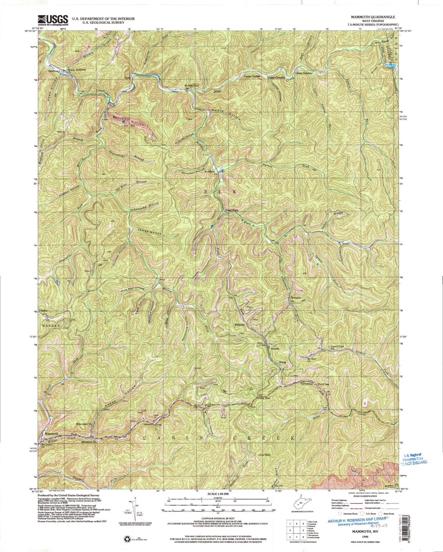
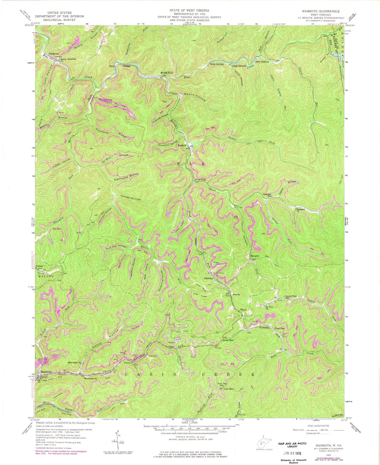
Classic USGS Mammoth West Virginia 7.5'x7.5' Topo Map
Couldn't load pickup availability
Historical USGS topographic quad map of Mammoth in the state of West Virginia. Map scale may vary for some years, but is generally around 1:24,000. Print size is approximately 24" x 27"
This quadrangle is in the following counties: Clay, Kanawha.
The map contains contour lines, roads, rivers, towns, and lakes. Printed on high-quality waterproof paper with UV fade-resistant inks, and shipped rolled.
Contains the following named places: Acup, Amelia, Bear Branch, Bear Hollow, Belcher Hollow, Blakeley, Blakley Cemetery, Blue Star Hollow, Boardtree Branch, Camp Camelot, Camp Carlisle, Camp Galahad, Campbell Fork, Coral Hollow, Danny Beasley Spring, Deadening Hollow, Durham Hollow, Egypt Hollow, Fivemile Fork, Goodman Hollow, Goose Hollow, Gravelick Branch, Hidden Hollow, Hillfield Hollow, Hitop, Horsehead Lake, Hurricane Fork, James Hollow, Jim Hollow, Joes Hollow, Kendalia, Laurel Fork School, Laurel Run, Left Fork Kellys Creek, Little Laurel Run, Low Gap, Low Gap School, Mammoth, Mammoth Church, Mammoth Post Office, McBride Hollow, Middle Fork, Middle Fork Blue Creek, Missionary Church, Moore Hollow, Morris, Morris Fork, Morris Memorial Church, Mount Lewis Church, Mount Zion Church, Mudlick Branch, Mudlick Hollow, Nans Branch, Nathan Branch, Oil Well Branch, Panther Hollow, Pond Fork, Pond Gap, Pond Gap Post Office, Putney, Rich Hollow, Rockcamp Fork, Sanderson, Sandlick Branch, Shirkey Branch, Slabcamp Hollow, Spangler, Spangler Church, Spangler Fork, Spangler School, Spruce Fork, Sugarcamp Branch, Turner Fork, Union Carbide Lake Number Three Dam, ZIP Codes: 25132, 25160