
MyTopo
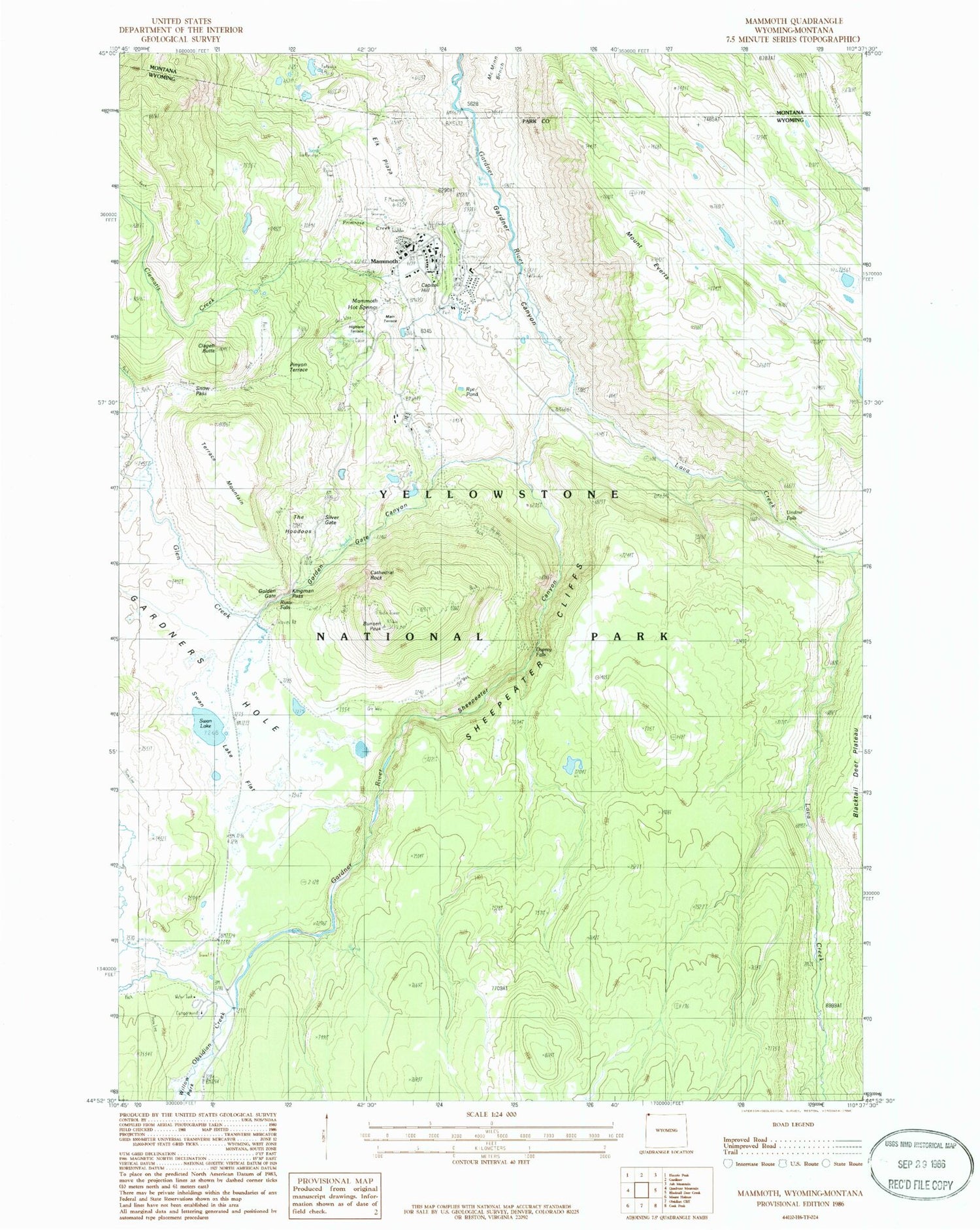
Classic USGS Mammoth Wyoming 7.5'x7.5' Topo Map
Couldn't load pickup availability
Historical USGS topographic quad map of Mammoth in the states of Wyoming, Montana. Typical map scale is 1:24,000, but may vary for certain years, if available. Print size: 24" x 27"
This quadrangle is in the following counties: Park.
The map contains contour lines, roads, rivers, towns, and lakes. Printed on high-quality waterproof paper with UV fade-resistant inks, and shipped rolled.
Contains the following named places: Beaver Lakes Loop Trail, Cathedral Rock, Clematis Creek, Elk Plaza, Mount Everts, Glen Creek, Golden Gate, Golden Gate Canyon, Boiling River, Indian Creek, Indian Creek Campground, Kingman Pass, Lava Creek Campgrounds, Lava Creek Canyon, Lupine Creek, Mammoth, Obsidian Creek, Panther Creek, Pinyon Terrace, Primrose Creek, Rye Pond, Sepulcher Loop Trail, Sevenmile Bridge, Sheepeater Canyon, Sheepeater Canyon Bridge, Sheepeater Cliffs, Silver Gate, Lava Creek, Swan Lake Flat, Highland Spring, Bunsen Peak, Capitol Hill, Clagett Butte, Mammoth Hot Springs, Rustic Falls, Snow Pass, Swan Lake, Terrace Mountain, The Hoodoos, Undine Falls, Osprey Falls, Liberty Cap, Opal Terrace, Squirrel Springs Ridge, Highland Terrace, Main Terrace, Mammoth Census Designated Place, Yellowstone National Park Fire Department - Mammoth Station, Yellowstone National Park Post Office, Fort Yellowstone Army Cemetery, Mammoth Civilian Cemetery, Beaver Lakes Loop Trail, Beaver Ponds


