
MyTopo
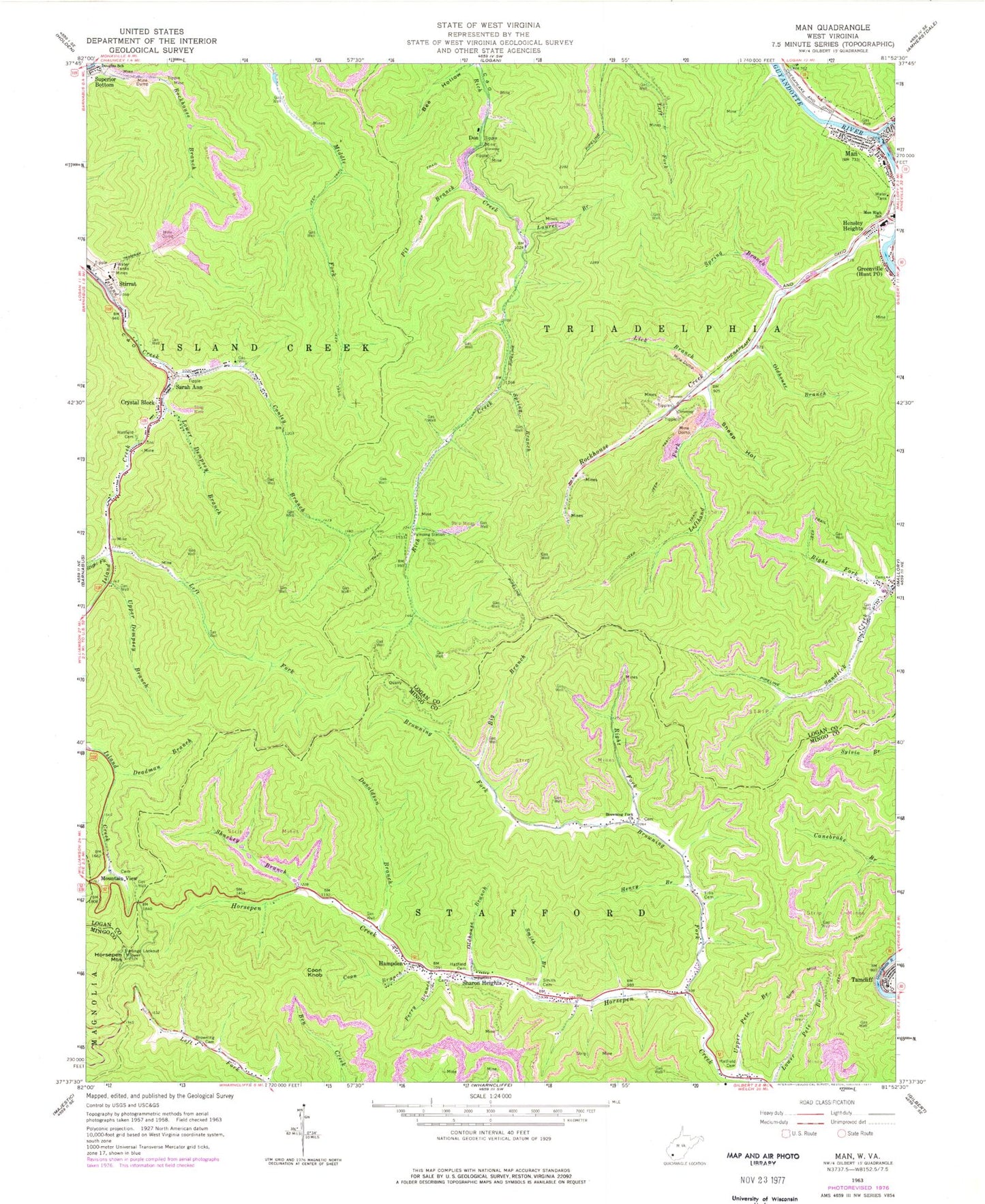
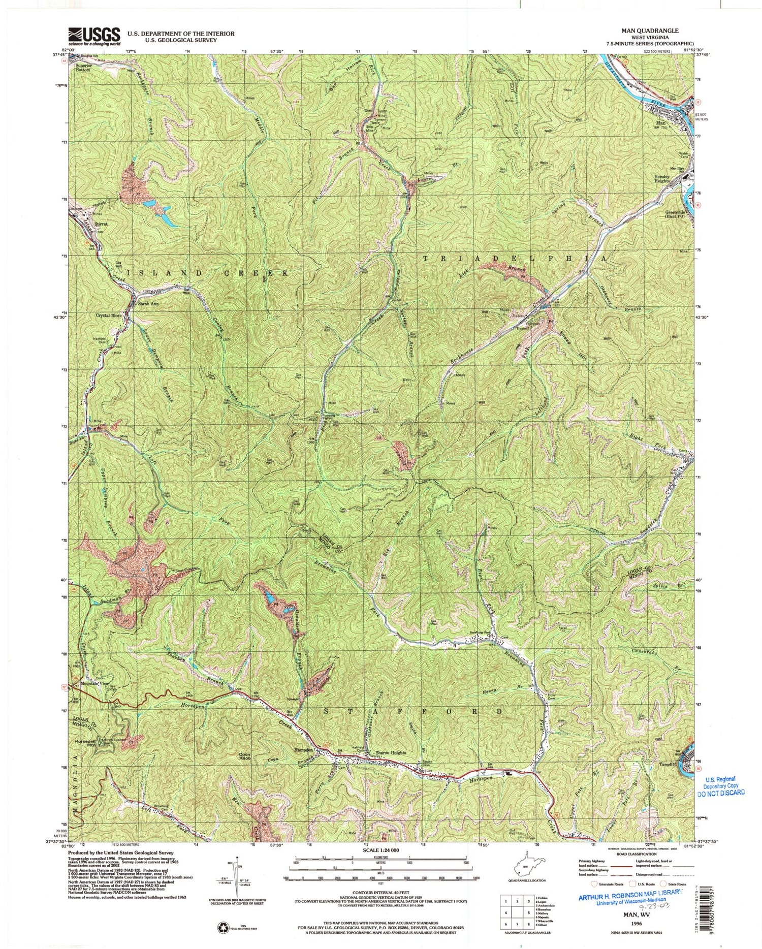
Classic USGS Man West Virginia 7.5'x7.5' Topo Map
Couldn't load pickup availability
Historical USGS topographic quad map of Man in the state of West Virginia. Map scale may vary for some years, but is generally around 1:24,000. Print size is approximately 24" x 27"
This quadrangle is in the following counties: Logan, Mingo.
The map contains contour lines, roads, rivers, towns, and lakes. Printed on high-quality waterproof paper with UV fade-resistant inks, and shipped rolled.
Contains the following named places: Big Branch, Browning Cemetery, Browning Fork, Browning Fork Church, Browning-Grimmet Cemetery, Buffalo Creek, Buffalo Creek Memorial Public Library, Conley Branch, Coon Branch, Coon Knob, Crystal Block, Deadman Branch, Don, Donaldson Branch, Douglas School, Ellis Cemetery, Gilbert High School, Hampden, Hampden Post Office, Hatfield Cemetery, Henry Branch, Hensley Heights, Horsepen Mountain, Laurel Branch, Left Fork, Lefthand Fork, Lick Branch, Logan County Fire Department Station 2, Lower Dempsey Branch, Man, Man High School, Mingo Lookout Tower, Mountain View, Oldhouse Branch, Perry Branch, Pit Branch, Right Fork Browning Fork, Right Fork Island Creek, Right Fork Sandlick Creek, Road Fork, Rockhouse Branch, Rockhouse Creek, Sarah Ann, Sarah Ann Census Designated Place, Sarah Ann Post Office, Sharkey Branch, Sharon Heights, Sheep Hollow, Smith Branch, Smith Cemetery, South Man Elementary School, Spring Branch, Stirrat Number 15 Impoundment, Stirrat Number 15 Waste Embankment Dam, Superior Bottom, Tamcliff, Town of Man, Upper Dempsey Branch, Upper Pete Branch, West Virginia State Police Troop 5 - Gilbert Detachment, ZIP Codes: 25621, 25632, 25635