MyTopo
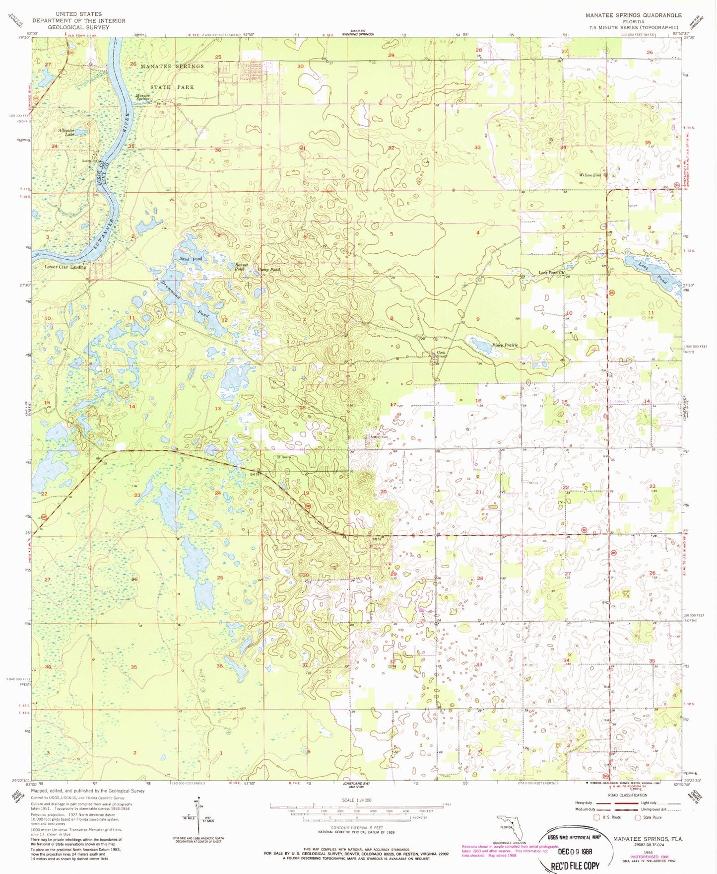
Classic USGS Manatee Springs Florida 7.5'x7.5' Topo Map
Couldn't load pickup availability
Historical USGS topographic quad map of Manatee Springs in the state of Florida. Map scale may vary for some years, but is generally around 1:24,000. Print size is approximately 24" x 27"
This quadrangle is in the following counties: Dixie, Levy.
The map contains contour lines, roads, rivers, towns, and lakes. Printed on high-quality waterproof paper with UV fade-resistant inks, and shipped rolled.
Contains the following named places: Alligator Lake, Antioch Cemetery, Bonnet Pond, Camp Pond, Chiefland Division, Cook Sink, Dipple Field, Drummond Pond, Hardee Cemetery, Janney, Long Pond, Long Pond Church, Lower Clay Landing, Manatee, Manatee Springs, Manatee Springs Airport, Manatee Springs State Park, Piney Prairie, Sand Pond, Sunnyvale Fish Camp, Willow Sink, WTBH-FM (Chiefland), ZIP Code: 32626