MyTopo
Classic USGS Manawa Wisconsin 7.5'x7.5' Topo Map
Couldn't load pickup availability
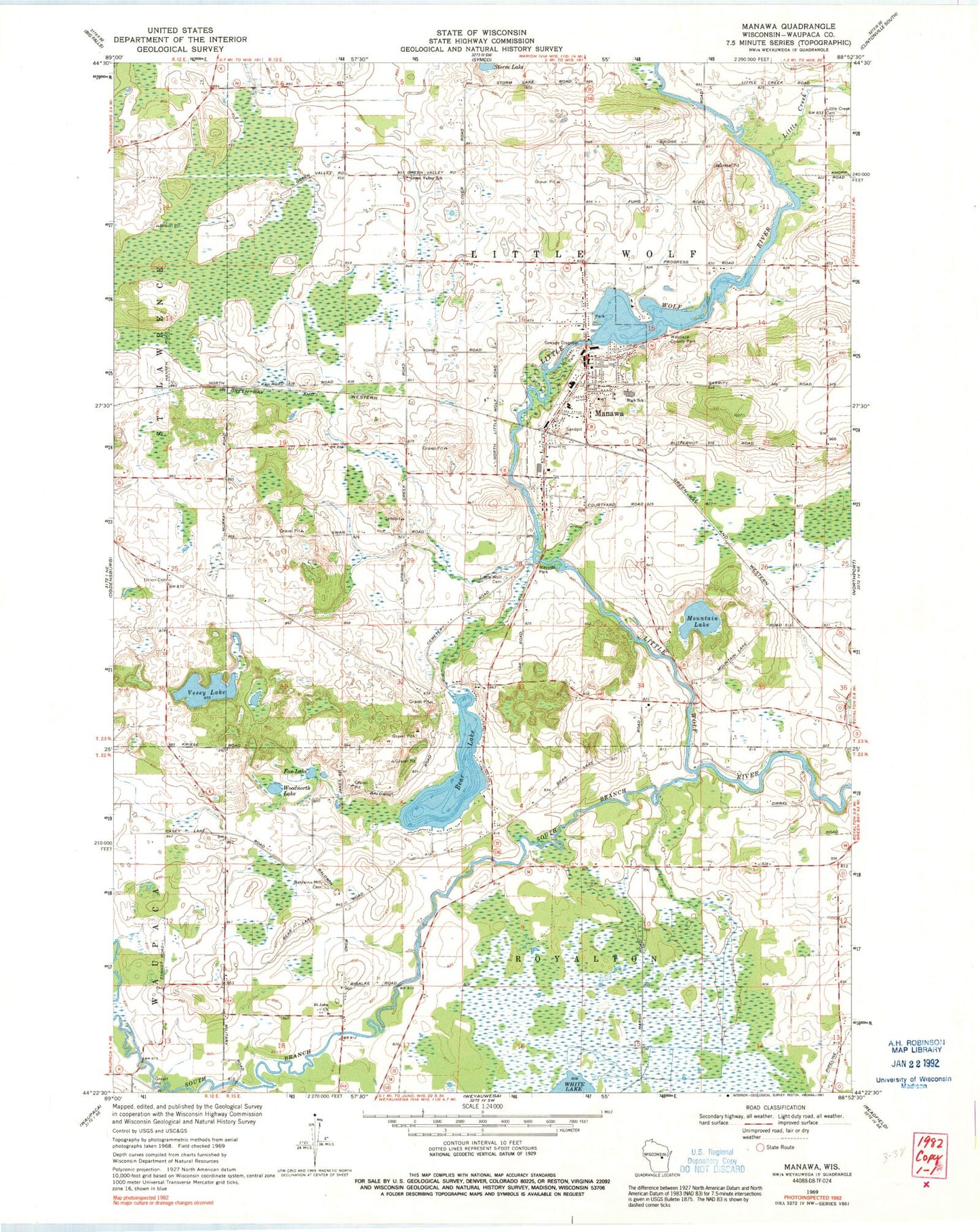
Historical USGS topographic quad map of Manawa in the state of Wisconsin. Map scale may vary for some years, but is generally around 1:24,000. Print size is approximately 24" x 27"
This quadrangle is in the following counties: Waupaca.
The map contains contour lines, roads, rivers, towns, and lakes. Printed on high-quality waterproof paper with UV fade-resistant inks, and shipped rolled.
Contains the following named places: Baldwins Mill, Baldwins Mill Cemetery, Baldwins Mill School, Bear Lake, Block Cemetery, Block School, City of Manawa, Fox Lake, Green Valley School, Little Creek, Little Creek Cemetery, Little Creek School, Little Wolf, Little Wolf Cemetery, Little Wolf Junior / Senior High School, Little Wolf-Royalton School, Manawa, Manawa 1899C177 Dam, Manawa Elementary School, Manawa Police Department, Manawa Pond 275, Manawa Post Office, Manawa Rural Ambulance, Manawa Rural Fire and Ambulance Department, Manawa Wastewater Treatment Facility, Maple Grove School, Mountain Lake, Sacred Hearth Catholic Church, Saint John Church, Saint Paul Lutheran Church, Saint Paul's Lutheran School, South Branch Little Wolf River, Spring Brook School, Sturms Hill School, Town of Little Wolf, Vesey Lake, Waupaca County, Waupaca County Home, Waupaca County Poor Farm Cemetery, Waupace County Park, Woodnorth Lake, Zion Lutheran Church, ZIP Code: 54949