MyTopo
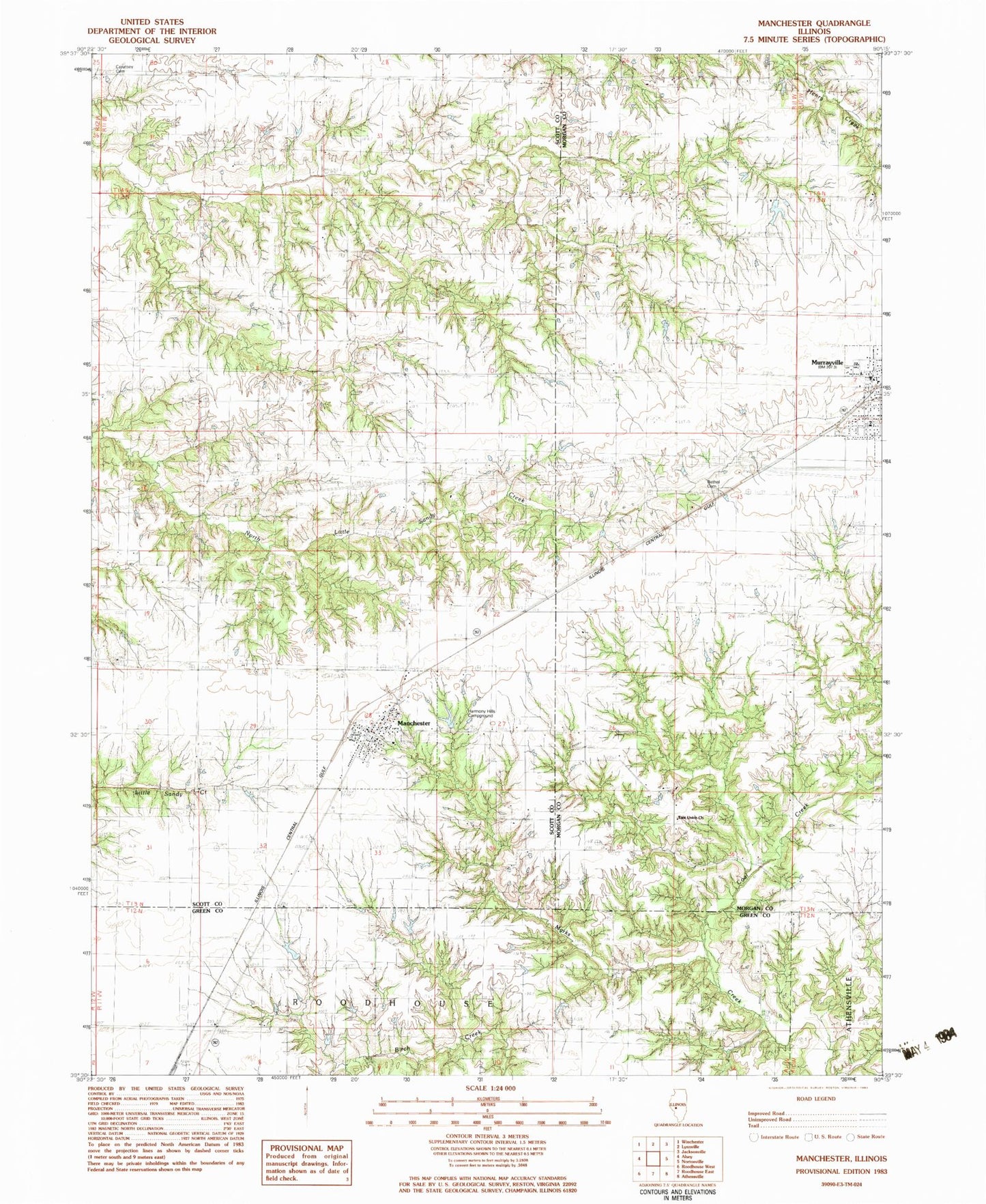
Classic USGS Manchester Illinois 7.5'x7.5' Topo Map
Couldn't load pickup availability
Historical USGS topographic quad map of Manchester in the state of Illinois. Map scale may vary for some years, but is generally around 1:24,000. Print size is approximately 24" x 27"
This quadrangle is in the following counties: Greene, Morgan, Scott.
The map contains contour lines, roads, rivers, towns, and lakes. Printed on high-quality waterproof paper with UV fade-resistant inks, and shipped rolled.
Contains the following named places: Akers School, Bethel Cemetery, Big Branch, Canatsey Cemetery, Carnes School, Coal Creek, East Union Church, Harmony Hills Campground, Harts School, Independence School, Manchester, Manchester Baptist Church, Manchester Cemetery, Manchester Election Precinct, Manchester Post Office, Manchester Volunteer Fire Department, McCracken School, Mount Olive School, Murrayville, Murrayville Baptist Church, Murrayville Cemetery, Murrayville Fire District, Murrayville Number 2 Election Precinct, Murrayville Post Office, Murrayville United Methodist Church, Oak Hill School, Old Manchester Cemetery, Saint Bartholomew Church, Union School, Village of Manchester, Village of Murrayville, WEAI-FM (Lynnville), ZIP Code: 62663