MyTopo
Classic USGS Manchester Kansas 7.5'x7.5' Topo Map
Couldn't load pickup availability
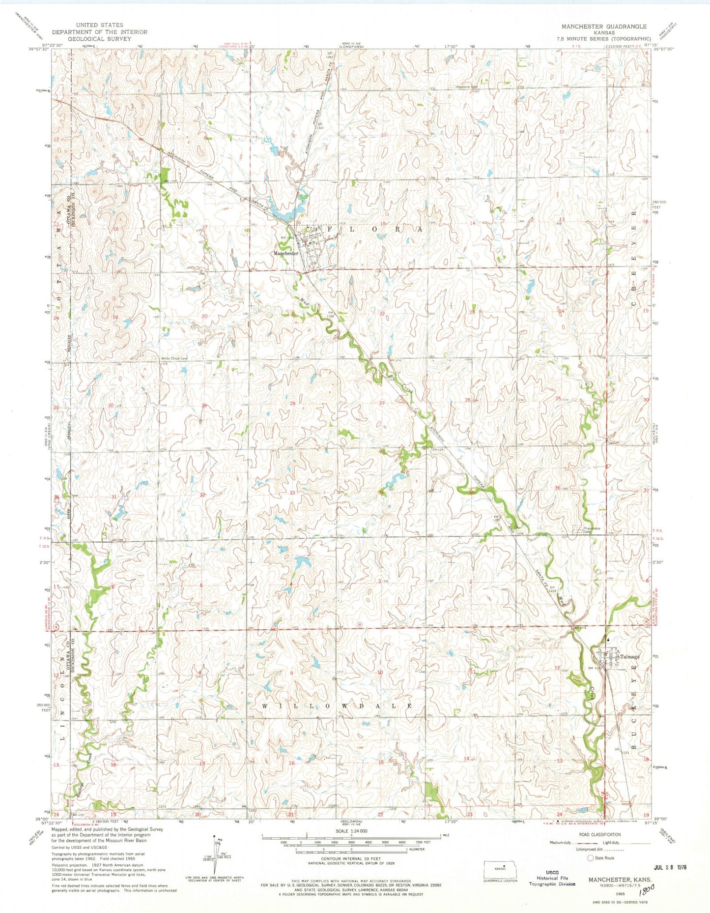
Historical USGS topographic quad map of Manchester in the state of Kansas. Map scale may vary for some years, but is generally around 1:24,000. Print size is approximately 24" x 27"
This quadrangle is in the following counties: Dickinson, Ottawa.
The map contains contour lines, roads, rivers, towns, and lakes. Printed on high-quality waterproof paper with UV fade-resistant inks, and shipped rolled.
Contains the following named places: City of Manchester, Keystone, Keystone Cemetery, Longford Rural Fire District 1 Talmadge Station 6, Manchester, Manchester Fire Department, Manchester Wastewater Plant, Poplar Hill, Prairiedale Cemetery, Talmage, Talmage Census Designated Place, Talmage Post Office, Talmage United Methodist Church, Talmage Wastewater Plant, Team Marketing Alliance Grain Elevator Number 46, The Lord's Chapel, Township of Flora, Township of Willowdale, White Cloud Cemetery, ZIP Code: 67482