MyTopo
Classic USGS Manchester Texas 7.5'x7.5' Topo Map
Regular price
$16.95
Regular price
Sale price
$16.95
Unit price
per
Couldn't load pickup availability
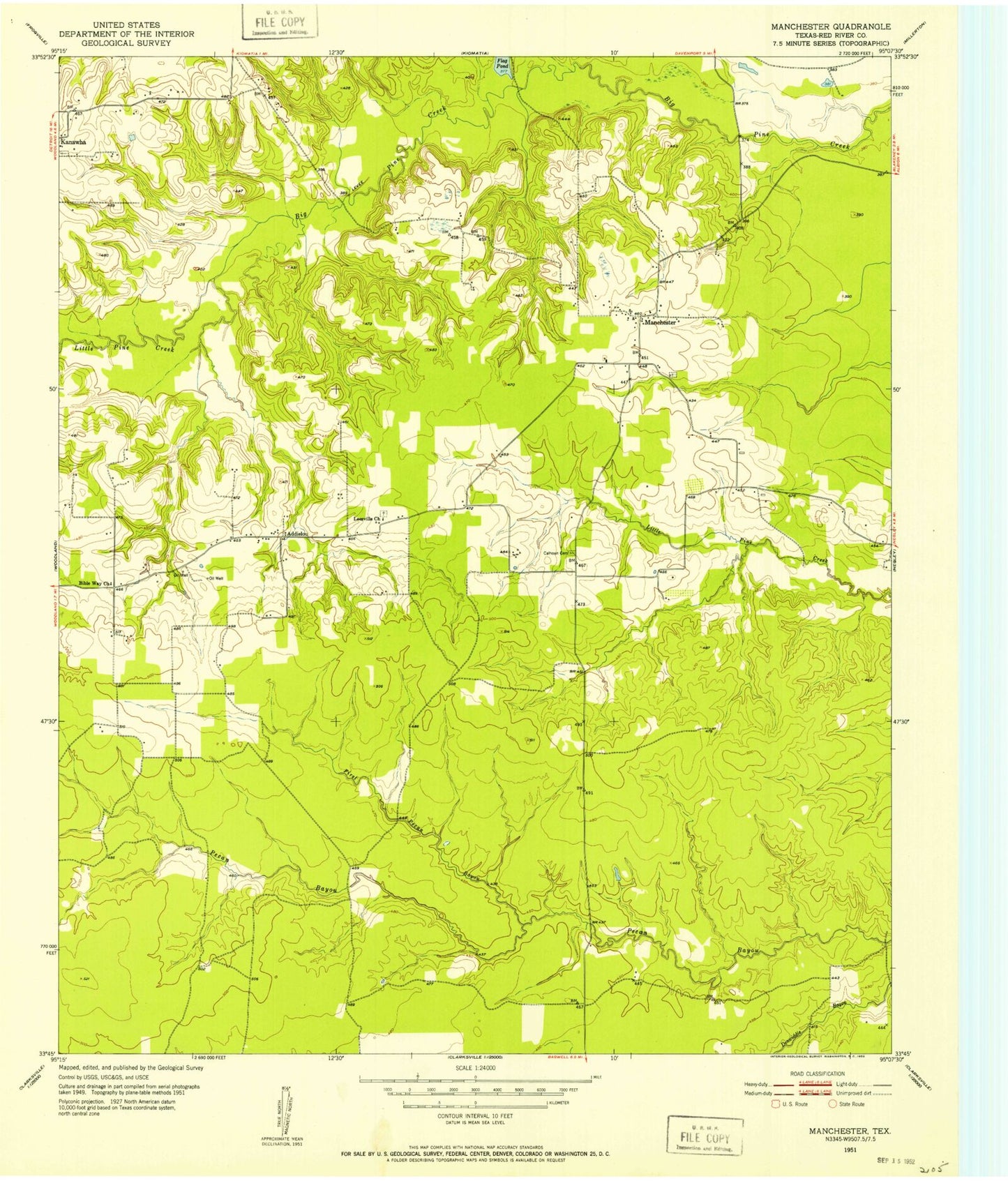
Historical USGS topographic quad map of Manchester in the state of Texas. Map scale may vary for some years, but is generally around 1:24,000. Print size is approximately 24" x 27"
This quadrangle is in the following counties: Red River.
The map contains contour lines, roads, rivers, towns, and lakes. Printed on high-quality waterproof paper with UV fade-resistant inks, and shipped rolled.
Contains the following named places: Addielou, Bible Way Church, Calhoun Cemetery, Cowper Lake, Cowper Lake Dam, First Pecan Bayou, Flag Pond, Igo Lake 1, Igo Lake Dam 1, Leesville Church, Little Pine Creek, Manchester, Manchester Division, Tallant Lake, Tallant Lake Dam, Tanyard Creek, ZIP Code: 75412