MyTopo
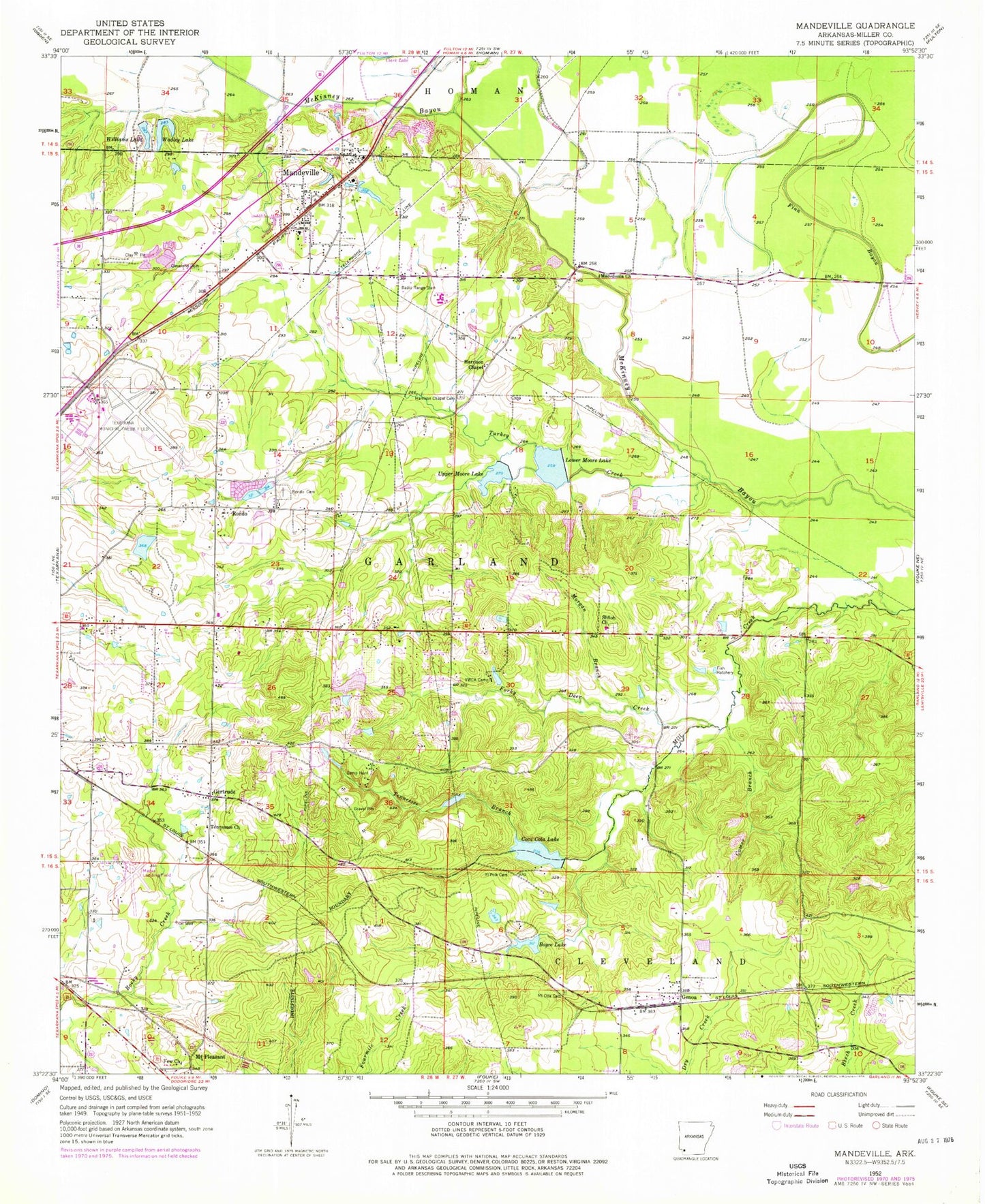
Classic USGS Mandeville Arkansas 7.5'x7.5' Topo Map
Couldn't load pickup availability
Historical USGS topographic quad map of Mandeville in the state of Arkansas. Map scale may vary for some years, but is generally around 1:24,000. Print size is approximately 24" x 27"
This quadrangle is in the following counties: Miller.
The map contains contour lines, roads, rivers, towns, and lakes. Printed on high-quality waterproof paper with UV fade-resistant inks, and shipped rolled.
Contains the following named places: Boyce Lake, Boyce Lake Dam, Buford Lake, Buford Lake Dam, Camp Hunt, City of Texarkana, Cleveland Cemetery, Coca Cola Lake, Coca Cola Lake Dam, Comer Branch, Cox Lake, Cox Lake Dam, Few Memorial United Methodist Church, Forky Deer Creek, Gary E Cobb Middle School, Genoa, Genoa Baptist Church, Genoa Census Designated Place, Genoa Central Elementary School, Genoa Post Office, Genoa Volunteer Fire Department, Gertrude, Gill Lake, Gill Lake Dam, Harrison Chapel, Harrison Chapel Cemetery, KUKB-FM (Texarkana), Lakewood Estates, Lifenet Air Ambulance, Lower Moore Lake, Macedonia Church, Macks Airport, Mandeville, Mandeville Volunteer Fire Department, Morgan Branch, Mount Oba Cemetery, Mount Pleasant, Old Bitty Lake, Old Bitty Lake Dam, Polk Cemetery, Robinson Lake Dam, Rondo, Rondo Cemetery, Shiloh Church, Smith Lake, Smith Lake Dam, Tennessee Baptist Church, Tennessee Branch, Texarkana Air Force Station, Texarkana Fire Department Station 4, Texarkana Regional Airport Rescue and Fire Department, Texarkana Regional Airport-Webb Field, Township of Garland, Turkey Creek, Upper Moore Lake, Upper Moore Lake Dam, Wadley Lake, Williams Lake, Williams Lake Dam, Wona, Wooten Lake, Wooten Lake Dam, ZIP Code: 71854