MyTopo
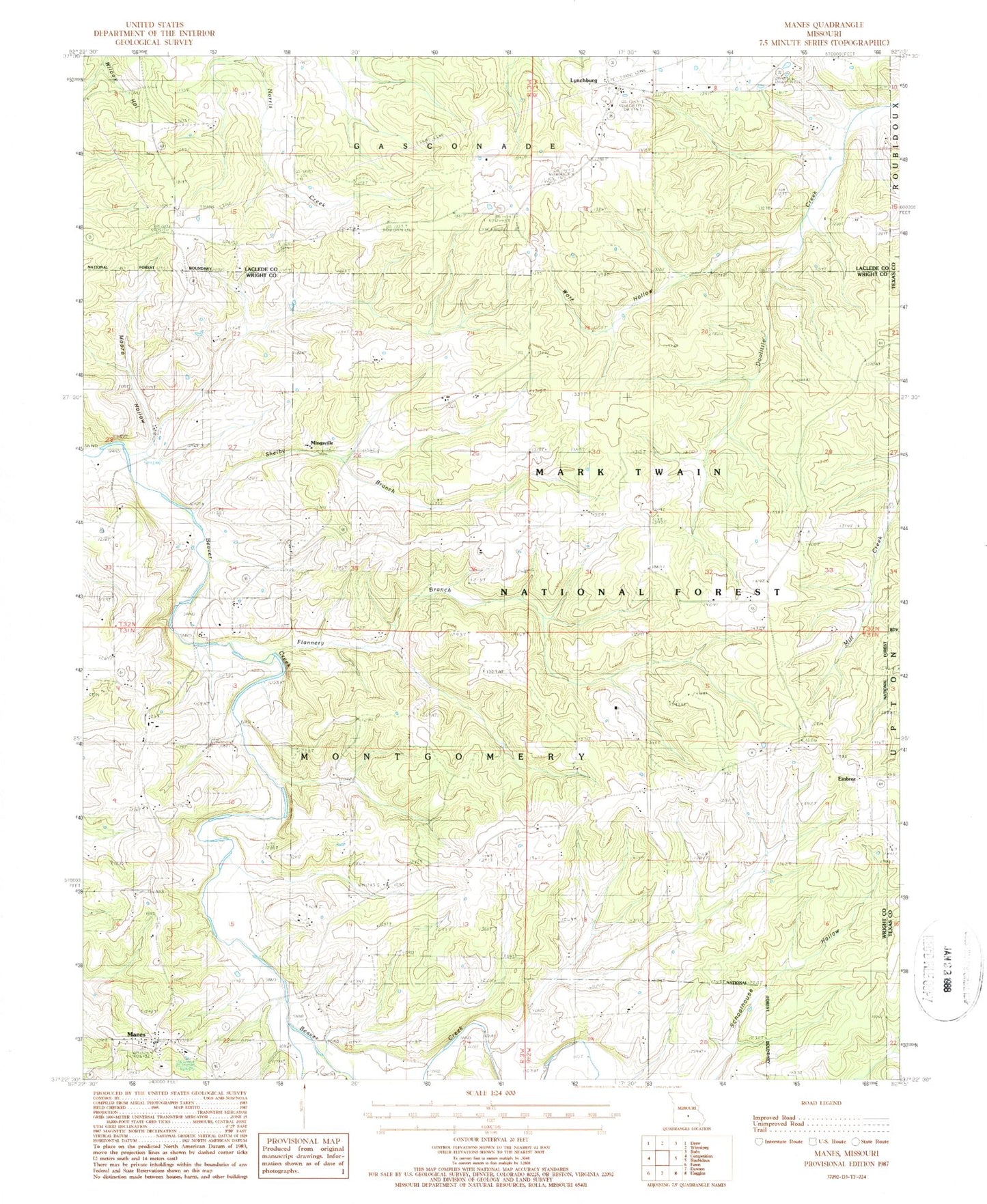
Classic USGS Manes Missouri 7.5'x7.5' Topo Map
Couldn't load pickup availability
Historical USGS topographic quad map of Manes in the state of Missouri. Map scale may vary for some years, but is generally around 1:24,000. Print size is approximately 24" x 27"
This quadrangle is in the following counties: Laclede, Texas, Wright.
The map contains contour lines, roads, rivers, towns, and lakes. Printed on high-quality waterproof paper with UV fade-resistant inks, and shipped rolled.
Contains the following named places: Astoria, Blankenship Cemetery, Embree, Evening Shade Church, Flannery Branch, Jarres Ford, Lone Star School, Lynchburg, Maines, Manes, Mingsville, Montgomery School, Moore Hollow, Nebo Falcon Rural Volunteer Fire Department Station 3, Postoak School, Rose School, Shelby Branch, Sunny Side, Sunnyside Post Office, Sycamore School, Township of Montgomery, Union Star Church, Victory School, Wolf Hollow, ZIP Code: 65543