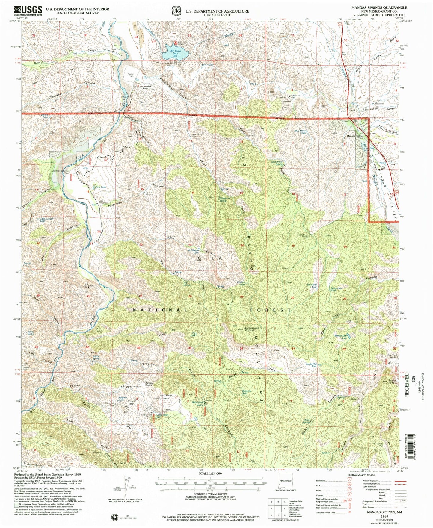
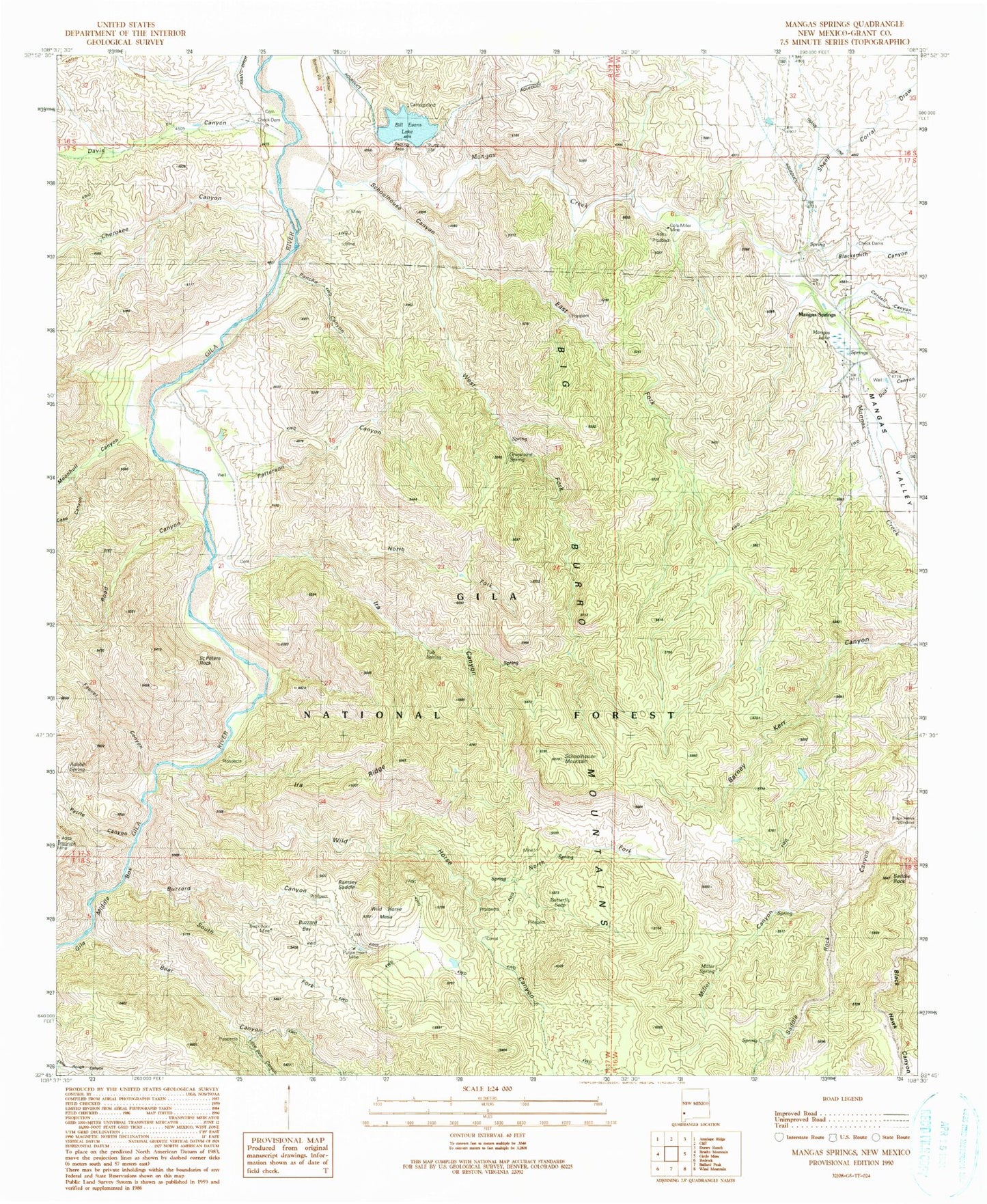
MyTopo
Classic USGS Mangas Springs New Mexico 7.5'x7.5' Topo Map
Couldn't load pickup availability
Historical USGS topographic quad map of Mangas Springs in the state of New Mexico. Map scale may vary for some years, but is generally around 1:24,000. Print size is approximately 24" x 27"
This quadrangle is in the following counties: Grant.
The map contains contour lines, roads, rivers, towns, and lakes. Printed on high-quality waterproof paper with UV fade-resistant inks, and shipped rolled.
Contains the following named places: Adobe Spring, Barney Kerr Tank, Bear Canyon, Big Burro Mountains, Bill Evans Lake, Bill Evans Lake Dam, Black Hawk Canyon, Black Hawk Windmill, Black Hay Windmill, Blackhawk, Blackmoor Mine, Blacksmith Canyon, Blue Stone Tank, Blue Stone Well, Bone Tank, Boundary Tank, Butterfly Seep, Buzzard Bay, Buzzard Canyon, Cake Canyon, Cake Canyon Tank, Cherokee Canyon, Cora Miller Mine, Cordell Canyon, Dale McCauley Ranch, Davis Canyon, Dud Canyon, East Fork Schoolhouse Canyon, East Prong Spring, Faucet Canyon, Fence Line Tank, Fleming Canyon Prospects, Grapevine Spring, Grassy Flat Tank, Hap McCauley Ranch, Ira Canyon, Ira Canyon Tank, Ira Ridge, Juniper Tank, Lebus Recreation Reservoir Dam, Little Bear Canyon, Little Windmill, Mangas Creek, Mangas Lake, Mangas Springs, Mangas Valley, Miller Canyon, Miller Spring, Moonhull Canyon, North Fork Ira Canyon, North Fork Wild Horse Canyon, Old Smokey Group, Pancho Canyon, Patterson Canyon, Patterson Windmill, Pig Tank, Purple Heart Mine, Purple Heart Tank, Pyrite Canyon, Ramsey Saddle, Road Canyon, Saddle Rock, Saint Peters Rock, Schoolhouse Canyon, Schoolhouse Mountain, Schoolhouse Windmill, Sheep Corral Draw, South Fork Buzzard Canyon, Telegraph, Telegraph Mine, Tony Corral, Tub Spring, West Fork Schoolhouse Canyon, West Prong Windmill, Wild Horse Canyon, Wild Horse Mesa, Wild Horse Spring