MyTopo
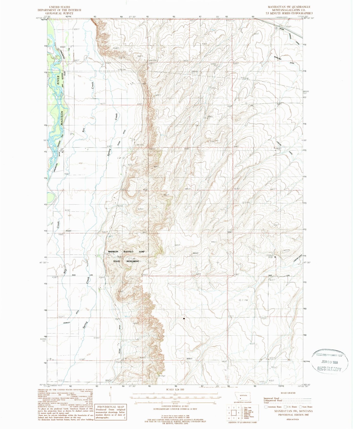
Classic USGS Manhattan SW Montana 7.5'x7.5' Topo Map
Couldn't load pickup availability
Historical USGS topographic quad map of Manhattan SW in the state of Montana. Map scale may vary for some years, but is generally around 1:24,000. Print size is approximately 24" x 27"
This quadrangle is in the following counties: Gallatin.
The map contains contour lines, roads, rivers, towns, and lakes. Printed on high-quality waterproof paper with UV fade-resistant inks, and shipped rolled.
Contains the following named places: 01N02E04CB__01 Well, 01N02E04DCCC01 Well, 01N02E09BBB_01 Well, 01N02E10DB__01 Well, 01N02E10DBAB01 Well, 01N02E12AA__01 Well, 01N02E15DCBB01 Well, 01N02E15DCBD01 Well, 01N02E15DD__01 Well, 01N02E16CBD_01 Well, 01N02E20ADDB01 Well, 01N02E21ABBA01 Well, 01N02E21ABBB01 Well, 01N02E22AB__01 Well, 01N02E22ABB_01 Well, 01N02E22ABBB01 Well, 01N02E22BABA01 Well, 01N02E22BADD01 Well, 01N02E22CA__01 Well, 01N02E22CABD01 Well, 01N02E22CDCC01 Well, 01N02E26AB__01 Well, 01N02E27BBDA01 Well, 01N02E27BCCB01 Well, 01N02E29ADC_01 Well, 01N02E29DCA_01 Well, 01N02E33DAB_01 Well, 01N02E34CB__01 Well, 01N03E07CDDA01 Well, 01N03E19ADBB01 Well, 01N03E19DADC01 Well, 01N03E20CADA01 Well, 01S02E01ADBD01 Well, 01S02E01BDDD01 Well, 01S02E02DD__01 Well, 01S02E03DCC_01 Well, 01S02E03DCCC02 Well, 01S02E04AACC01 Well, 01S02E10ABBB01 Well, 01S02E10AC__01 Well, 01S02E10CAAC01 Well, 01S02E12BA__01 Well, 01S02E13AA__01 Well, 01S02E17AAAB01 Well, C A Ranch, Crowley Ditch, Darlington Ditch, Jorgenson Ranch, Lower Madison, Lower Madison School, Madison Buffalo Jump State Monument, Madison Dike, McDonnell Ranch, Nodtinghan Ranch, Rice Ranch, Sinnema Ranch, Spring Creek