MyTopo
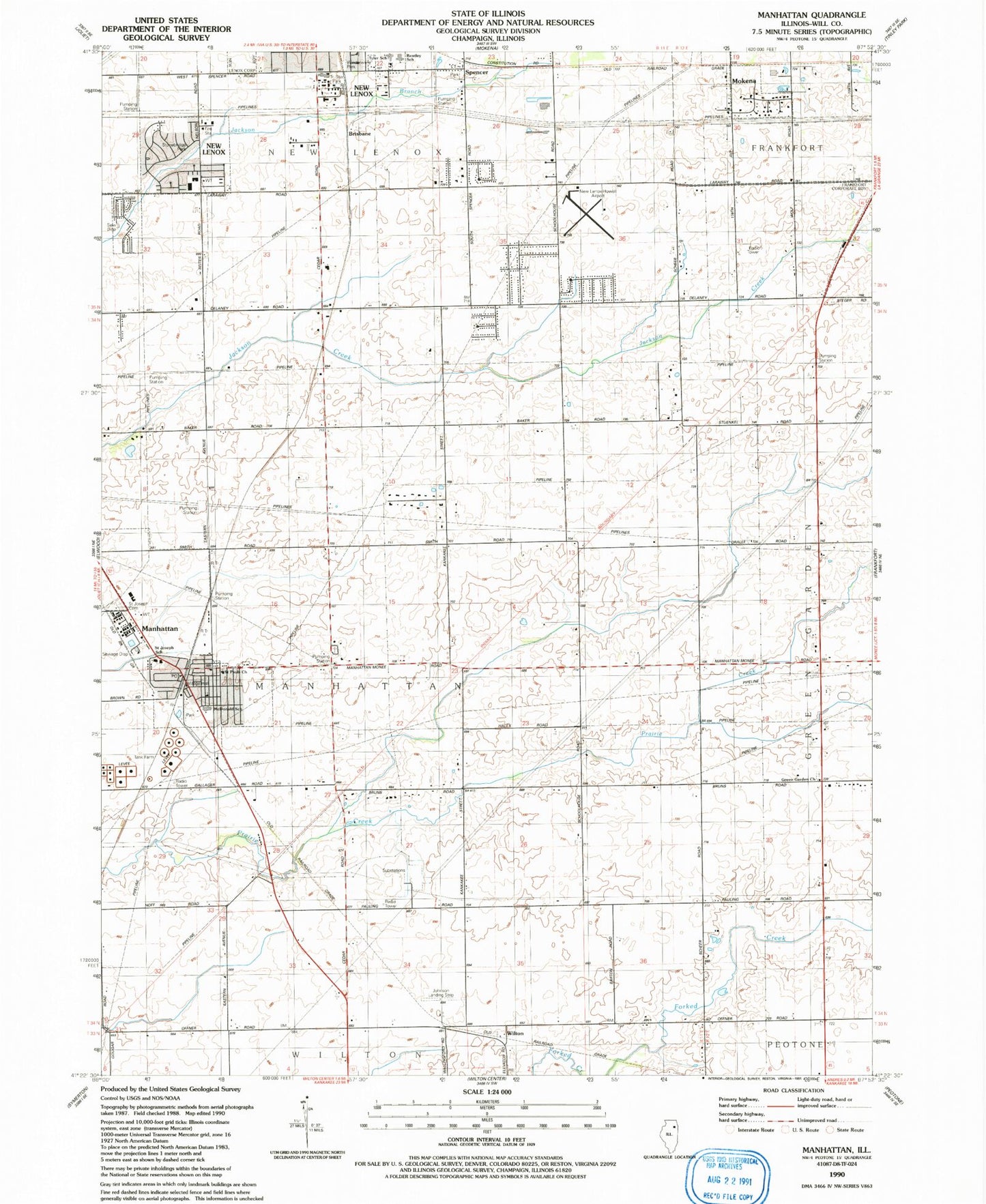
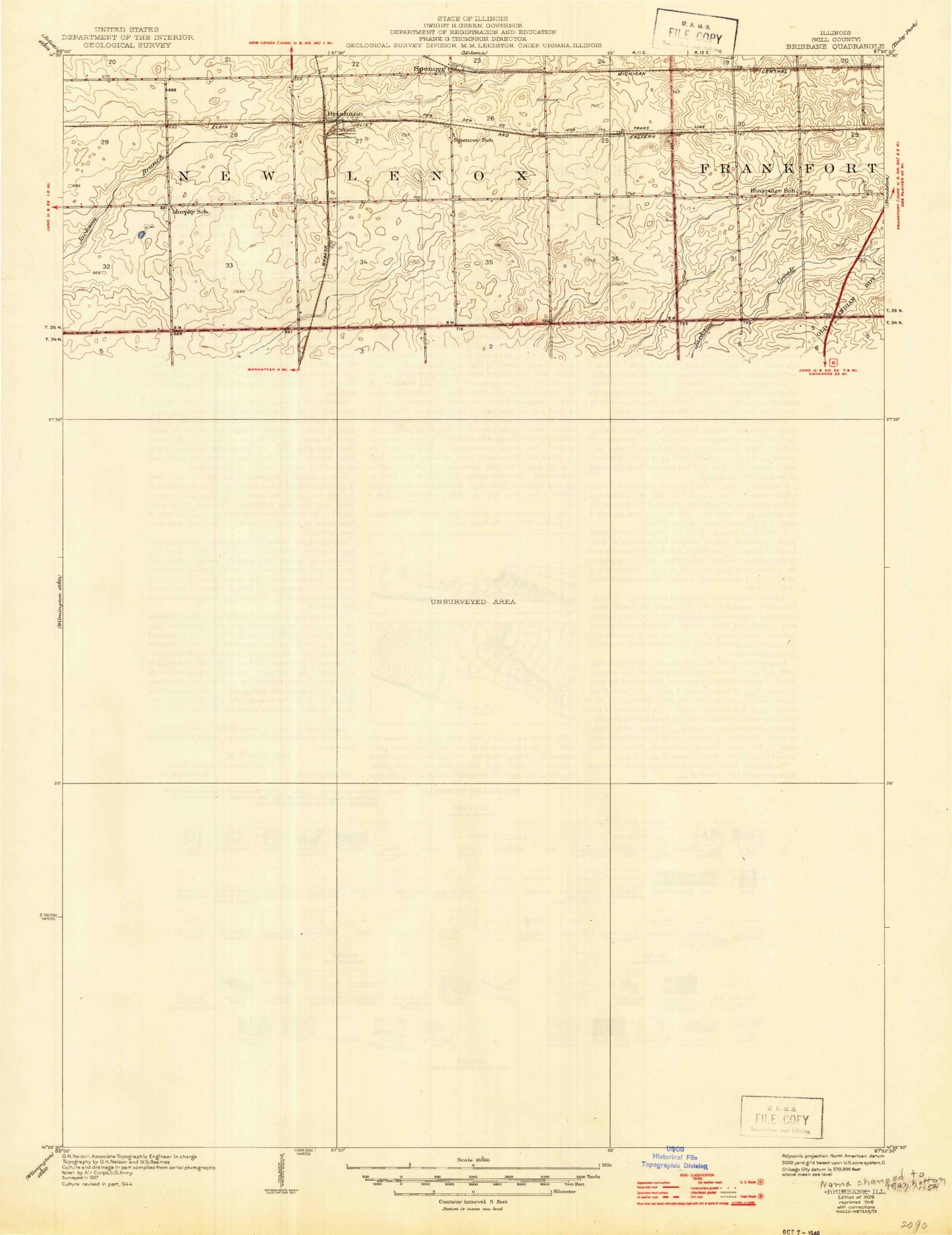
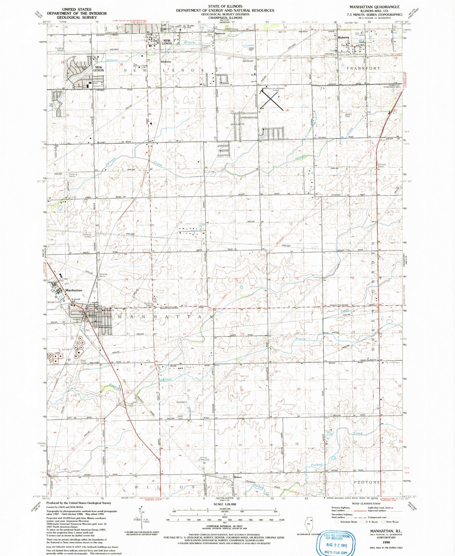
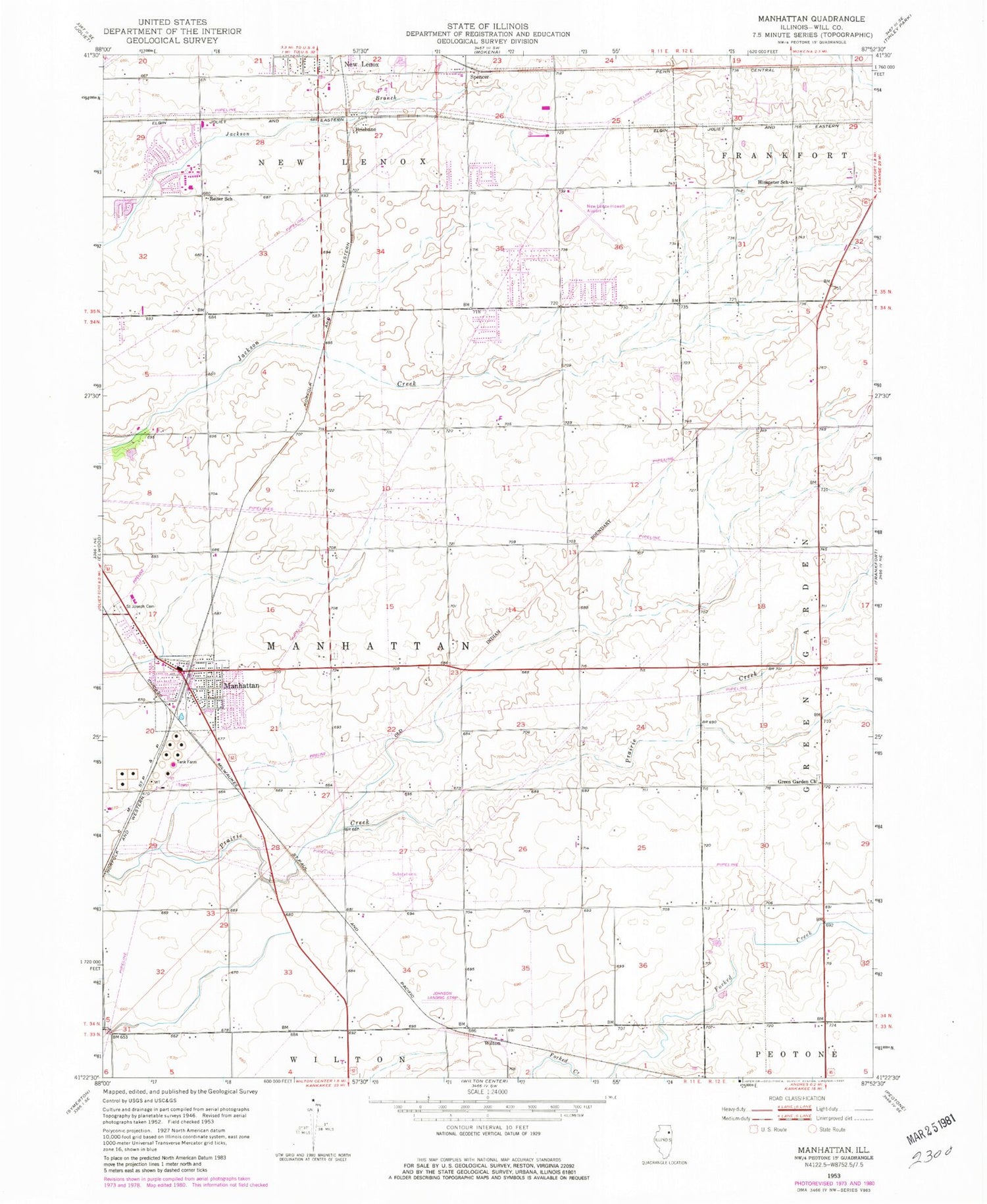
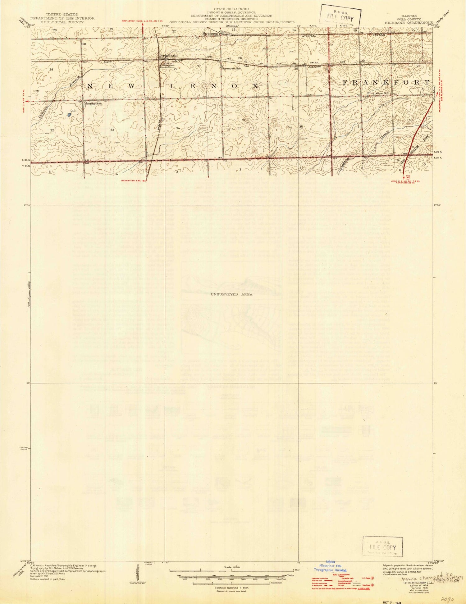
Classic USGS Manhattan Illinois 7.5'x7.5' Topo Map
Couldn't load pickup availability
Historical USGS topographic quad map of Manhattan in the state of Illinois. Map scale may vary for some years, but is generally around 1:24,000. Print size is approximately 24" x 27"
This quadrangle is in the following counties: Will.
The map contains contour lines, roads, rivers, towns, and lakes. Printed on high-quality waterproof paper with UV fade-resistant inks, and shipped rolled.
Contains the following named places: Anna McDonald Elementary School, Arnold J Tyler School, Barr School, Bentley Elementary School, Bettenhausen School, Brisbane, Cedar Industrial Park, Century East, Clarence C Johnson Airport, Five Mile Grove, Fivemile Grove School, Frankfort Fire Protection District Station 73, Geuther School, Green Garden Methodist Church Cemetery, Green Garden United Methodist Church, Hansen School, Hinspeter School, Howell-New Lenox Airport, Johnson Landing Strip, Manhattan, Manhattan Center Cemetery, Manhattan Center School, Manhattan Fire Protection District Station 1, Manhattan Post Office, Manhattan Village Hall, Mud Creek School, Mueller School, New Lenox Fire Protection District Station 3, New Lenox-Howell Airport, Paton School, Pfundstein School, Reiter School, Saint Joseph Cemetery, Saint Joseph School, Saint Joseph's Church, Saint Pauls Church, Sky Corp Industrial Park, Spencer, Spencer School, Stonebridge Park, Township of Manhattan, Tri-Star Park, Village of Manhattan, Will County, Wilton, Winderwere Park, ZIP Code: 60442