MyTopo
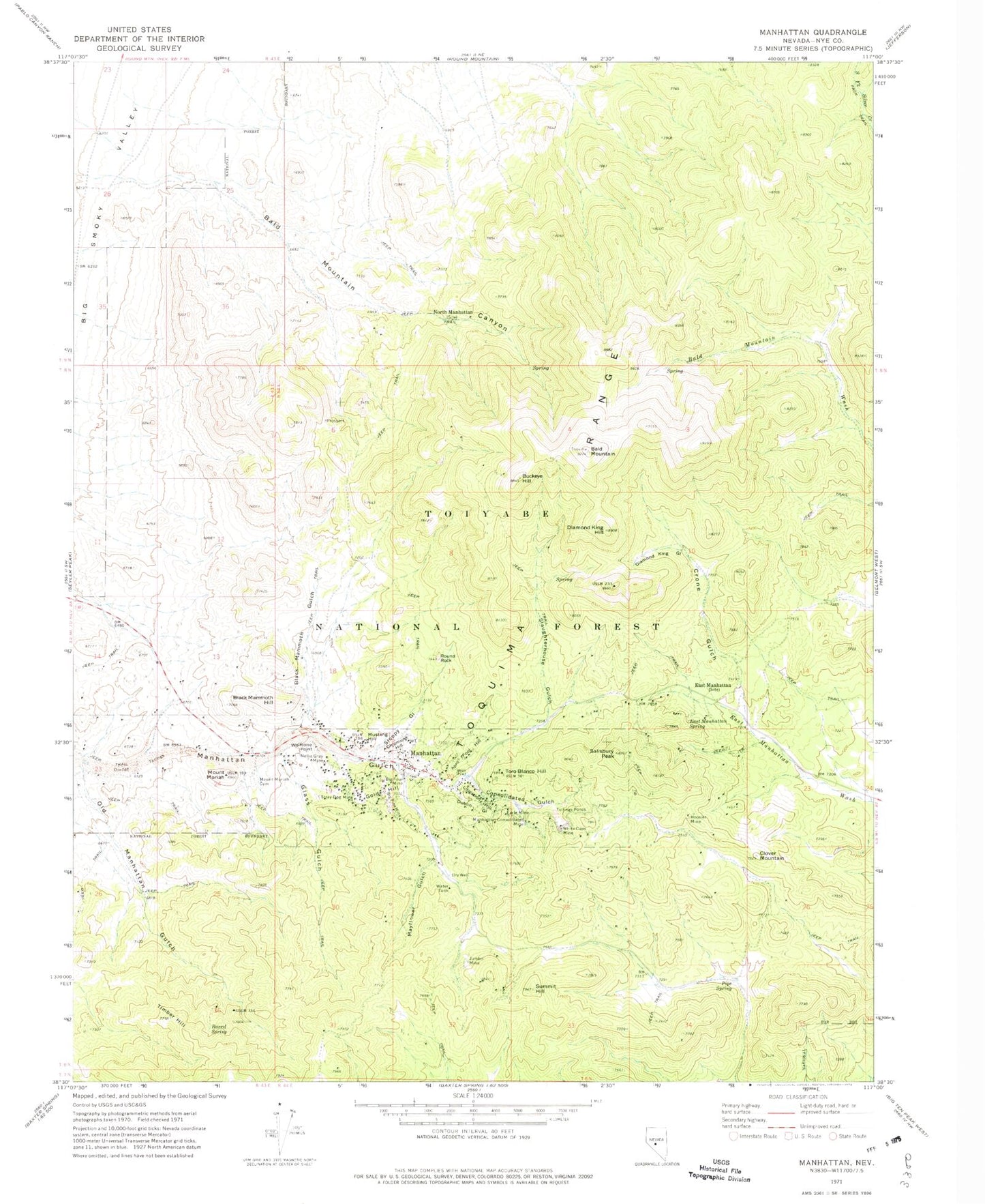
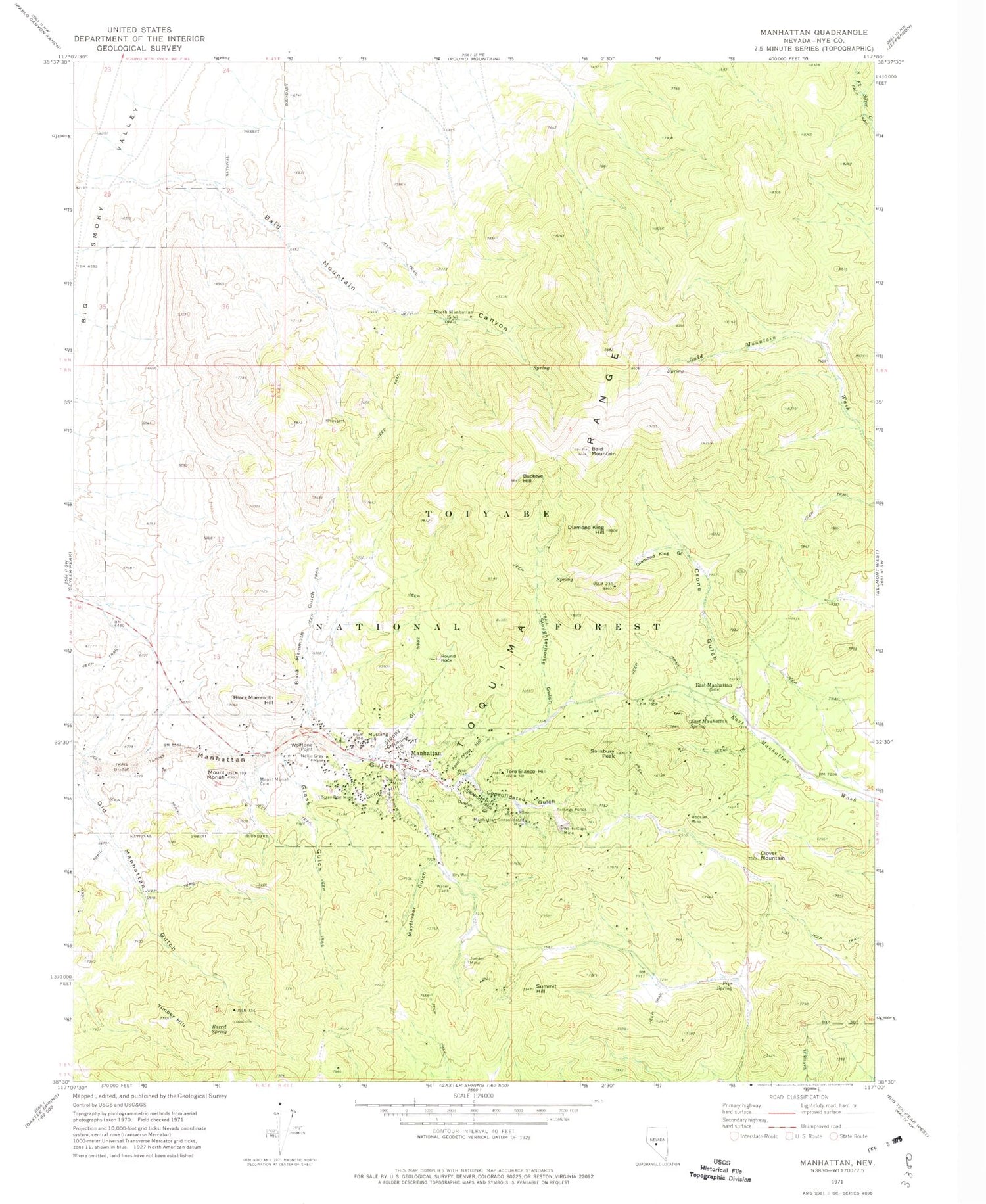
Classic USGS Manhattan Nevada 7.5'x7.5' Topo Map
Couldn't load pickup availability
Historical USGS topographic quad map of Manhattan in the state of Nevada. Map scale may vary for some years, but is generally around 1:24,000. Print size is approximately 24" x 27"
This quadrangle is in the following counties: Nye.
The map contains contour lines, roads, rivers, towns, and lakes. Printed on high-quality waterproof paper with UV fade-resistant inks, and shipped rolled.
Contains the following named places: April Fool Hill, Bald Mountain, Bald Mountain Canyon, Barrel Spring, Big Four Mine, Big Pine Mine, Black Mammoth Gulch, Black Mammoth Hill, Buckeye Hill, Central, Central Post Office, Chipmunk Hill, Clover Mountain, Consolidated Gulch, Crone Gulch, Diamond King Gulch, Diamond King Hill, Dublin Gulch, Earle Mine, East Manhattan, East Manhattan Spring, Ferguson Hill, Glass Gulch, Gold Hill, Hoosier Mine, Jumbo Mine, Litigation Hill, Manhattan, Manhattan Consolidated Mill, Manhattan Consolidated Mine, Manhattan Mining District, Manhattan Ore and Milling Company Mill, Manhattan Post Office, Manhattan Volunteer Fire Department, Mayflower Gulch, Mount Moriah, Mount Moriah Cemetery, Mustang Hill, Nellie Gray Mine, North Manhattan, Old Manhattan Gulch, Pipe Spring, Round Rock, Salisbury Peak, Slaughterhouse Gulch, Sloppy Gulch, Stray Dog Mine, Summit Hill, The Bald Brother, The Bald Sister, Timber Hill, Toro Blanco Hill, War Eagle Mill, White Caps, White Caps Mine, Wolftone Point, ZIP Code: 89022