MyTopo
Classic USGS Manheim Pennsylvania 7.5'x7.5' Topo Map
Couldn't load pickup availability
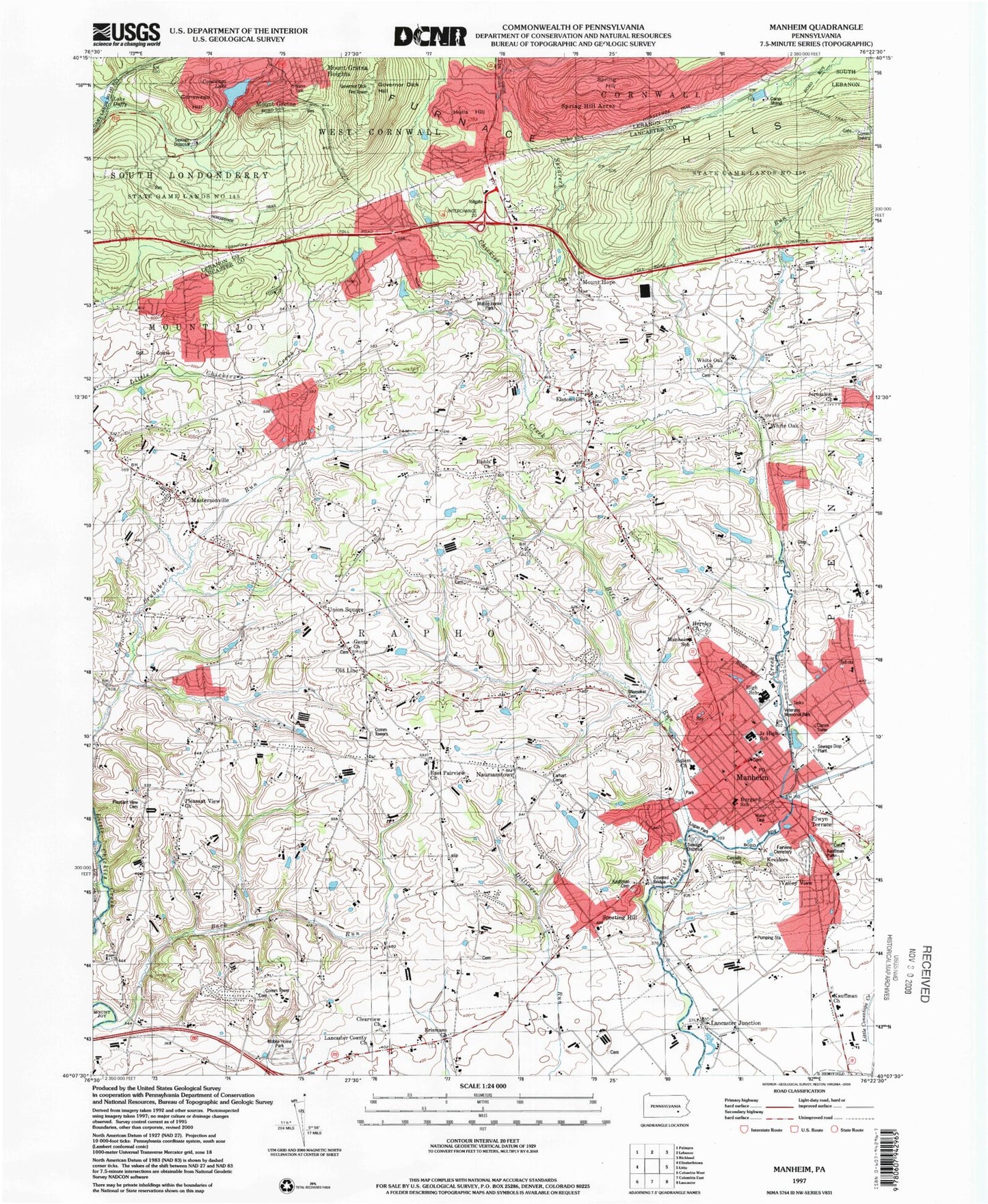
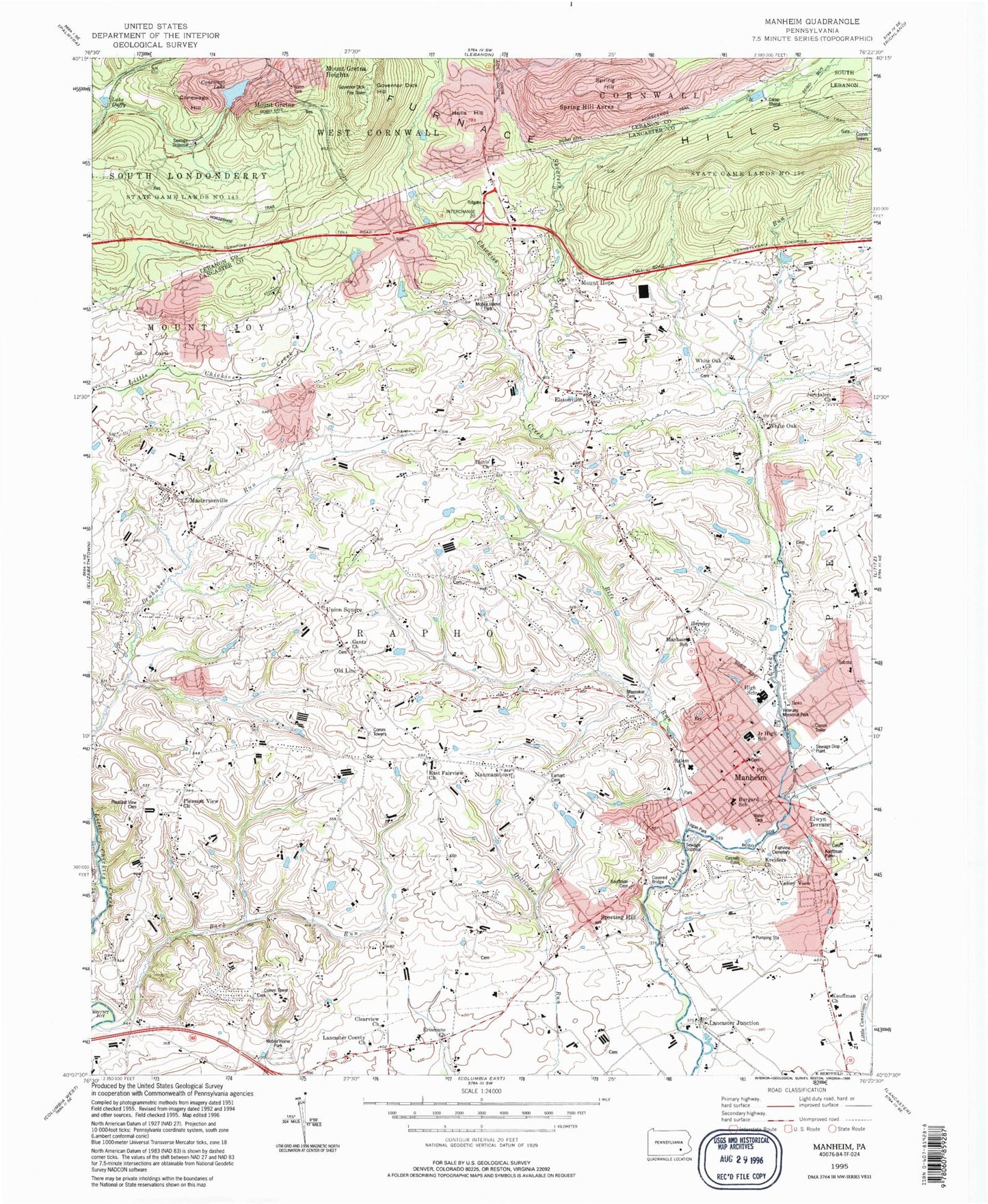
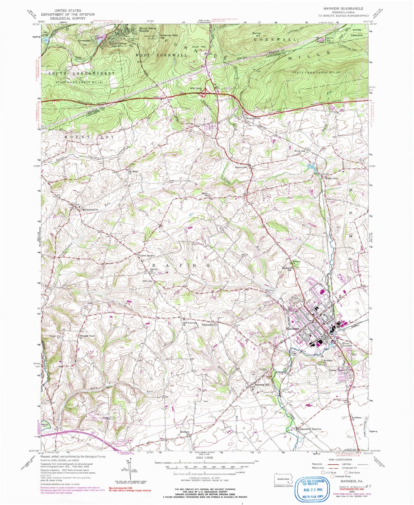
Historical USGS topographic quad map of Manheim in the state of Pennsylvania. Typical map scale is 1:24,000, but may vary for certain years, if available. Print size: 24" x 27"
This quadrangle is in the following counties: Lancaster, Lebanon.
The map contains contour lines, roads, rivers, towns, and lakes. Printed on high-quality waterproof paper with UV fade-resistant inks, and shipped rolled.
Contains the following named places: Boyers Run, Conewago Hill, Conewago Lake, Lake Duffy, Earhart Cemetery, East Fairview Church, Elwyn Terrace, Erismans Church, Gantzs Church, Governor Dick Hill, Hernley Church, Hulls Hill, Kauffman Cemetery, Kauffman Church, Kreiders Church, Lancaster Junction, Manheim, Manheim School, Mastersonville, Mount Gretna, Mount Gretna Heights, Mount Hope Church, Old Line, Penryn Park YMCA Camp, Pleasant View Cemetery, Pleasant View Church, Rife Run, Ruhls Church, Shearers Creek, Shumaker Cemetery, Sporting Hill, Spring Hill, Union Church, Union Square, Valley View, White Oak, White Oak Church, Metzler Airport (historical), Steigel Valley Air Park (historical), State Game Lands Number 156, Elstonville, Mount Hope, Naumanstown, Tree Top Golf Course, Sporting Hill Elementary School, Stiegel Elementary School, Manheim Central Junior High School, H C Bergard Elementary School, Manheim Fairview Cemetery, Kauffman Park, Back Run, Manheim Central Senior High School, Behm Run, Mastersonville Post Office (historical), Old Line Post Office (historical), Sporting Hill Post Office (historical), Mount Hope Post Office (historical), White Oak Post Office (historical), Borough of Manheim, Borough of Mount Gretna, Township of Rapho, Timber Hills, Mount Gretna Post Office (historical), Manheim Fire Department Station 26, Mastersonville Volunteer Fire Company Station 27, Mount Gretna Heights Census Designated Place, Timber Hills Census Designated Place, Doe Run, Aljane Farm, Fittery Farms, Hershvale Farms, King Dairy Farm, Maplebrink Farms, Sparkle Stream Farm, Wil Lyn Farms, Skyview Dairy, Kulpdale Farm, Lehman Farms, Graemont Farm, Oberley Farms, Fahnestock Farms, Longnecker Farm, Windward Farms, Kready Farm, Blueberry Hill Farm, Seibel Farms, Valley View Farms, Peaceful Grove Farm, Skyview Farm, Walnut Hill Farm, Rapho Valley Farm, Sycamore Farms, Tuck - A - Way Farms, Manheim Veterans Memorial Ambulance, Manheim Post Office, Mount Greta Post Office, Manheim Borough Police Department, Ruhls United Methodist Church Cemetery, Mastersonville Brethren in Christ Cemetery, Shelly Gravesite, Clearview Mennonite Church Cemetery, Erisman Mennonite Cemetery, Harnley - Longenecker Graveyard, Dohner Farm Cemetery, Becker Graveyard, Greiner Cemetery, Witmer Cemetery, Kreiders Church of the Brethren Cemetery, Hershey Graveyard, Gibbel Farm Cemetery, Longenecker Graveyard, Zion Lutheran Cemetery, Nissley Cemetery, Hossler Cemetery, Saint Pauls United Church of Christ Memorial Garden, Ginder - Kinsey - Stauffer Cemetery, East Fairview Church of the Brethren Cemetery, Eby United Brethren Cemetery, Givler Cemetery, Manheim Evangelical Cemetery, Kauffman's Mennonite Church Cemetery, Hernle Cemetery, Hernley Mennonite Cemetery, Frick / Erisman Graveyard, Mount Hope Mennonite Cemetery, Stauffer Graveyard, White Oak Mennonite Cemetery, Horst Cemetery, Gibble Graveyard, Hope Episcopal Church Cemetery, Gantz Menonite Church Cemetery, Shearer Cemetery, Boyers Run, Conewago Hill, Conewago Lake, Lake Duffy, Earhart Cemetery, East Fairview Church, Elwyn Terrace, Erismans Church, Gantzs Church, Governor Dick Hill, Hernley Church, Hulls Hill, Kauffman Cemetery, Kauffman Church, Kreiders Church, Lancaster Junction, Manheim, Manheim School, Mastersonville, Mount Gretna, Mount Gretna Heights, Mount Hope Church, Old Line, Penryn Park YMCA Camp, Pleasant View Cemetery, Pleasant View Church, Rife Run, Ruhls Church, Shearers Creek, Shumaker Cemetery, Sporting Hill, Spring Hill, Union Church, Union Square, Valley View, White Oak, White Oak Church, Metzler Airport (historical), Steigel Valley Air Park (historical), State Game Lands Number 156, Elstonville, Mount Hope, Naumanstown, Tree Top Golf Course, Sporting Hill Elementary School, Stiegel Elementary School, Manheim Central Junior High School, H C Bergard Elementary School, Manheim Fairview Cemetery, Kauffman Park, Back Run, Manheim Central Senior High School, Behm Run, Mastersonville Post Office (historical), Old Line Post Office (historical), Sporting Hill Post Office (historical), Mount Hope Post Office (historical), White Oak Post Office (historical), Borough of Manheim, Borough of Mount Gretna, Township of Rapho, Timber Hills, Mount Gretna Post Office (historical), Manheim Fire Department Station 26, Mastersonville Volunteer Fire Company Station 27, Mount Gretna Heights Census Designated Place, Timber Hills Census Designated Place, Doe Run, Aljane Farm, Fittery Farms, Hershvale Farms, King Dairy Farm, Maplebrink Farms, Sparkle Stream Farm, Wil Lyn Farms, Skyview Dairy, Kulpdale Farm, Lehman Farms, Graemont Farm, Oberley Farms, Fahnestock Farms, Longnecker Farm, Windward Farms, Kready Farm, Blueberry Hill Farm, Seibel Farms, Valley View Farms, Peaceful Grove Farm, Skyview Farm, Walnut Hill Farm, Rapho Valley Farm, Sycamore Farms, Tuck - A - Way Farms, Manheim Veterans Memorial Ambulance, Manheim Post Office, Mount Greta Post Office, Manheim Borough Police Department, Ruhls United Methodist Church Cemetery, Mastersonville Brethren in Christ Cemetery, Shelly Gravesite, Clearview Mennonite Church Cemetery, Erisman Mennonite Cemetery, Harnley - Longenecker Graveyard, Dohner Farm Cemetery


