MyTopo
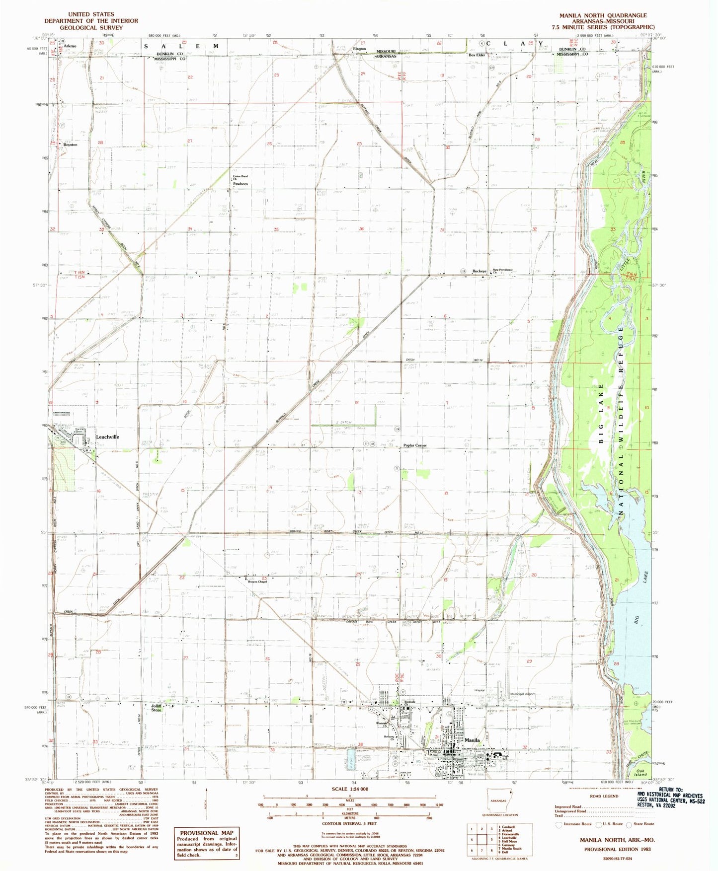
Classic USGS Manila North Arkansas 7.5'x7.5' Topo Map
Couldn't load pickup availability
Historical USGS topographic quad map of Manila North in the states of Arkansas, Missouri. Map scale may vary for some years, but is generally around 1:24,000. Print size is approximately 24" x 27"
This quadrangle is in the following counties: Dunklin, Mississippi.
The map contains contour lines, roads, rivers, towns, and lakes. Printed on high-quality waterproof paper with UV fade-resistant inks, and shipped rolled.
Contains the following named places: Arkmo, Bethany Baptist Church, Box Elder, Box Elder Cemetery, Box Elder School, Boxelder Church, Boynton, Boynton School, Brown, Brown School, Browns Chapel Baptist Church, Buckeye, Bucks Point, Buffalo Arm Number 8, Buffalo Ditch Number 1, Buffalo Island Community Hospital, Church of Christ, City of Manila, Cottonwood Point, Ditch Number 10, Ditch Number 14, Ditch Number 16, Ditch Number 17, Ditch Number 6, Dredge Boat Creek Ditch Number 1, Dredge Boat Creek Ditch Number 12, Dry Land Creek Ditch Number 5, Emerson Ambulance Service Manila, First Baptist Church of Manila, Garson, Hills Store, Hone Cypress Ditch Number 2, Honey Cypress Swamp, Jolliff Store, Justin Veach Elementary School, Little River, Manila, Manila Fire Department, Manila High School, Manila Municipal Airport, Manila Police Department, Manila Post Office, New Hope Church, New Hope School, New Providence Baptist Church, Pawheen, Pawheen School, Poplar Corner, Rington, Skidway Church, Skidway School, Spur Number 4, Tims Point, Township of Neal, Union Band Church, Westside Baptist Church, Westside Church, ZIP Code: 72438