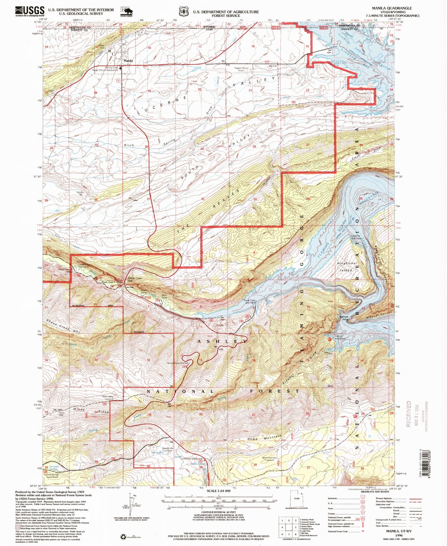
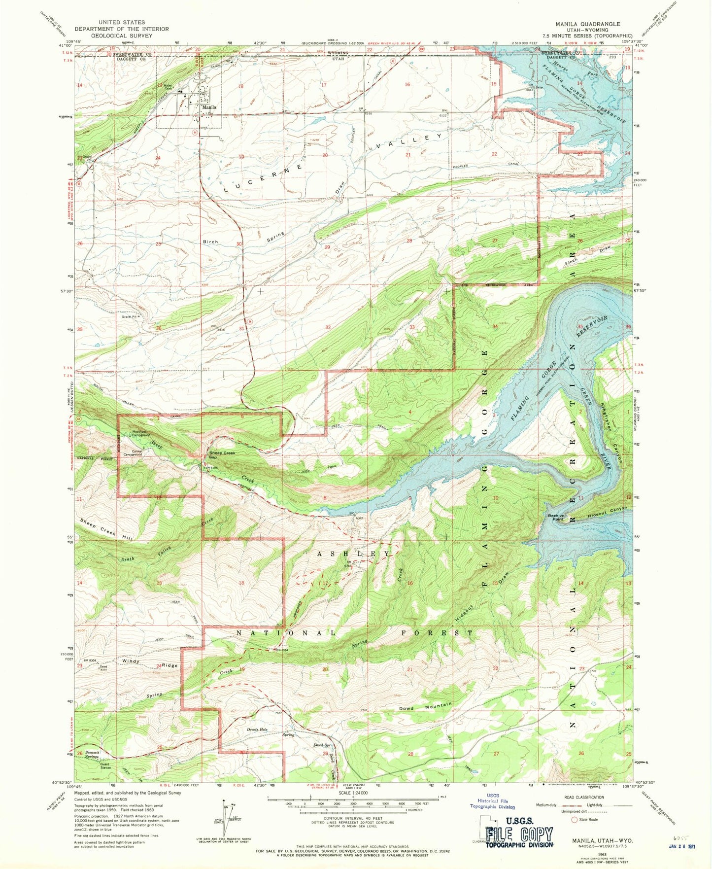
MyTopo
Classic USGS Manila Utah 7.5'x7.5' Topo Map
Couldn't load pickup availability
Historical USGS topographic quad map of Manila in the states of Utah, Wyoming. Map scale may vary for some years, but is generally around 1:24,000. Print size is approximately 24" x 27"
This quadrangle is in the following counties: Daggett, Sweetwater.
The map contains contour lines, roads, rivers, towns, and lakes. Printed on high-quality waterproof paper with UV fade-resistant inks, and shipped rolled.
Contains the following named places: Beehive Point, Birch Spring Draw, Carmel Campground, Daggett County Ambulance Service, Death Valley Creek, Death Valley Enclosure, Dowd Mountain, Dowd Mountain Enclosure, Dowd Mountain Overlook Picnic Area, Dowd Spring, Dowd Spring Recreation Area, Dowds Hole, Dowds Hole Enclosure, Flamingo Gorge Overlook, Henrys Fork, Hideout Boat Camp, Hideout Canyon Campground, Hideout Draw, Hideout Eagle Basin Trail, Kingfisher Canyon, Kingfisher Creek, Kingfisher Island, Kingfisher Island Campground, Kingfisher Park, Linwood, Manila, Manila Airport, Manila Cemetery, Manila Elementary School, Manila High School, Manila Post Office, Manila Ranger Station, Manila Volunteer Fire Department, Mann Camp, Moenkopi Campground, Navajo Cliffs Picnic Area, Peoples Canal, Sheep Creek, Sheep Creek Bay, Sheep Creek Bay Campground, Sheep Creek Canal, Sheep Creek Gap, South Valley, Spring Creek, Summit Springs, Summit Springs Guard Station, The Church of Jesus Christ of Latter Day Saints, The Reaves, Town of Manila, United States Forest Service Fire Station - Manila Office, West Daggett Division, Willow Camp