MyTopo
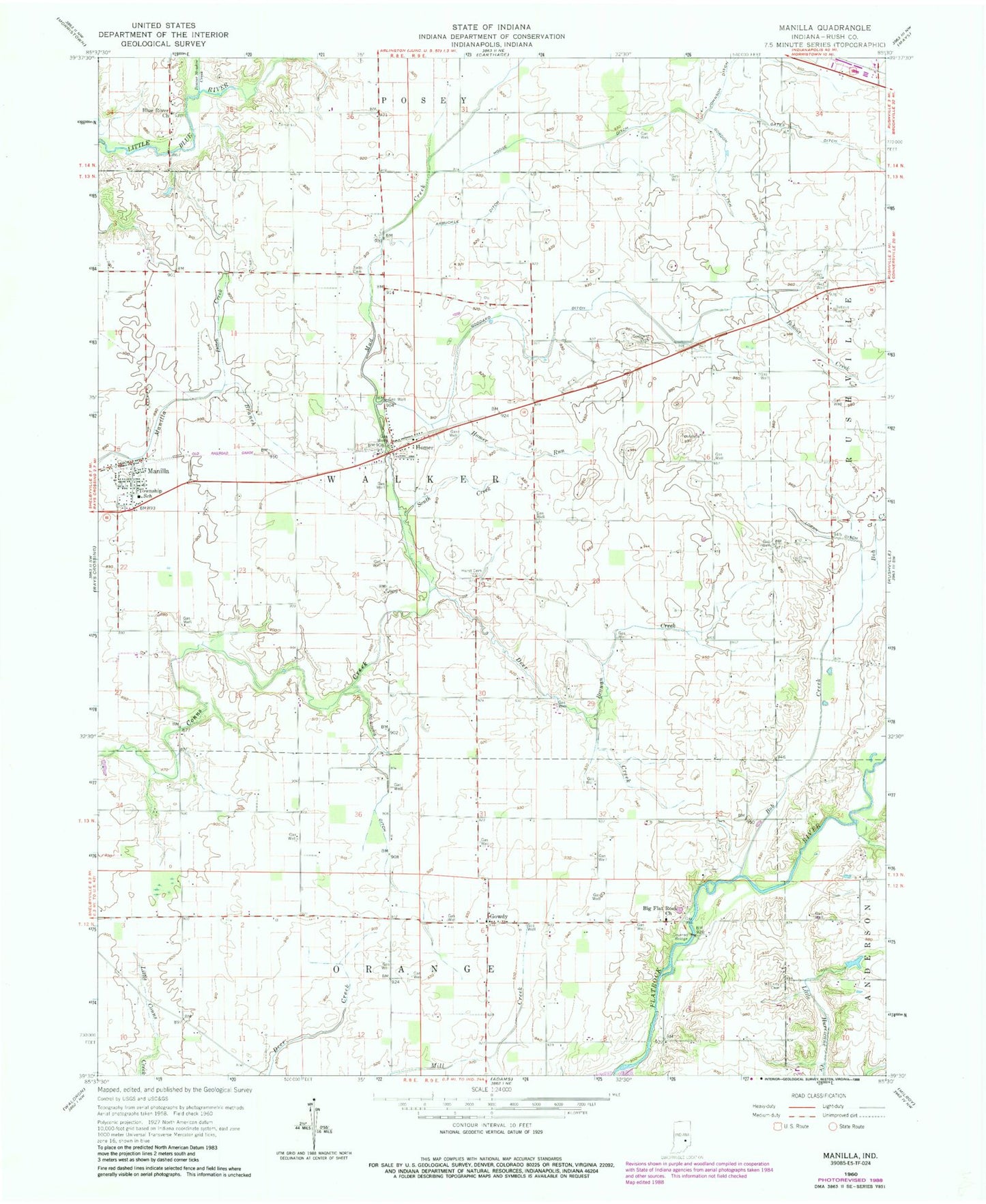
Classic USGS Manilla Indiana 7.5'x7.5' Topo Map
Couldn't load pickup availability
Historical USGS topographic quad map of Manilla in the state of Indiana. Map scale may vary for some years, but is generally around 1:24,000. Print size is approximately 24" x 27"
This quadrangle is in the following counties: Rush.
The map contains contour lines, roads, rivers, towns, and lakes. Printed on high-quality waterproof paper with UV fade-resistant inks, and shipped rolled.
Contains the following named places: Arbuckle Ditch, Beaver Meadow Creek, Bebout Cemetery, Bebout Creek, Big Flat Rock Church, Blue River Church, Bob Creek, Branan Creek, Deer Creek, Ditch Creek, Gates Ditch, Goddard Cemetery, Goddard Ditch, Gordon Ditch, Gowdy, Green Cemetery, Hodge Ditch, Homer, Homer Run, Hurst Cemetery, Johnson Ditch, Logan Nine Hundred Forty-Five Ditch, Manilla, Manilla Census Designated Place, Manilla Elementary School, Manilla Post Office, Manilla Volunteer Fire Department, McCarty Cemetery, McCorkle Quarry, McGinnis Ditch, Mud Creek, Ormes Cemetery, Radar - Bowman - Worland Cemetery, Sells Cemetery, South Creek, Summer Post Office, Township of Walker, Webster Airport, ZIP Codes: 46146, 46150