
MyTopo
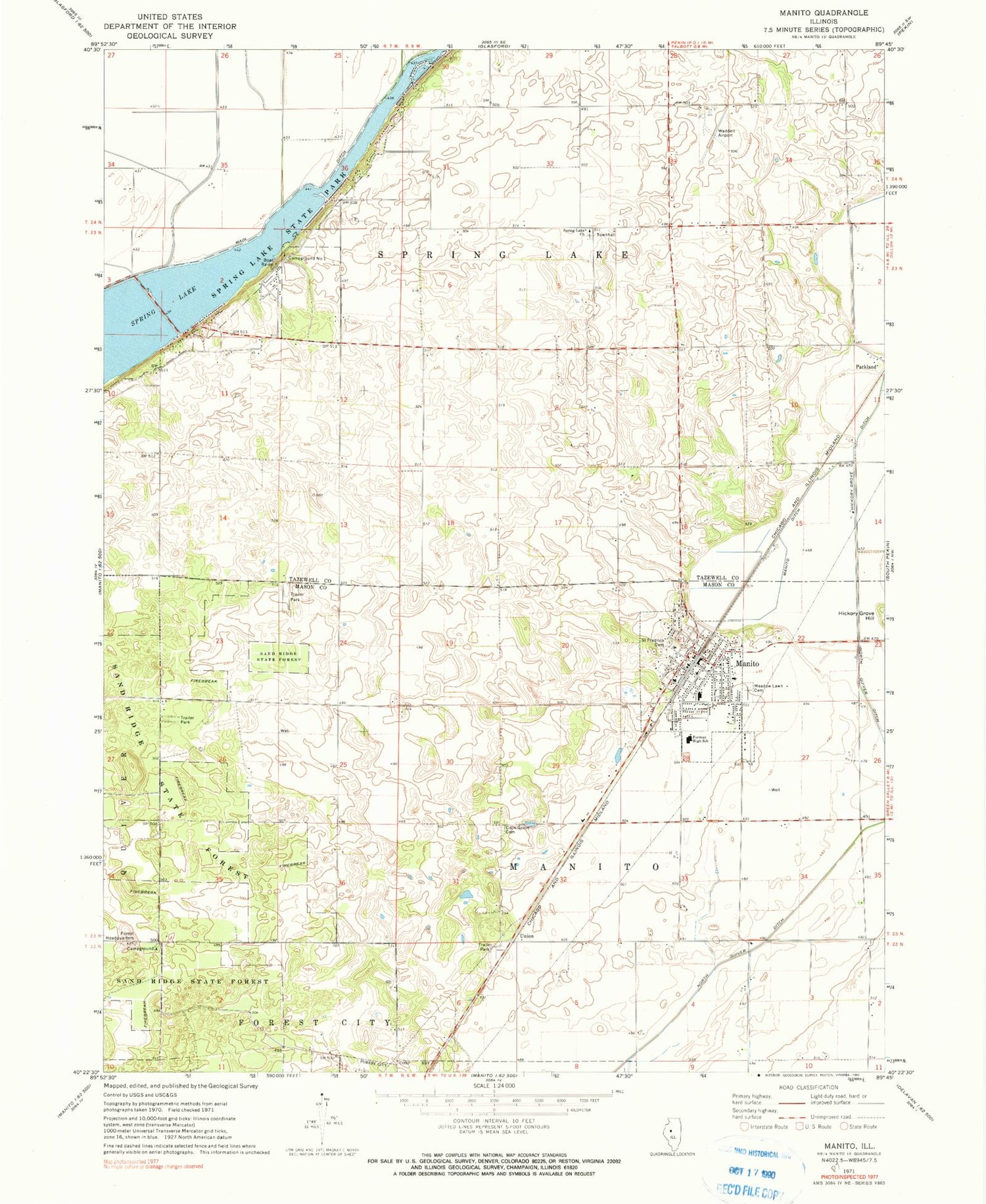
Classic USGS Manito Illinois 7.5'x7.5' Topo Map
Couldn't load pickup availability
Historical USGS topographic quad map of Manito in the state of Illinois. Typical map scale is 1:24,000, but may vary for certain years, if available. Print size: 24" x 27"
This quadrangle is in the following counties: Mason, Tazewell.
The map contains contour lines, roads, rivers, towns, and lakes. Printed on high-quality waterproof paper with UV fade-resistant inks, and shipped rolled.
Contains the following named places: North Quiver Ditch, Coon Grove Cemetery, Midwest Central High School, Main Ditch, Manito, Manito Ditch, Meadow Lawn Cemetery, Saint Fredricks Cemetery, Sand Ridge State Forest, Spring Lake, Spring Lake Church, Spring Lake State Park, Parkland, Union, Campground Number 1, Palmer Flying Service Inc, Township of Manito, Township of Spring Lake, County Line School (historical), Crescent School (historical), Sand Ridge State Forest Headquarters, Union School (historical), Dodds School (historical), Golden School (historical), Radville, Sewell Lake (historical), Spring Garden School (historical), Spring Lake Townhall, Star School (historical), Waddell Airport (historical), North Park Picnic Area, Midwest Central Primary School, Pine Campground, Springlake Cemetery, Oak Grove Cemetery, Village of Manito, Forman Fire Protection District, Manito Post Office


