MyTopo
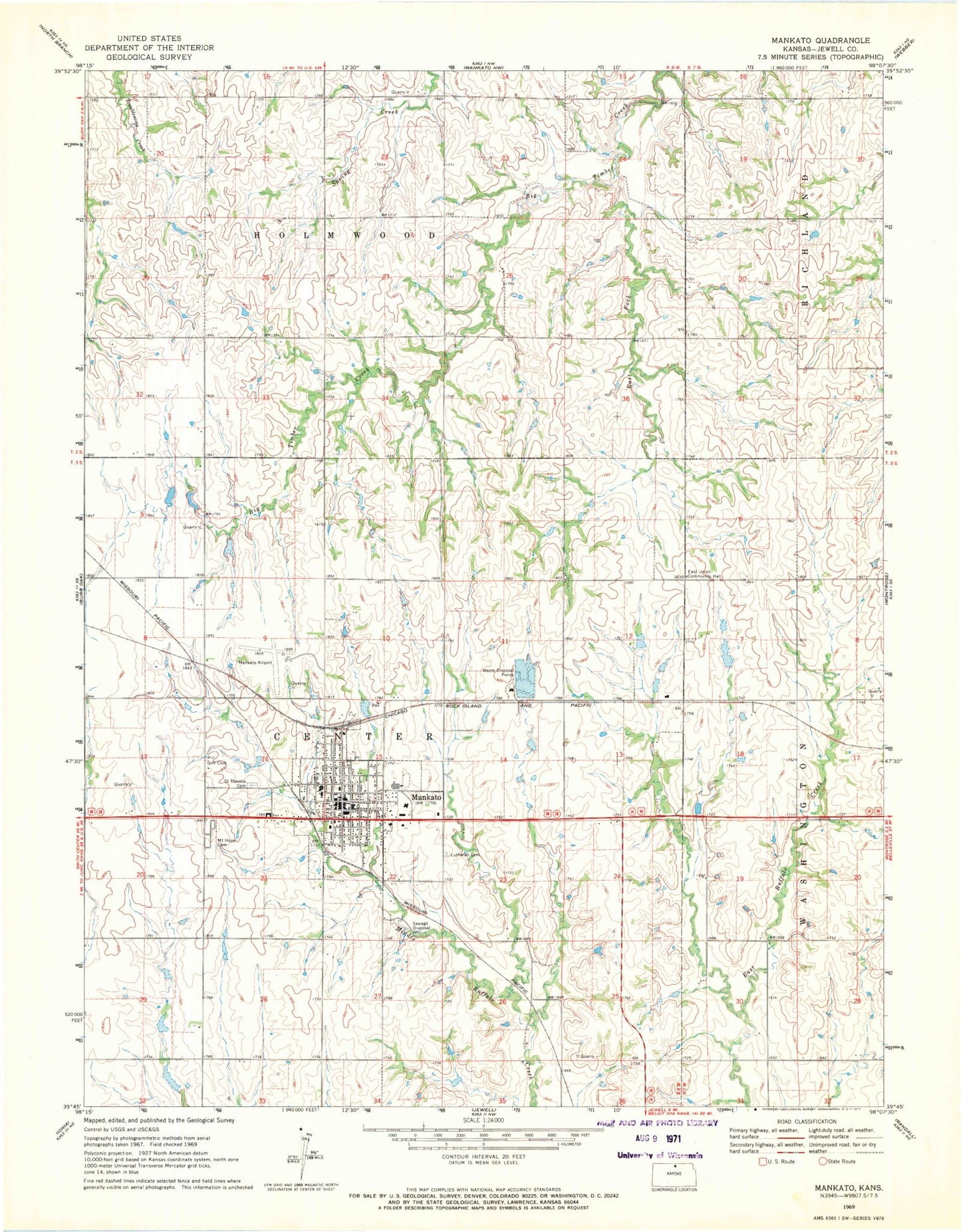
Classic USGS Mankato Kansas 7.5'x7.5' Topo Map
Couldn't load pickup availability
Historical USGS topographic quad map of Mankato in the state of Kansas. Map scale may vary for some years, but is generally around 1:24,000. Print size is approximately 24" x 27"
This quadrangle is in the following counties: Jewell.
The map contains contour lines, roads, rivers, towns, and lakes. Printed on high-quality waterproof paper with UV fade-resistant inks, and shipped rolled.
Contains the following named places: Blue Hills Upland, City of Mankato, East Fork Big Timber Creek, East Lutheran Cemetery, East Union Community Hall, Evangelical Lutheran Church, First Baptist Church, Harmony United Methodist Church, Jewell County, Jewell County Courthouse, Jewell County Emergency Medical Services, Jewell County Fairgrounds, Jewell County Health Department, Jewell County Historical Museum, Jewell County Hospital, Jewell County Jail, Jewell County Sheriff's Office, Kansas Department of Transportation District 2 Area 2 Mankato Area Office, Lutheran Cemetery, Mankato, Mankato Airport, Mankato Christian Church, Mankato City Hall, Mankato Municipal Wastewater Treatment Plant, Mankato Post Office, Mankato Volunteer Fire Department, Mount Hope Cemetery, Rock Hills Elementary School, Rock Hills Junior / Senior High School, Rock Hills Middle School, Saint Theresa Catholic Church, Saint Theresa Cemetery, Township of Center, Township of Holmwood, ZIP Code: 66956