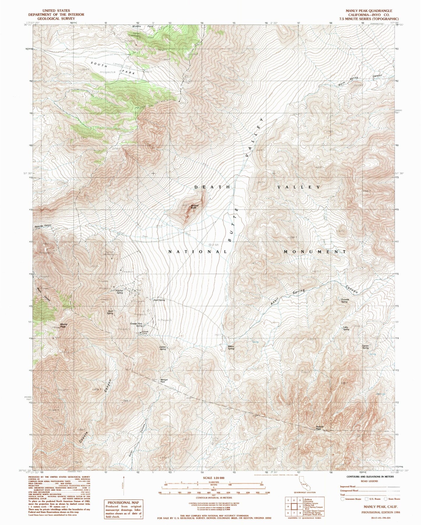
MyTopo
Classic USGS Manly Peak California 7.5'x7.5' Topo Map
Regular price
$16.95
Regular price
Sale price
$16.95
Unit price
per
Couldn't load pickup availability
Historical USGS topographic quad map of Manly Peak in the state of California. Typical map scale is 1:24,000, but may vary for certain years, if available. Print size: 24" x 27"
This quadrangle is in the following counties: Inyo.
The map contains contour lines, roads, rivers, towns, and lakes. Printed on high-quality waterproof paper with UV fade-resistant inks, and shipped rolled.
Contains the following named places: Anvil Spring, Fivemile Spring, Greater View Spring, Manly Peak, Mengel Pass, Needle Peak, Russell Camp, South Park, Squaw Spring, Willow Spring, Striped Butte, Butte Valley, Hatchet Spring, Jubilee Spring, Little Spring, Quail Spring