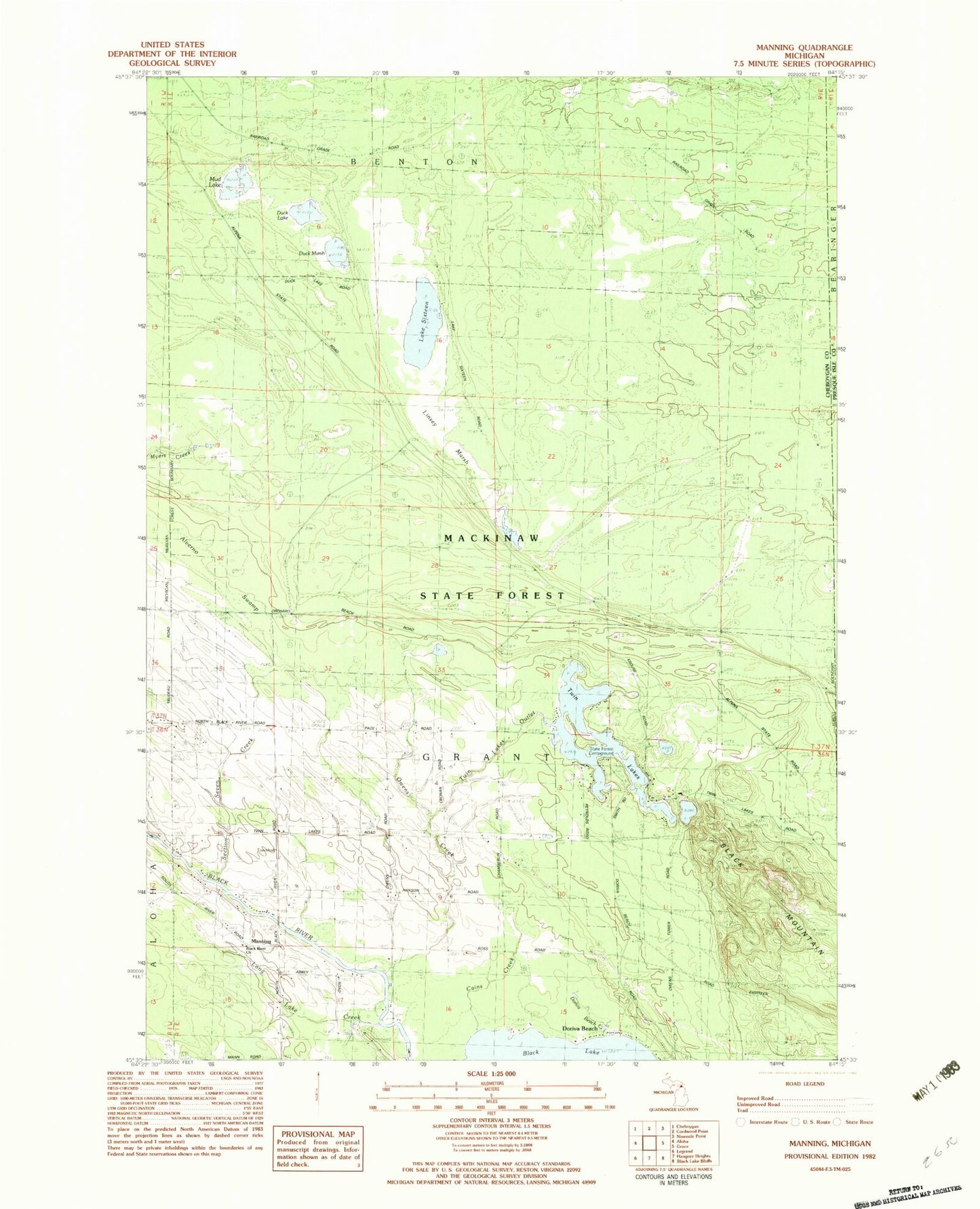
MyTopo
Classic USGS Manning Michigan 7.5'x7.5' Topo Map
Couldn't load pickup availability
Historical USGS topographic quad map of Manning in the state of Michigan. Map scale may vary for some years, but is generally around 1:24,000. Print size is approximately 24" x 27"
This quadrangle is in the following counties: Cheboygan, Presque Isle.
The map contains contour lines, roads, rivers, towns, and lakes. Printed on high-quality waterproof paper with UV fade-resistant inks, and shipped rolled.
Contains the following named places: Alverno Swamp, Black Mountain, Black River Church, Cains Creek, Doriva Beach, Doriva Beach Creek, Duck Lake, Duck Marsh, Hoffman's Black Mountain Aerodrome, Lake Sixteen, Linsey Marsh, Long Lake Creek, Manning, Manning Post Office, Mud Lake, Owens Creek, Owens Lookout Tower, School Number 1, Section Seven Creek, Township of Grant, Twin Lakes, Twin Lakes Outlet, Twin Lakes State Forst Campground