MyTopo
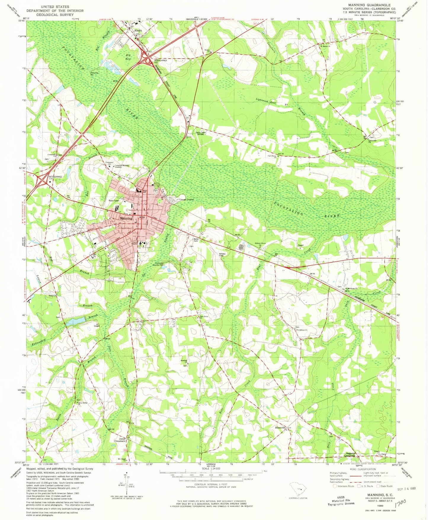
Classic USGS Manning South Carolina 7.5'x7.5' Topo Map
Couldn't load pickup availability
Historical USGS topographic quad map of Manning in the state of South Carolina. Map scale may vary for some years, but is generally around 1:24,000. Print size is approximately 24" x 27"
This quadrangle is in the following counties: Clarendon.
The map contains contour lines, roads, rivers, towns, and lakes. Printed on high-quality waterproof paper with UV fade-resistant inks, and shipped rolled.
Contains the following named places: Alcolu Baptist Church, All Saints Episcopal Church, Baggette Crossroads, Baywood School, Bear Creek, Bell Branch, Bethel School, Big Bay, Big Branch, Bi-Lo Plaza Shopping Center, Bloomville, Bloomville Church, Bloomville School, City of Manning, Clarendon County, Clarendon County Court House, Clarendon County Fire Department, Clarendon County Jail, Clarendon County Rural Fire Department Headquarters, Clarendon County Sheriff's Office, Clarendon County Sheriff's Office and Detention Center, Clarendon Fire Department Station 6, Clarendon Golf And Country Club, Clarendon Memorial Hospital Heliport, Country Club Estates, Crossroads Church, Davis Branch, Ebenezer Baptist Church, Emmanuel Church, Fair Haven Church, Fellowship Branch, Fellowship Cemetery, Goodwill Church, Goodwill School, Gum Pond, Harvin Clarendon County Library, Harvin Pond, Harvin Pond Dam D-3489, Hog Branch, James Crossroads, Juneburn School, Juneville, Laurence Manning Academy, Lees Cemetery, Lemon Branch, Liberty Church, Lightwood Knot Branch, Little Bethel Church, Little Star Church, Loss Branch, Manning, Manning Baptist Church, Manning Cemetery, Manning Fire Department, Manning High School, Manning Methodist Church, Manning Middle School, Manning Police Department, Manning Post Office, Manning Presbyterian Church, Manning Primary School, Manning Training School, Manning Wastewater Treatment Facility, McLeod Health - Clarendon, Midlands MedTech, Mount Chapel Church, Mount Chapel School, Oak Grove Church, Ox Swamp, Palmetto Air Plantation Airport, Providence Church, Saint Marks School, Saint Marys Church, Saint Matthews Church, Saint Matthews School, Spreadoak Branch, Trinity African Methodist Episcopal Church, Trinity Cemetery, Trinity Church, Trinity Cross Roads, Trinity School, WYMB-AM (Manning), ZIP Code: 29102