MyTopo
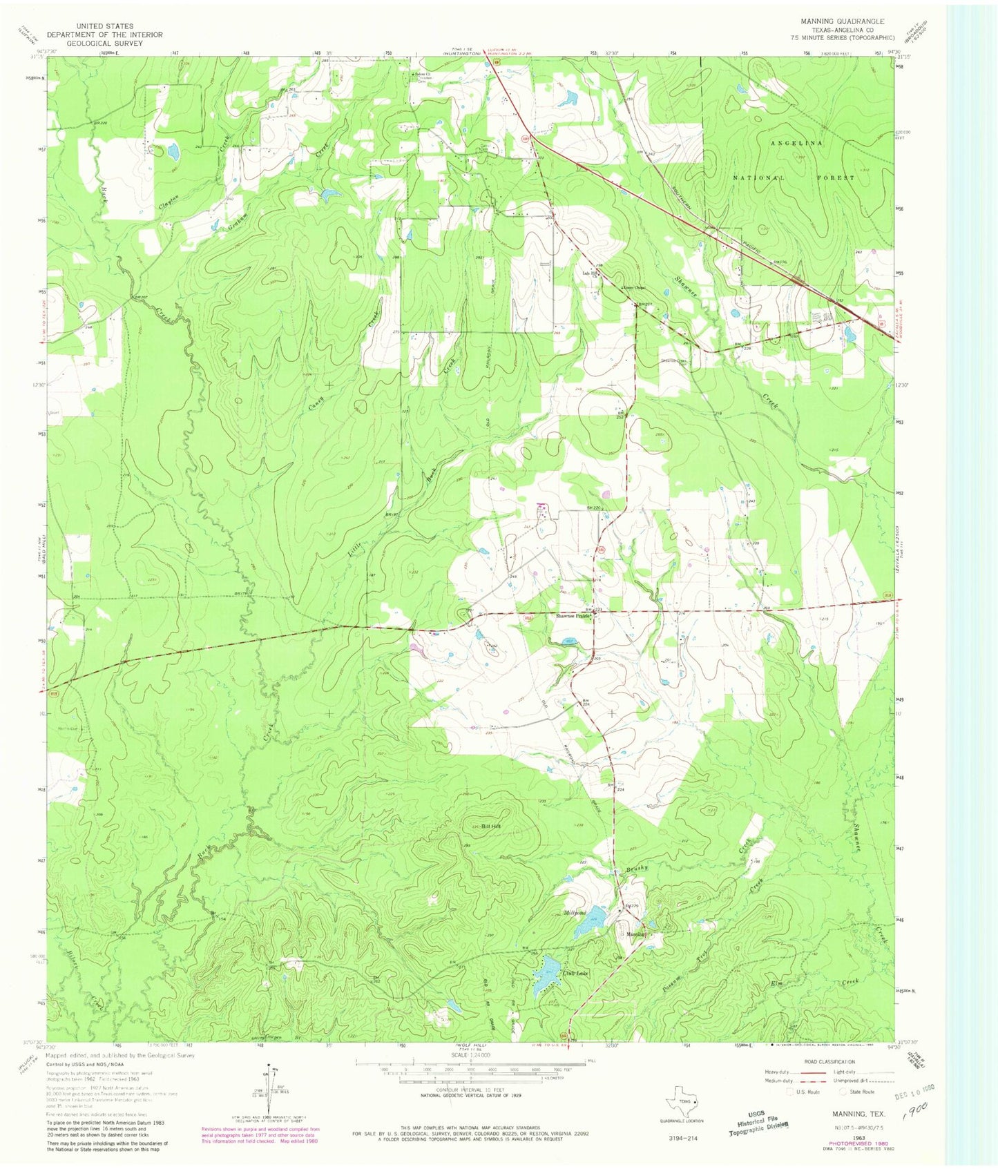
Classic USGS Manning Texas 7.5'x7.5' Topo Map
Couldn't load pickup availability
Historical USGS topographic quad map of Manning in the state of Texas. Map scale may vary for some years, but is generally around 1:24,000. Print size is approximately 24" x 27"
This quadrangle is in the following counties: Angelina.
The map contains contour lines, roads, rivers, towns, and lakes. Printed on high-quality waterproof paper with UV fade-resistant inks, and shipped rolled.
Contains the following named places: Bill Hill, Brushy Creek, Bufords Field, Caney Creek, Carrell Cemetery, Clayton Creek, Club Lake, Cowpen Branch, Elm Creek, Gibbs-Flournoy House, Graham Creek, Huntington Division, James Chapel, KDFX-AM (Huntington), Lala Hill Church, Little Buck Creek, M M Flournoy Dam, Manning, Manning Club Lake Dam, Manning Mill Ponds, Millpond, Possum Trot Creek, Red Branch, Renfro Cemetery, Salem Church, Shawnee Creek Cemetery, Shawnee Prairie, Treadwell Cemetery, ZIP Code: 75949