MyTopo
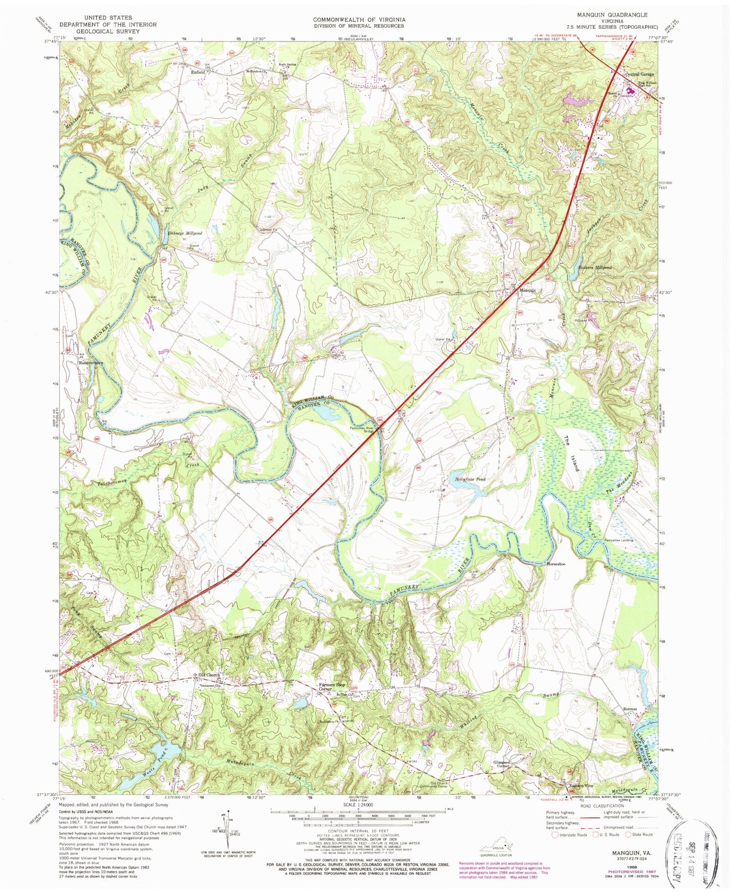
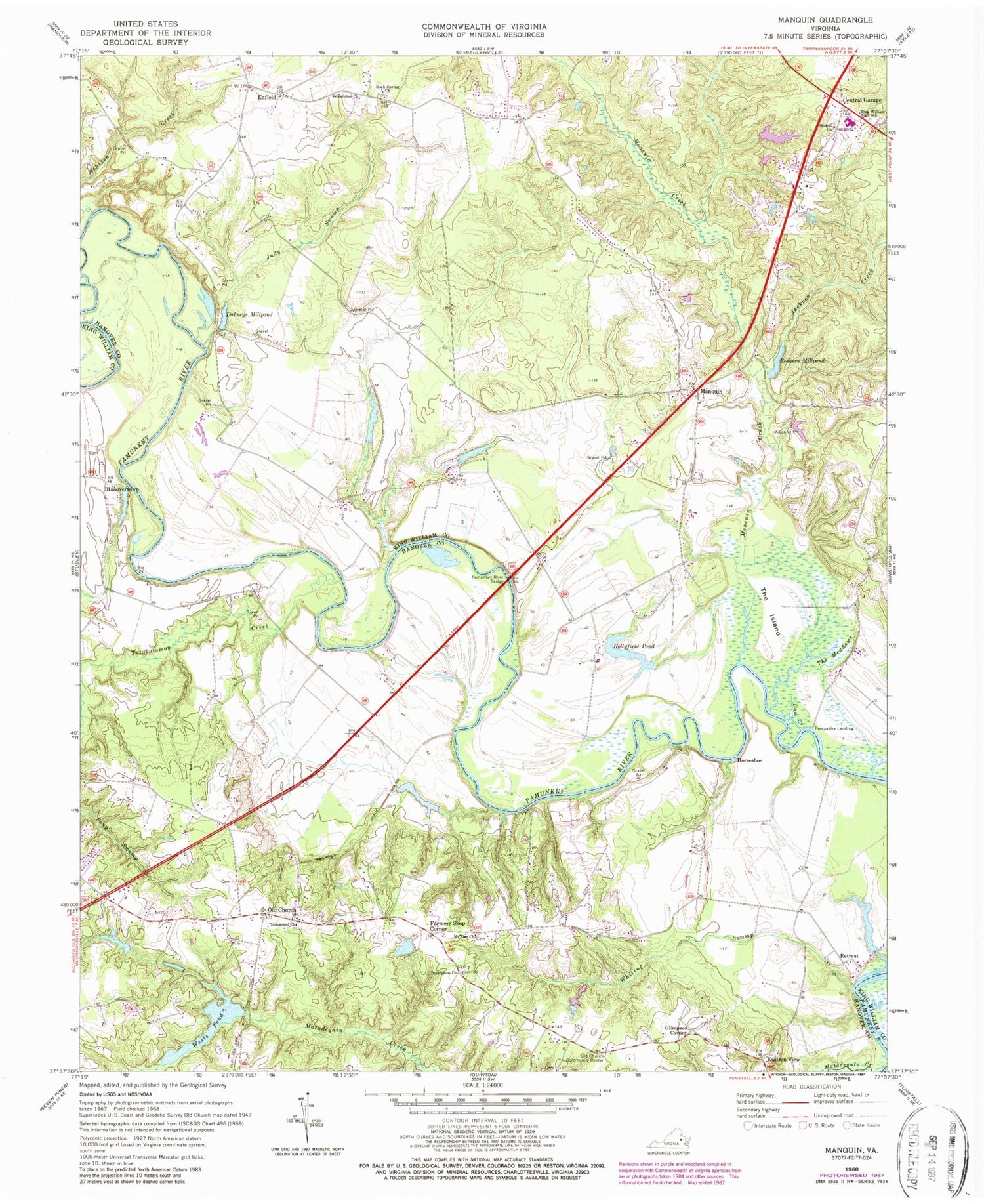
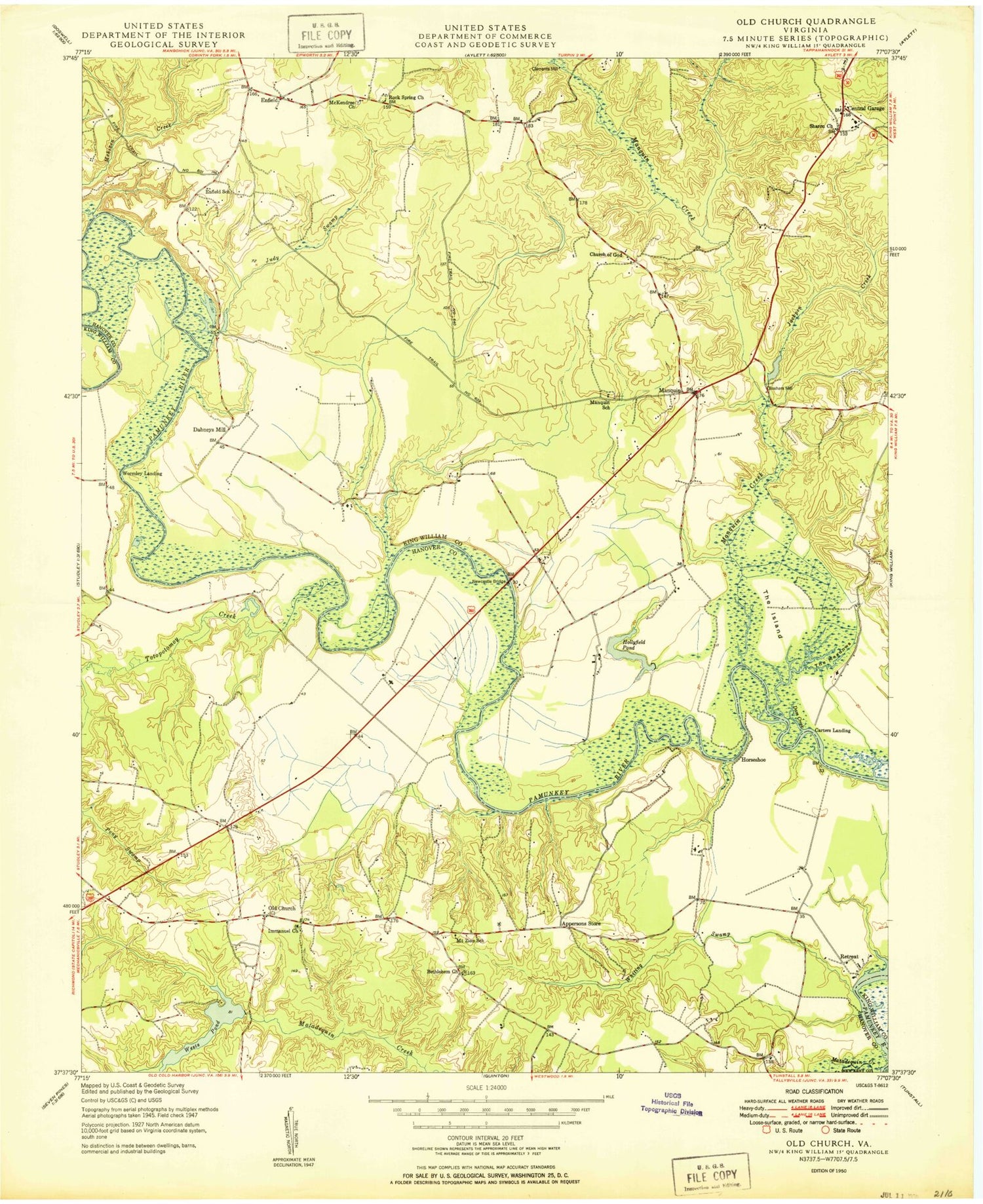
Classic USGS Manquin Virginia 7.5'x7.5' Topo Map
Couldn't load pickup availability
Historical USGS topographic quad map of Manquin in the state of Virginia. Map scale may vary for some years, but is generally around 1:24,000. Print size is approximately 24" x 27"
This quadrangle is in the following counties: Hanover, King William, New Kent.
The map contains contour lines, roads, rivers, towns, and lakes. Printed on high-quality waterproof paper with UV fade-resistant inks, and shipped rolled.
Contains the following named places: Appersons Store, Bassett Bar, Bethlehem Presbyterian Church, Boshers Millpond, Boshers Millpond Dam, Carters Mill, Central Garage, Central Garage Census Designated Place, Clifton Dam, Curling Dam, Dabneys Mill, Dabneys Millpond, Dam Creek, Eastern View, Enfield, Farmers Shop Corner, Francis Broaddus Dam, Glimpses Corner, Gloucester County Regional Alternative School, Hanovertown, Hollyfield Pond, Horseshoe, Immanuel Church, Jackpen Creek, Judy Swamp, King William High School, Manquin, Manquin Post Office, McKendree Methodist Church, McKendree Methodist Church Cemetery, Mehixen Creek, Moncuin Creek, Mount Zion Church, Old Church, Old Church Community Center, Pampatike Landing, Pamunkey, Pamunkey Regional Library Upper King William Branch Library, Pamunkey River Bridge, Queenfield Golf Club, Retreat, Rock Spring Church, Sharon Baptist Church, Sharon Baptist Church Cemetery, Skidmore Bar, Spring Bar, The Island, The Meadows, Totopotomoy Creek, Townsends Dam Number One, Townsends Dam Number Two, Webb Creek, Wests Dam, Wests Pond, Whiting Swamp, Wrights Dam, Wrights Pond, ZIP Code: 23106