MyTopo
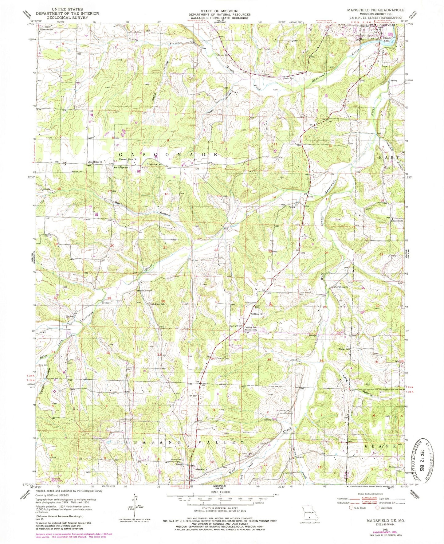
Classic USGS Mansfield NE Missouri 7.5'x7.5' Topo Map
Couldn't load pickup availability
Historical USGS topographic quad map of Mansfield NE in the state of Missouri. Map scale may vary for some years, but is generally around 1:24,000. Print size is approximately 24" x 27"
This quadrangle is in the following counties: Wright.
The map contains contour lines, roads, rivers, towns, and lakes. Printed on high-quality waterproof paper with UV fade-resistant inks, and shipped rolled.
Contains the following named places: Alsop Hollow, Baker Creek, Berry Cemetery, Binkley Cemetery, Boatright Cemetery, Buck Hollow, Campbell Branch, Casador Lake, Casador Lake Dam, Claxton Family Cemetery, Dennis Cemetery, Dennis Church, Dugger Hollow, Elmwood Cemetery, Fagan School, Fry Creek, Hartville Fire and Rescue, Hartville Post Office, Hensley Cemetery, High Point School, Johnson School, Long Hollow, Mansfield Municipal Airport, Matlock Cemetery, Mc Intosh Cemetery, Mission Temple, Newton School, Oetting Cemetery, Oetting Church, Oetting School, Pea Ridge Cemetery, Pea Ridge Church, Pea Ridge School, Pleasant Hope Church, Possum Hollow, Prairie Branch, Quillen Branch, Rembert, Rembert Post Office, Spence Creek, Township of Gasconade, Turner Cemetery, Umpire, Umpire Post Office, Wolf Creek, Wolf Creek Church, ZIP Code: 65704