MyTopo
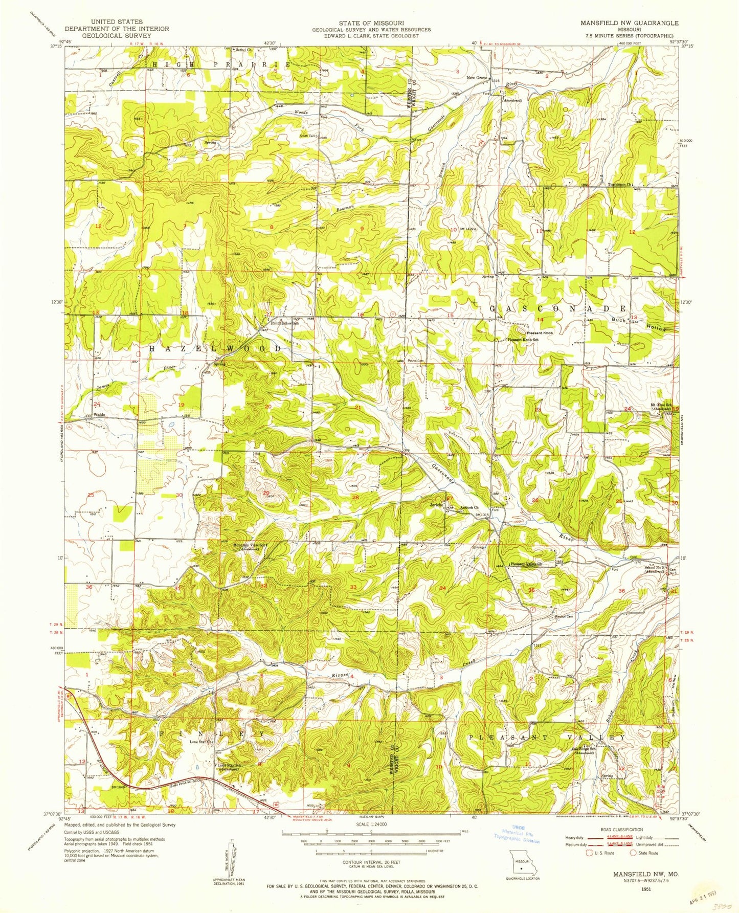
Classic USGS Mansfield NW Missouri 7.5'x7.5' Topo Map
Couldn't load pickup availability
Historical USGS topographic quad map of Mansfield NW in the state of Missouri. Map scale may vary for some years, but is generally around 1:24,000. Print size is approximately 24" x 27"
This quadrangle is in the following counties: Webster, Wright.
The map contains contour lines, roads, rivers, towns, and lakes. Printed on high-quality waterproof paper with UV fade-resistant inks, and shipped rolled.
Contains the following named places: Albert Smouse Dam, Antioch Church, Antrim, Antrim Post Office, Bennington, Bethel Church, Bowman Branch, Cemetery Number 5, Crabbs, Flint Hollow School, Jerico, Lone Star Church, Lone Star School, Midway, Mount Olive School, Mountain View School, New Grove, New Grove School, Newton Cemetery, Oak Ridge School, Owen Field, Peters Cemetery, Pleasant Knob, Pleasant Knob School, Pleasant Valley Church, Pleasant Valley School, Rippee Creek, School Number 5, Seymour State Wildlife Management Area, Smith Cemetery Number 01, Sparlin Lake Section 3 Dam, Sparlin Lake Section 35 Dam, Tombleson Church, Township of Hazelwood, Waldo