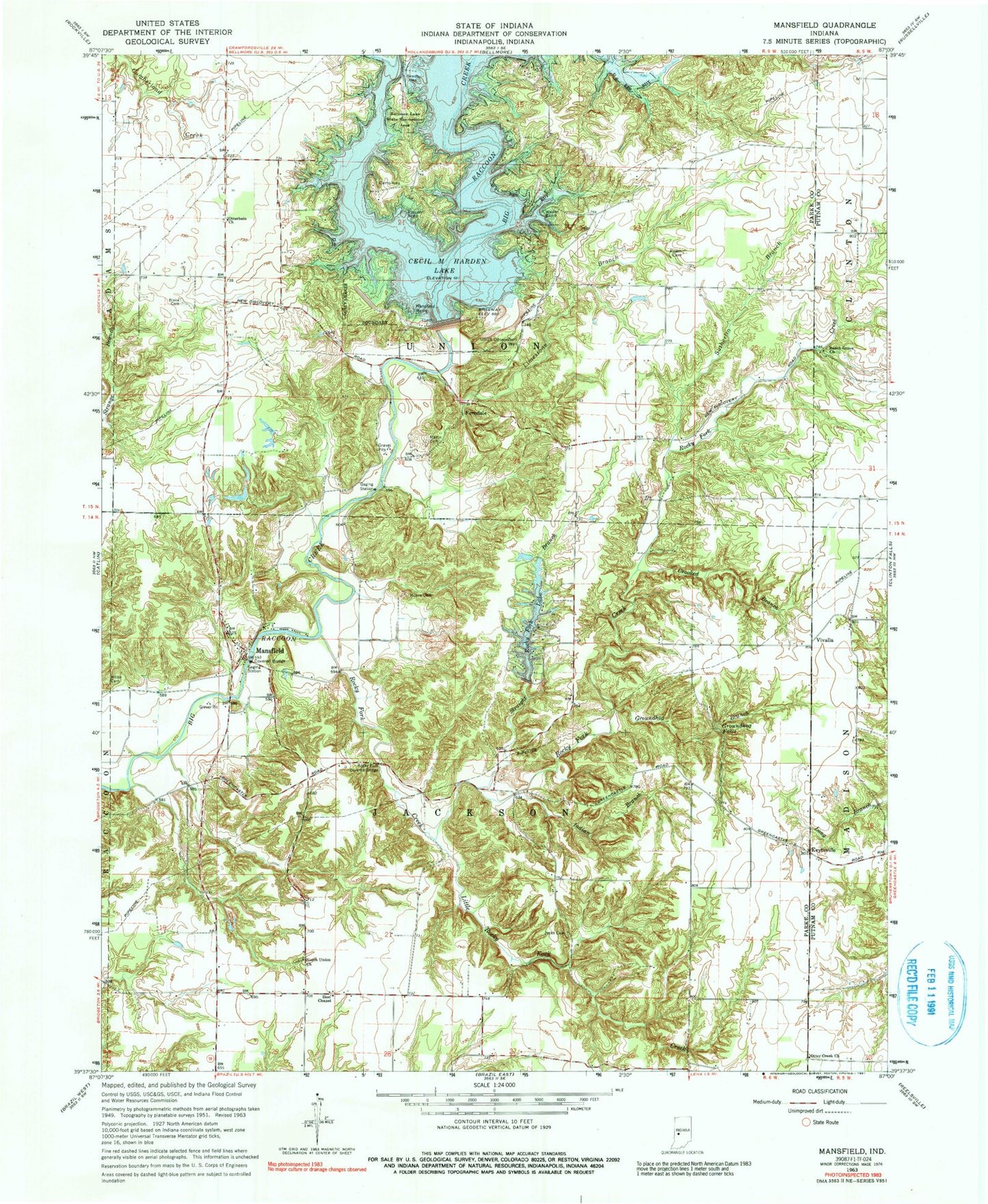
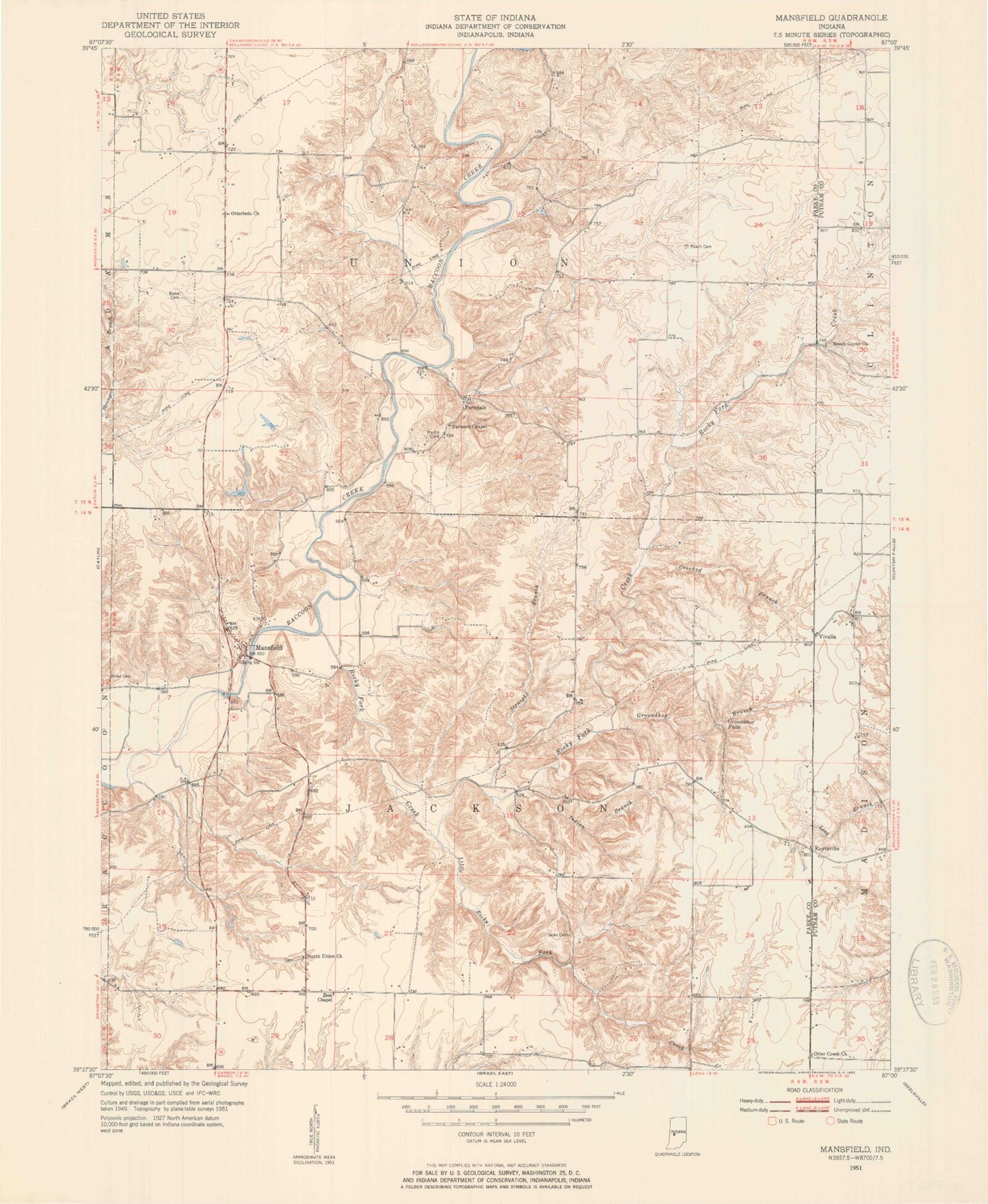
MyTopo
Classic USGS Mansfield Indiana 7.5'x7.5' Topo Map
Couldn't load pickup availability
Historical USGS topographic quad map of Mansfield in the state of Indiana. Typical map scale is 1:24,000, but may vary for certain years, if available. Print size: 24" x 27"
This quadrangle is in the following counties: Parke, Putnam.
The map contains contour lines, roads, rivers, towns, and lakes. Printed on high-quality waterproof paper with UV fade-resistant inks, and shipped rolled.
Contains the following named places: Beach Grove Church, Blake Cemetery, Britton Cemetery, Cecil M Harden Lake, Crooked Branch, Ferndale, Groundhog Branch, Groundhog Falls, Holder Cemetery, Indian Branch, Jacks Cemetery, Keytsville, Little Rocky Fork Creek, Mansfield, Mansfield Ramp, Martin Cemetery, Moore Cemetery, North Union Church, Otter Creek Church, Otterbein Church, Raccoon Lake State Recreation Area, Roach Cemetery, Rocky Fork Creek, Rocky Fork Lake, Straight Branch, Troutman Branch, Vivalia, Zion Chapel, Rocky Fork Covered Bridge, Rocky Fork Lake Dam, Cecil M Harden Lake Dam, Limestone Branch, Sutherlin Branch, Readys Creek, Raccoon Ramp, Walker Ramp, Madalline, Township of Jackson, Township of Union, Mansfield Bridge