MyTopo
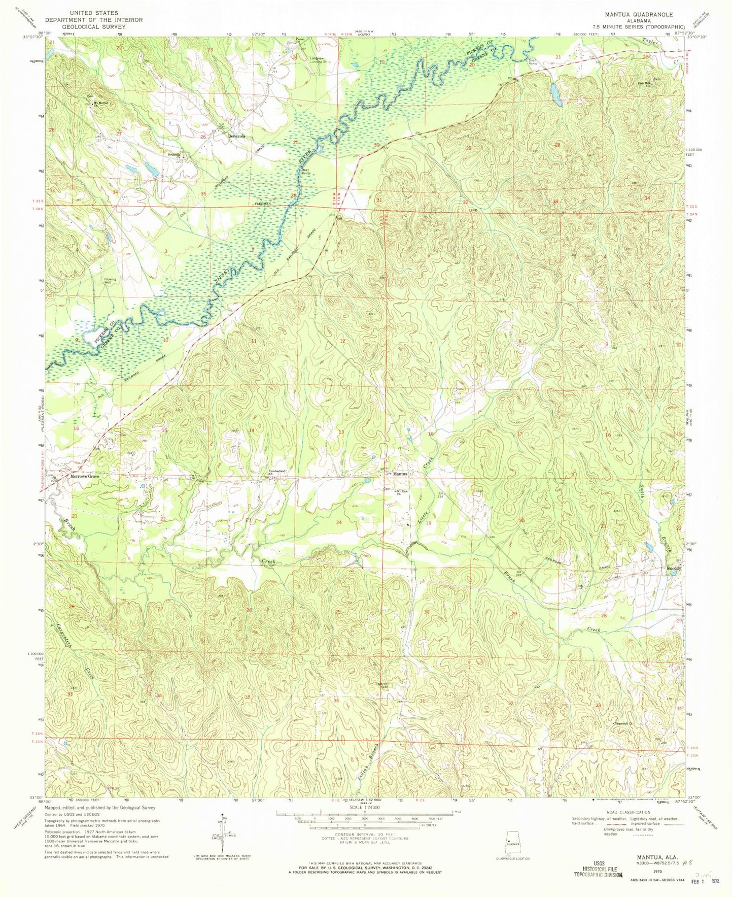
Classic USGS Mantua Alabama 7.5'x7.5' Topo Map
Couldn't load pickup availability
Historical USGS topographic quad map of Mantua in the state of Alabama. Map scale may vary for some years, but is generally around 1:24,000. Print size is approximately 24" x 27"
This quadrangle is in the following counties: Greene, Pickens.
The map contains contour lines, roads, rivers, towns, and lakes. Printed on high-quality waterproof paper with UV fade-resistant inks, and shipped rolled.
Contains the following named places: Baileys Bridge, Benevola, Bethesda Church Yard Cemetery, Bethesda Presbyterian Church, Box Creek, Brush Creek, Cottons Bridge, Eutaw African Methodist Episcopal Church, Forest Baptist Church, Forest Church Cemetery, Hebron Cemetery, Hollingsworth School, Hopewell Baptist Church, Hopewell Cemetery, Laniers Mill, Little Creek, Manatua Cemetery, Mantua, Mantua - Lewiston Volunteer Fire Department, Mantua Post Office, Morrows Grove, Mount Moriah Cemetery, Mount Moriah Church, Mount Sinai Methodist Church, Mount Zion Church, Rosenwald School, Saint Pauls Church, Sixteenth Section Cemetery, Smith Branch, Snoddy, White Oak Grove School, White Oak Presbyterian Church, Zion Hill Baptist Church, Zion Hill Cemetery