

MyTopo
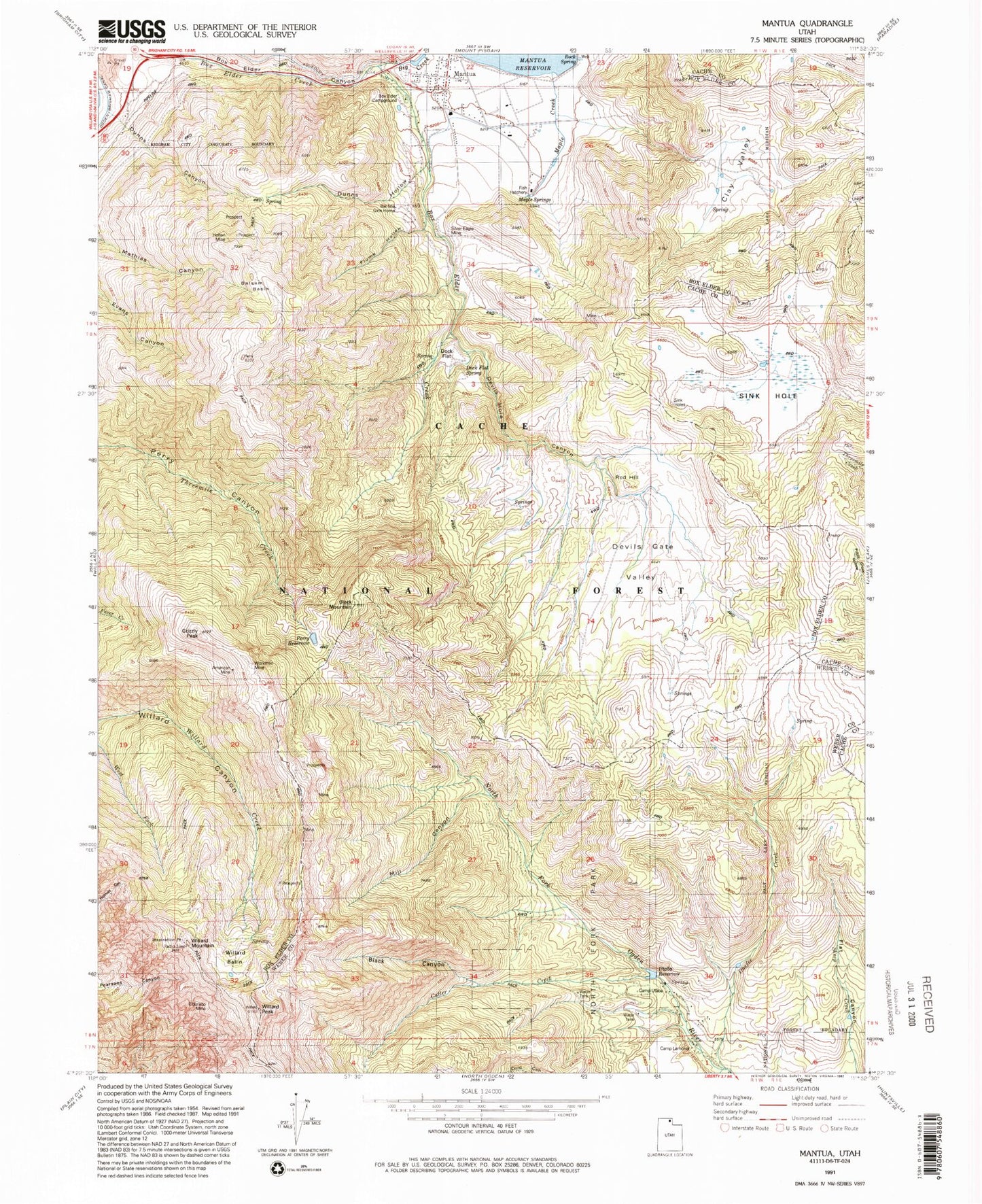
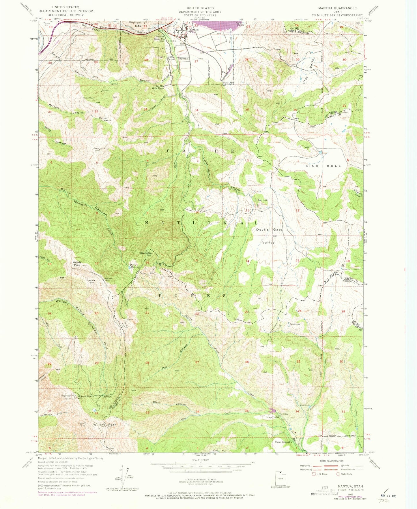
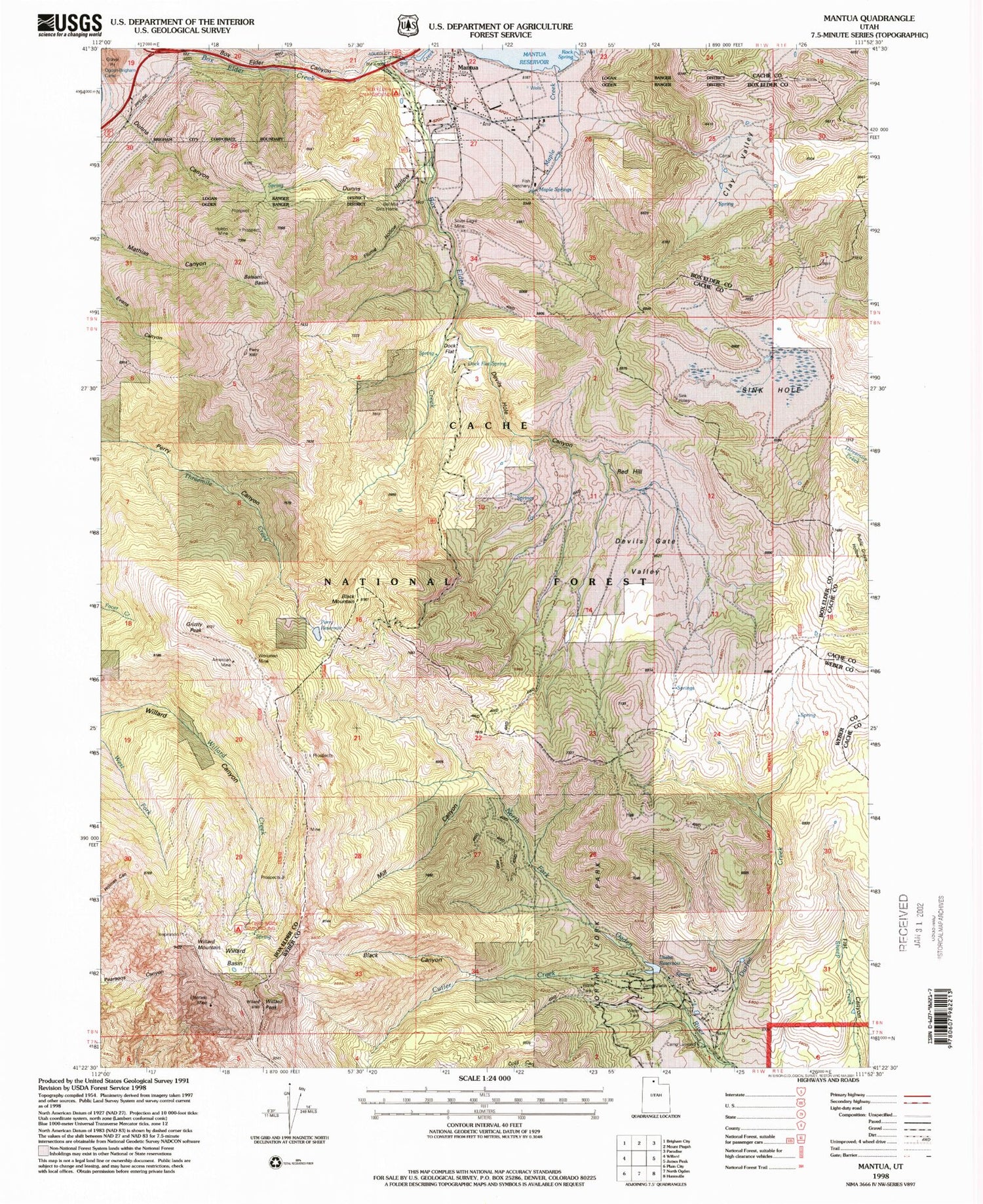
Classic USGS Mantua Utah 7.5'x7.5' Topo Map
Couldn't load pickup availability
Historical USGS topographic quad map of Mantua in the state of Utah. Typical map scale is 1:24,000, but may vary for certain years, if available. Print size: 24" x 27"
This quadrangle is in the following counties: Box Elder, Cache, Weber.
The map contains contour lines, roads, rivers, towns, and lakes. Printed on high-quality waterproof paper with UV fade-resistant inks, and shipped rolled.
Contains the following named places: Dock Flat Spring, Alvarado Mine, American Mine, Balsam Basin, Bel Mia Girls Home, Big Creek, Black Canyon, Black Mountain, Box Elder Canyon, Box Elder Picnic Grounds, Camp Lamondi, Camp Utaba, Clay Valley, Cutler Creek, Devils Gate Valley, Devils Hole Canyon, Dunns Canyon, Dunns Hollow, Durfee Creek, Flume Hollow, Grizzly Peak, Holton Mine, Inspiration Point, Mantua, Mantua Guard Station, Maple Creek, Mill Canyon, Perry Reservoir, Red Hill, Rock Spring, Sink Hole, Willard Mountain, Willard Peak, Workman Mine, Brigham Face Wildlife Management Area, Mantua Cemetery, Mountain View Campground, Box Elder Campground, Dock Flat, Willard Basin Trailhead, Maple Creek Fish Hatchery, Durfee Creek Estates, Bighorn Enclosure, Box Elder Campground, Dock Flat Spring, Utaba Reservoir, Willard Basin, Willard Basin Campground, Maple Springs, Mantua Volunteer Fire Department, Dock Flat Spring, Alvarado Mine, American Mine, Balsam Basin, Bel Mia Girls Home, Big Creek, Black Canyon, Black Mountain, Box Elder Canyon, Box Elder Picnic Grounds, Camp Lamondi, Camp Utaba, Clay Valley, Cutler Creek, Devils Gate Valley, Devils Hole Canyon, Dunns Canyon, Dunns Hollow, Durfee Creek, Flume Hollow, Grizzly Peak, Holton Mine, Inspiration Point, Mantua, Mantua Guard Station, Maple Creek, Mill Canyon, Perry Reservoir, Red Hill, Rock Spring, Sink Hole, Willard Mountain, Willard Peak, Workman Mine, Brigham Face Wildlife Management Area, Mantua Cemetery, Mountain View Campground, Box Elder Campground, Dock Flat, Willard Basin Trailhead, Maple Creek Fish Hatchery, Durfee Creek Estates, Bighorn Enclosure, Box Elder Campground, Dock Flat Spring, Utaba Reservoir, Willard Basin, Willard Basin Campground, Maple Springs, Mantua Volunteer Fire Department