MyTopo
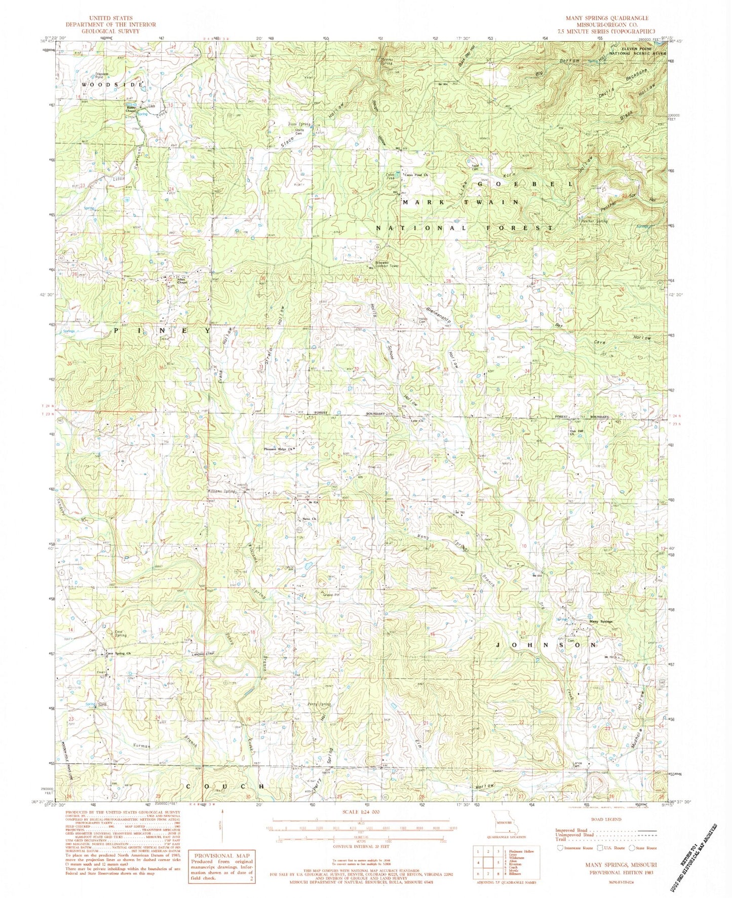
Classic USGS Many Springs Missouri 7.5'x7.5' Topo Map
Couldn't load pickup availability
Historical USGS topographic quad map of Many Springs in the state of Missouri. Typical map scale is 1:24,000, but may vary for certain years, if available. Print size: 24" x 27"
This quadrangle is in the following counties: Oregon.
The map contains contour lines, roads, rivers, towns, and lakes. Printed on high-quality waterproof paper with UV fade-resistant inks, and shipped rolled.
Contains the following named places: Norman Branch, Simpson, Lulu, Oak Hill School (historical), Wild Cat Hill, Bailey Cemetery, Hollis, Braswell, Antioch Church (historical), Bailey Church, Billdad School, Blankenship Hollow, Braswell Lookout, Cates Pond, Cave Spring, Cave Spring School (historical), Devils Backbone, Elm Hollow, Evans Hollow, Hollis Cemetery Number 1, Hollis School (historical), Hollis School Hollow, Lance Cemetery, Lime Kiln Hollow, Many Springs, Many Springs Branch, Mudhole Hollow, Nebo School, Oak Hill Church (historical), Panther Spring, Perry Spring, Rough Hollow, Sanders Branch, Sisco Spring, Stevens Spring, Strain Hollow, Williams Spring, Williams Spring Branch, Hollis Cemetery Number 02, Neal Cemetery, Braswell Lookout Tower, Allen Chapel, Pleasant Ridge Church, Nebo Church, Cave Springs Church, Oak Hill Church, Lula Church, Cates Pond Church, Township of Goebel, Cave Spring Cemetery