MyTopo
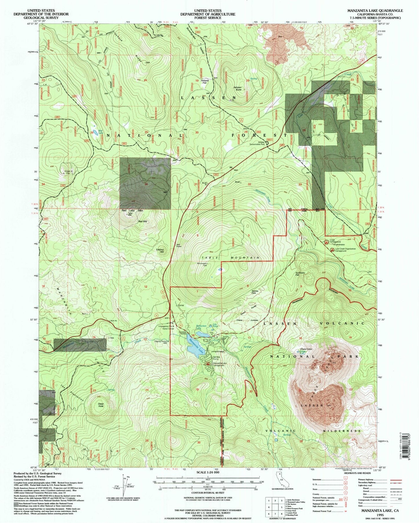
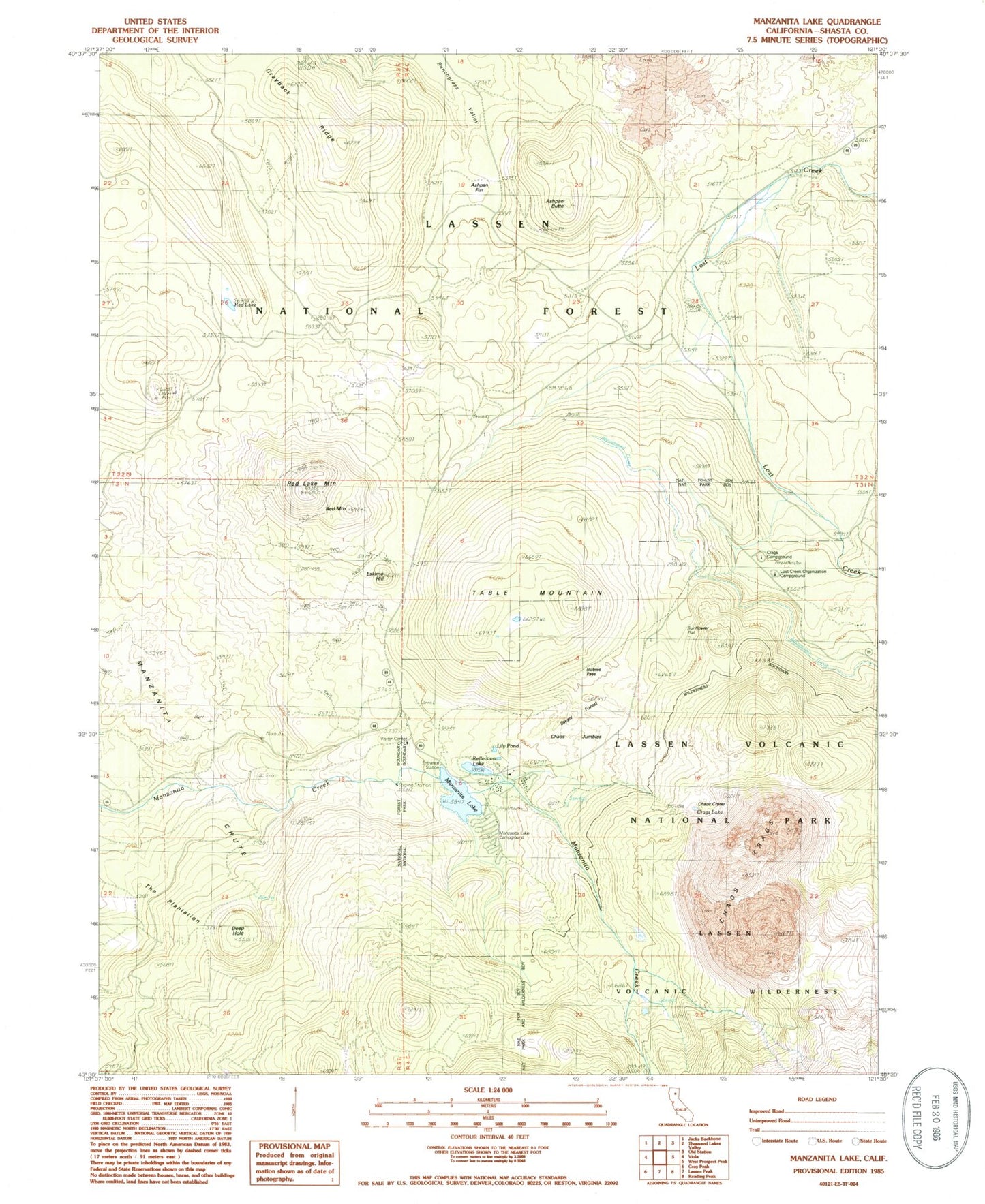
Classic USGS Manzanita Lake California 7.5'x7.5' Topo Map
Couldn't load pickup availability
Historical USGS topographic quad map of Manzanita Lake in the state of California. Map scale may vary for some years, but is generally around 1:24,000. Print size is approximately 24" x 27"
This quadrangle is in the following counties: Shasta.
The map contains contour lines, roads, rivers, towns, and lakes. Printed on high-quality waterproof paper with UV fade-resistant inks, and shipped rolled.
Contains the following named places: Ashpan Butte, Ashpan Flat, Ashpan Snowmobile Park, Chaos Crags, Chaos Crags Trail, Chaos Crater, Chaos Jumbles, Crags Campground, Crags Lake, Deep Hole, Dwarf Forest, Eskimo Hill, Grayback Ridge, Interagency Fire and Visitor Center, Lily Pond, Lost Creek Camp, Lost Creek Diversion Flume, Lost Creek Organization Campground, Manzanita Chute, Manzanita Lake, Manzanita Lake Campground, Manzanita Lake Dam, Noble Pass, Nobles Pass, Old Emigrant Trail, Red Lake, Red Lake Mountain, Red Mountain, Reflection Lake, Summertown, Sunflower Flat, Table Mountain, The Plantation