MyTopo
Classic USGS Maple Cane Swamp South Carolina 7.5'x7.5' Topo Map
Couldn't load pickup availability
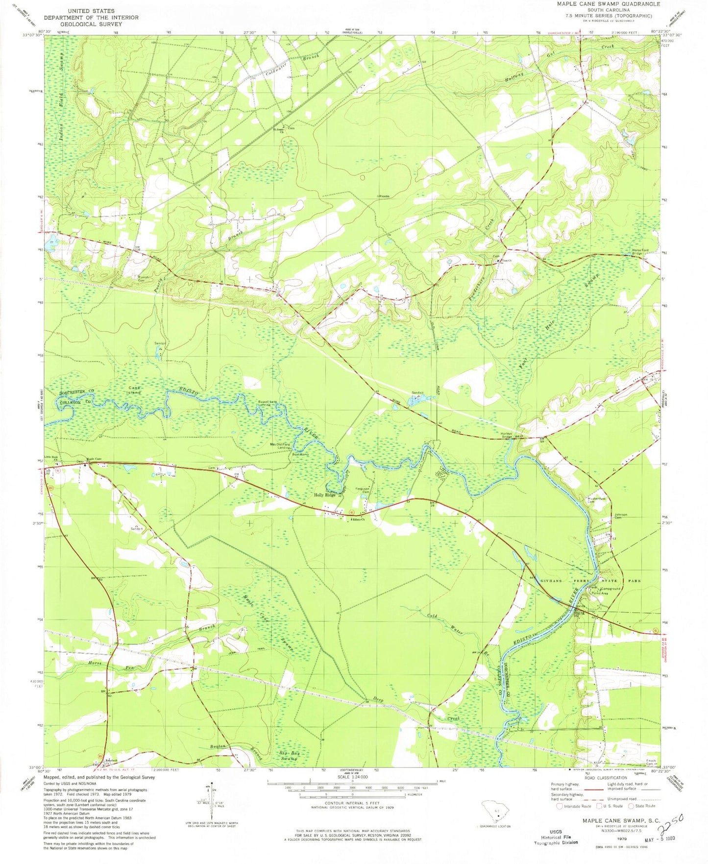
Historical USGS topographic quad map of Maple Cane Swamp in the state of South Carolina. Typical map scale is 1:24,000, but may vary for certain years, if available. Print size: 24" x 27"
This quadrangle is in the following counties: Colleton, Dorchester.
The map contains contour lines, roads, rivers, towns, and lakes. Printed on high-quality waterproof paper with UV fade-resistant inks, and shipped rolled.
Contains the following named places: Boston Branch, Bryant Temple Church, Cane Island, Cold Water Branch, Givhans Ferry State Park, Holly Ridge, Horse Ford Bridge, Horse Pen Branch, Johnson Cemetery, Little Rock Church, Maple Cane Swamp, Muckenfuss Cemetery, Poorly Branch, Rehoboth Church, Rumph Cemetery, Saint Joans Church, Zion Church, Mas Old Field Landing, Rumphs Pond Dam D-2549, Rumphs Pond, Rehoboth School (historical), Sheridan School (historical), Enon Station Church (historical), Enoch Station School (historical), Four Hole Special Church, Givhan Ferry (historical), Givhans Bridge, Muck Church (historical), Sand Ridge Church (historical), Sand Ridge School (historical), Sand Ridge School (historical), Zion School (historical), Harleys Bridge, Maple Cane Church, Edisto Church, Ferguson Cemetery, Four Hole Swamp, Dorchester County, Givhans Ferry Cemetery, Powderhorn Creek, Russell Lake Landing, WKQB-FM (Saint George), Colleton County Fire - Rescue Maple Cane, Saint John United Methodist Church