MyTopo
Classic USGS Maple City Michigan 7.5'x7.5' Topo Map
Couldn't load pickup availability
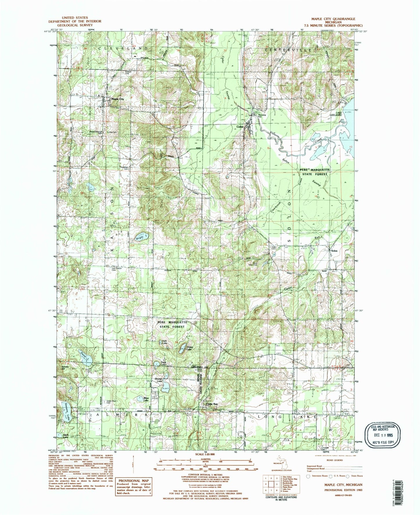
Historical USGS topographic quad map of Maple City in the state of Michigan. Map scale may vary for some years, but is generally around 1:24,000. Print size is approximately 24" x 27"
This quadrangle is in the following counties: Benzie, Grand Traverse, Leelanau.
The map contains contour lines, roads, rivers, towns, and lakes. Printed on high-quality waterproof paper with UV fade-resistant inks, and shipped rolled.
Contains the following named places: Black Lake, Bright Lake, Cedar, Cedar Area Fire and Rescue, Cedar Census Designated Place, Cedar Post Office, Cedar Run, Cedar Run Post Office, Cedar Run School, Cedar Run Station, Cedar Swamp, Clearbrook Creek, Cook Lake, Davis Lake, East Kasson Cemetery, Friend Post Office, Greenbrier Cemetery, Hart Lake, Kasson Cemetery, Leelanau Christian Fellowship Church, Linwood Cemetery, Maple City, Maple City Census Designated Place, Maple City Community Church, Maple City Post Office, Nash - Pettengill Cemetery, Pikes Lake, Round Top Cemetery, Saint Rita Cemetery, Saint Rita's Church, Shisler Lake, Shorter Lake, Solon, Solon Cemetery, Solon Post Office, Solon Station, Solon Swamp, Stevens Lake, Township of Solon, Victoria Creek, Vlack Memorial Park, West Side Community Church, ZIP Code: 49621