MyTopo
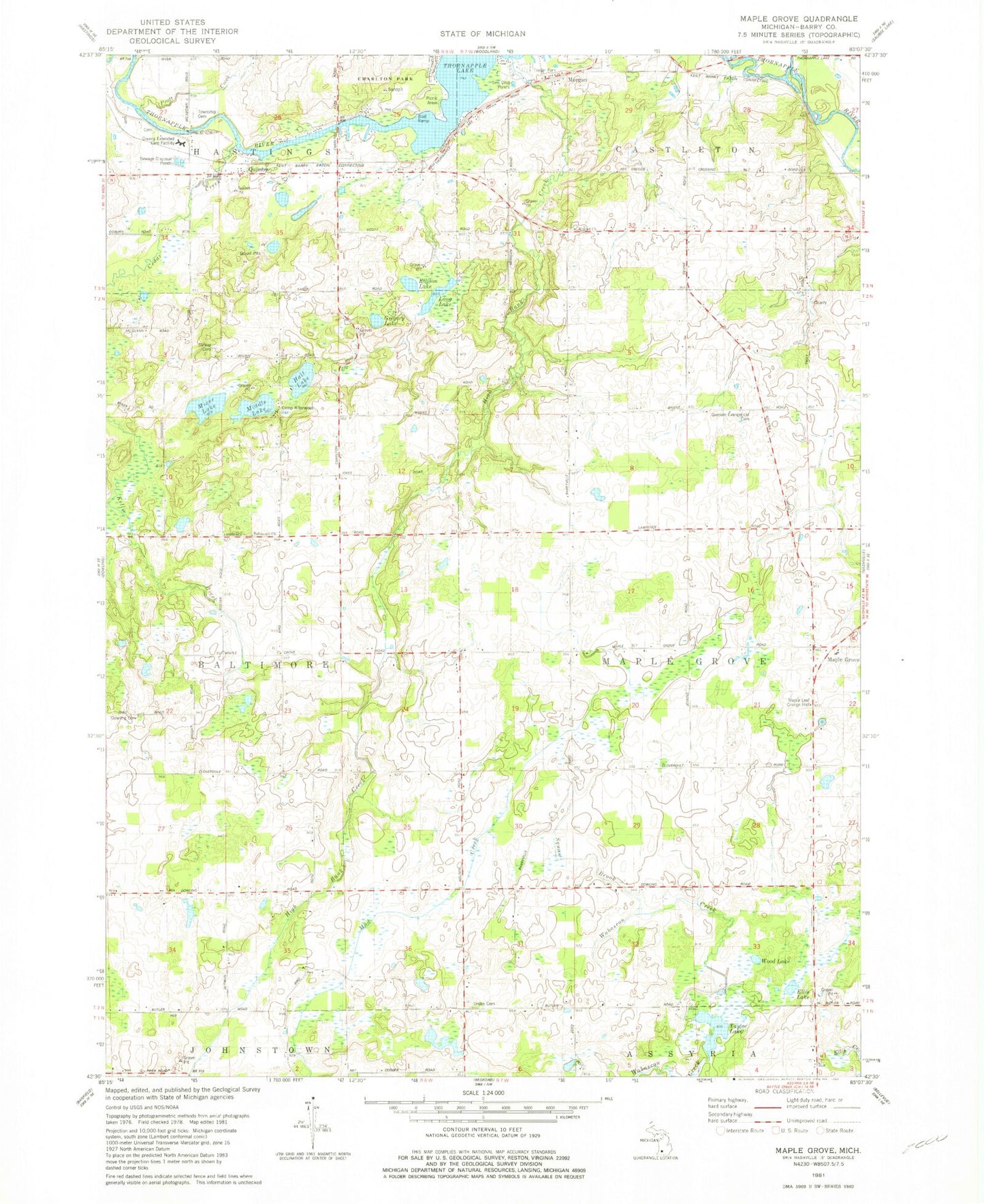
Classic USGS Maple Grove Michigan 7.5'x7.5' Topo Map
Couldn't load pickup availability
Historical USGS topographic quad map of Maple Grove in the state of Michigan. Map scale may vary for some years, but is generally around 1:24,000. Print size is approximately 24" x 27"
This quadrangle is in the following counties: Barry.
The map contains contour lines, roads, rivers, towns, and lakes. Printed on high-quality waterproof paper with UV fade-resistant inks, and shipped rolled.
Contains the following named places: Barry County Christian School, Barry County Extended Care Facility, Barry County Poor Farm Cemetery, Barry's Resort and Mobile Home Park, Barryville Cemetery, Barryville Historical Marker, Barryville Post Office, Barryville School, Branch School, Brethren Church, Camp Kitanniwa, Cedar Creek, Charlton Park, Dunhan School, Durfee School, Ellis Lake, Ellison Lake, German Evangelical Cemetery, Gregory Lake, Hall Lake, Hastings Township Cemetery, High Bank Creek, Highbank Post Office, Indian Landing-Charlton Park Historical Marker, Laurel Manor Rest Home, Long Lake, Maple Grove, Maple Grove Post Office, Maple Leaf Grange Hall, McKelvey School, Middle Lake, Mills School, Mixer Lake, Moore School, Morgan, Morgan Post Office, Morgan Station, Peace United Methodist Church, Pratt School, Quimby Post Office, Quimby Station, Quimby United Methodist Church, Qumby, Rivergate Family Campground, Squaw Brook, Striker Cemetery, Striker School, Taylor Lake, Thornapple Lake, Thornapple Lake Estates Mobile Home Park, Township of Baltimore, Township of Maple Grove, Union Cemetery, Wild Lake, ZIP Codes: 49050, 49073