MyTopo
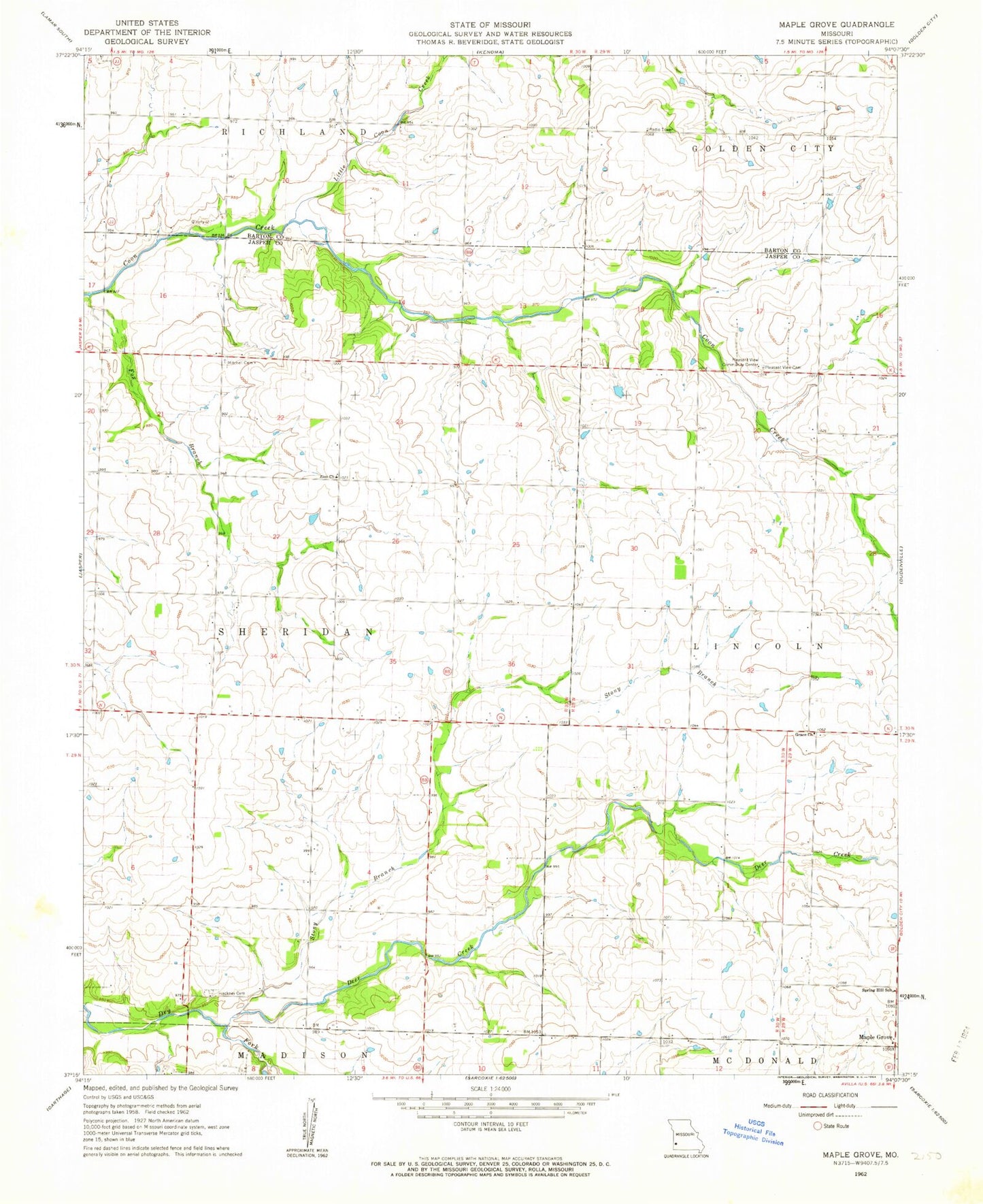
Classic USGS Maple Grove Missouri 7.5'x7.5' Topo Map
Couldn't load pickup availability
Historical USGS topographic quad map of Maple Grove in the state of Missouri. Map scale may vary for some years, but is generally around 1:24,000. Print size is approximately 24" x 27"
This quadrangle is in the following counties: Barton, Jasper.
The map contains contour lines, roads, rivers, towns, and lakes. Printed on high-quality waterproof paper with UV fade-resistant inks, and shipped rolled.
Contains the following named places: Bloomingdale School, Deer Creek, Deer Creek School, Fox Branch, Grace Church, Hackney Cemetery, Liberty School, Little Coon Creek, Malty, Maple Grove, Maple Lane Farms Lake Dam, Mayflower School, Mitchell Cemetery, Morning Star School, North Star School, Pleasant Valley School, Pleasant View Cemetery, Pleasant View Community Center, Spring Hill School, Stony Branch, Stony Branch Airport, Summit School, Township of Sheridan, Zion Church