MyTopo
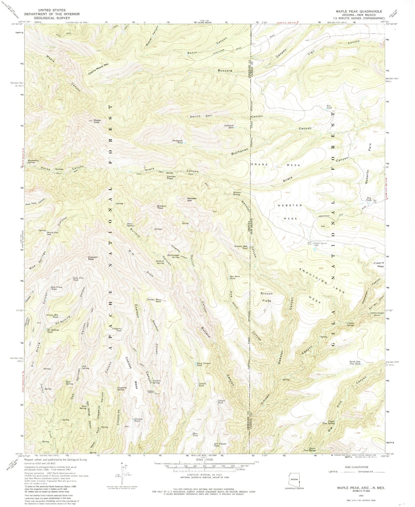
Classic USGS Maple Peak Arizona 7.5'x7.5' Topo Map
Couldn't load pickup availability
Historical USGS topographic quad map of Maple Peak in the states of Arizona, New Mexico. Map scale may vary for some years, but is generally around 1:24,000. Print size is approximately 24" x 27"
This quadrangle is in the following counties: Catron, Greenlee.
The map contains contour lines, roads, rivers, towns, and lakes. Printed on high-quality waterproof paper with UV fade-resistant inks, and shipped rolled.
Contains the following named places: Anderson Tank, Angel Tank, Apple Orchard Spring, Arizona Spring, Banjo Tank, Banjo Two Tank, Bear Spring, Blue Tank, Brand Tree Canyon Tank, BS Spring, Buchanan Tank, Bull Run Canyon, Bullard Canyon, Bullard Corral, Bullard Peak, Bullard Spring, Buzzard Branch Tank, Cement Tank, Center Tank, Charlie Moore Mountain, Charlie Moore Trailhead, Charlies Spring, Citizen Spring, Citizen Tank, Clear Spring, Coalson Mesa, Coalson Peak, Coalson Ranch, Coalson Spring, Coalson Tank, Cookstove Corral, Cookstove Tank, Copperas Spring, Copperas Tank, Corner Tank, Day Tank, Deer Spring, Deer Springs Canyon, Devils Den Canyon, Do Nothing Canyon, Do Nothing Tank, Dry Prong Tank, East Snare SPring, Fox Corral, Fox Tank, Gavilan Canyon, Gavilan Corral, Gavilan Number One Spring, Gavilan Peak, Gavilan Spring, Gavilan Tank, Grassy Mountain Tank, Heifers Delight Canyon, Hells Hole Tank, High Tank, Hobo Number Three Tank, Hobo Number Two Tank, Hogwallow Spring, Horse Canyon Trail Thirty-six, Indian Creek Spring, Indian Spring, J Lazy H Mesa, Jay Tank, Jim Tank, Judy Tank, Juniper Mesa Tank, Kelly Wells Spring, Lefty Spring, Little Buzzard Tank, Liza Tank, Lone Pine Tank, Lower Indian Corral, Lower Oak Spring, Lower Pine Spring, Maple Corral, Maple Peak, Maple Peak Tank, Maple Spring, Maple Tank, Mesa Tank, Morris Gap, Morris Gap Corral, Morris Spring, Nine Tank, No Permit Tank, North Side Pine Corral, North Side Pine Tank, Oak Spring, Oak Spring Number Two, Oak Springs Canyon, One Horn Canyon, One Horn Corral, One Horn Tank, Pen Canyon Springs, Petmaker Canyon, Pine Tank, Pop Top Spring, Pot Tank, Powerline Tank, Rattlesnake Canyon, Rattlesnake Spring, Rincon Flats, Salt Ground Tank, Section Twenty-nine Spring, Short Tank, Skeleton Canyon, Sluefoot Blue Tank, Smoothing Iron Camp, Smoothing Iron Mesa, Smoothing Iron Tank, Snare Mesa, Snare Mesa Tank, Snare Spring, Snare Tank, South Buzzard Tank, Stacy Spring, Stateline Water Storage Tank, Steep Canyon Tank, Steep Tank, Tributary Spring, Two-Fork Spring, Upper Oak Spring, Upper Pine Spring, Vigil Tank, W H Draw, Wavy Spring, Webster Canyon, Webster Hole Tank, Webster Mesa, Webster Mountain, Webster Spring, Wild Bunch Trick Tank, Wildbunch Spring, Wildbunch Trailhead