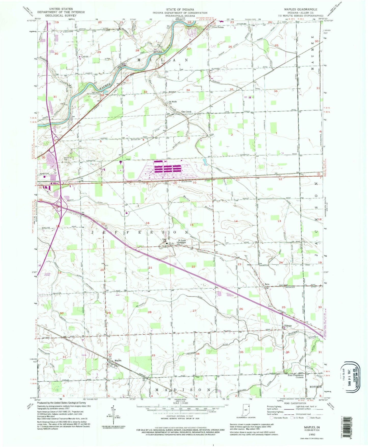
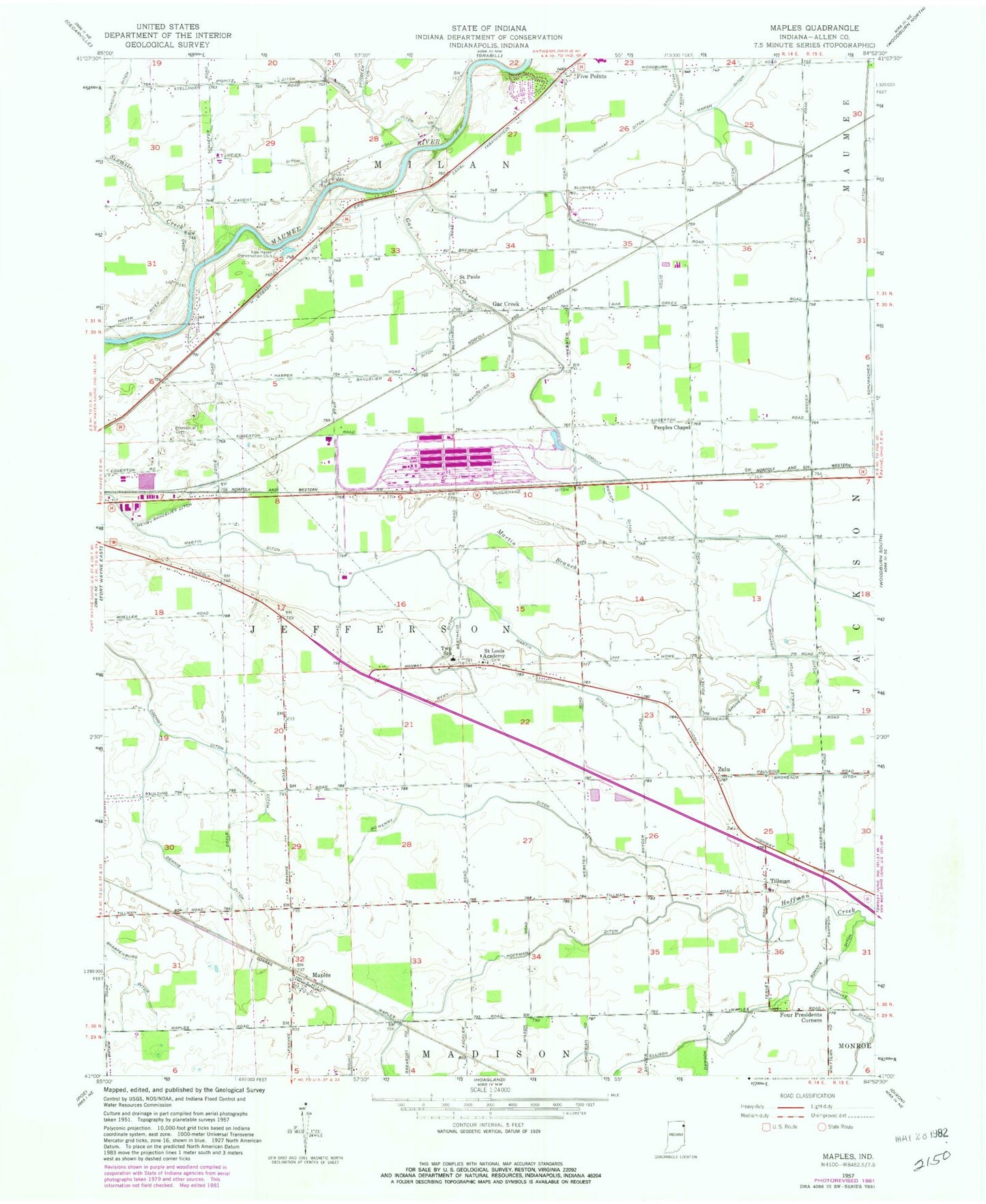
MyTopo
Classic USGS Maples Indiana 7.5'x7.5' Topo Map
Couldn't load pickup availability
Historical USGS topographic quad map of Maples in the state of Indiana. Map scale may vary for some years, but is generally around 1:24,000. Print size is approximately 24" x 27"
This quadrangle is in the following counties: Allen.
The map contains contour lines, roads, rivers, towns, and lakes. Printed on high-quality waterproof paper with UV fade-resistant inks, and shipped rolled.
Contains the following named places: Air Park Field, Bandelier Ditch, Bandelier Ditch Number Two, Bonjour Ditch, Casad Industrial Park Airport, Converset Ditch, Dennis Ditch, Ellison Ditch, Emanuel Cemetery, Five Points, Gar Creek, Gromeaux Ditch, Grover Ditch, Henry Bandelier Ditch, Huguenard Ditch, Klines Airport, Maples, Martin Branch, Martin Ditch, McHenry Ditch, Meier Ditch, Nahrwold Ditch, New Haven Conservation Club, Peoples Chapel, Popitz Ditch, Reichhart Airport, Rorick Ditch, Rushart Ditch, Ryan Ditch, Saint Louis School, Saint Pauls Church, Schaaf Ditch, Schumacher Ditch, Sharpenburg Ditch, Sixmile Creek, Spindler Ditch, Summers Ditch, Tillman, Township of Jefferson, Yoquelet Ditch, Zulu, ZIP Code: 46774