
MyTopo
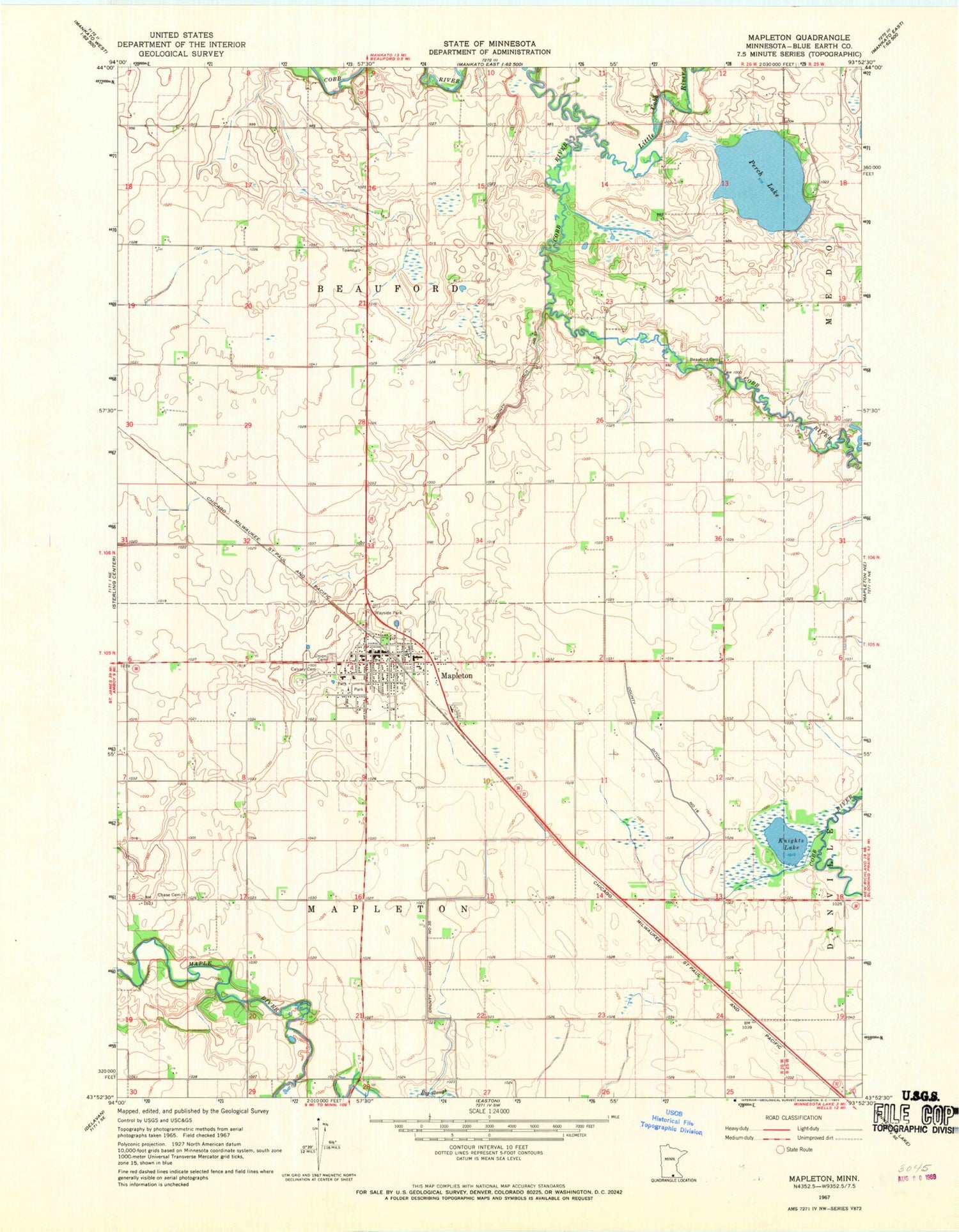
Classic USGS Mapleton Minnesota 7.5'x7.5' Topo Map
Couldn't load pickup availability
Historical USGS topographic quad map of Mapleton in the state of Minnesota. Map scale may vary for some years, but is generally around 1:24,000. Print size is approximately 24" x 27"
This quadrangle is in the following counties: Blue Earth.
The map contains contour lines, roads, rivers, towns, and lakes. Printed on high-quality waterproof paper with UV fade-resistant inks, and shipped rolled.
Contains the following named places: Beauford Cemetery, Boening Mobile Home Park, Calvary Cemetery, Chase Cemetery, City of Mapleton, County Ditch Number Fiftyseven, County Ditch Number Sixteen, County Ditch Number Thirtyfive, Cradle of Curling in Minnesota Historical Marker, Knights Lake, Little Cobb River, Maple River High School, Mapleton, Mapleton Community Home, Mapleton Family Clinic, Mapleton Fire Department, Mapleton Historical Marker, Mapleton Police Department, Mapleton Post Office, Mapleton Public Library, Mapleton Wayside Park, Perch Lake, Perch Lake Dam, Saint Johns Lutheran Church, Saint Theresa Catholic Church, Township of Beauford, Township of Mapleton, Union Cemetery, United Church of Mapleton, ZIP Code: 56065


