MyTopo
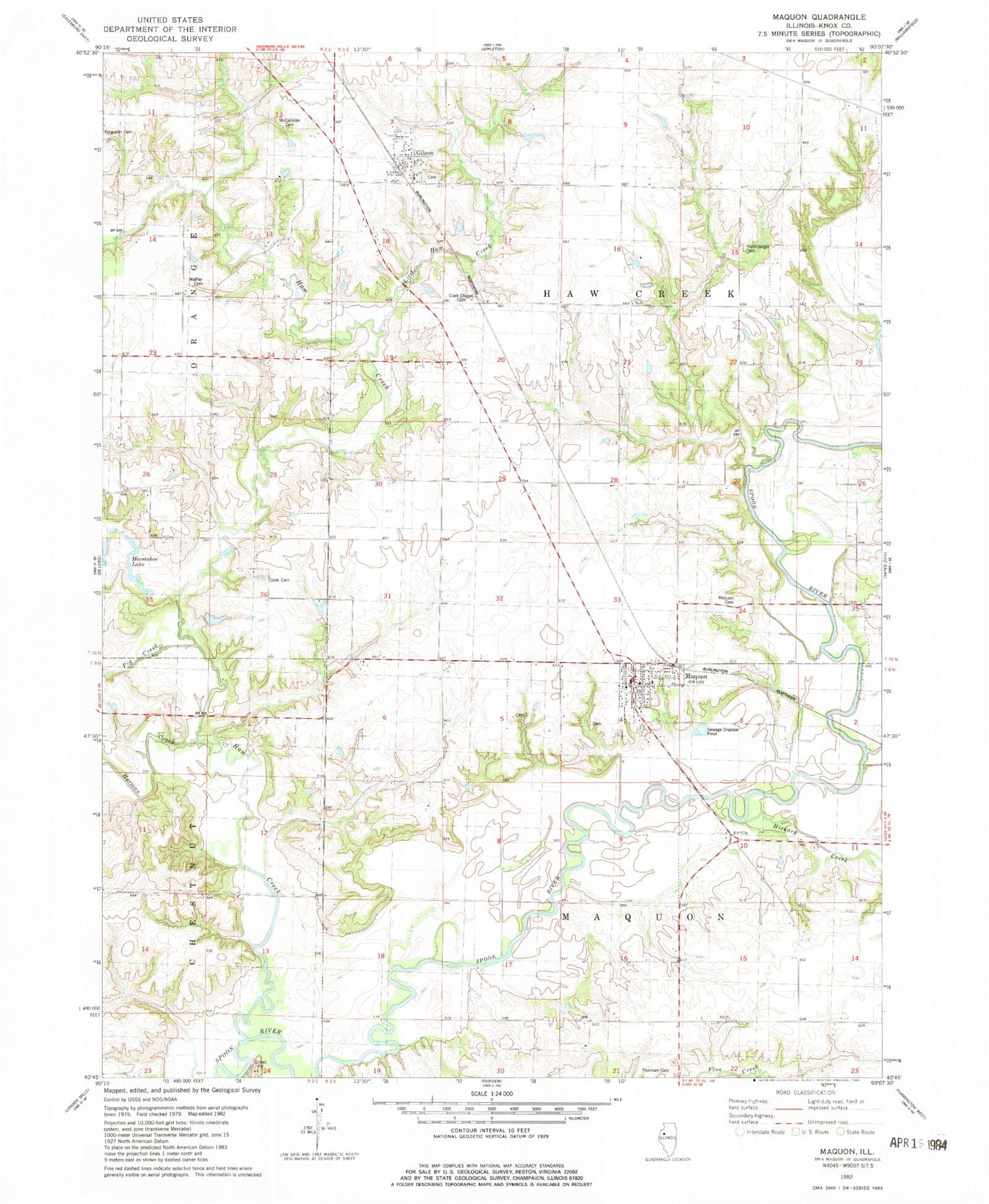
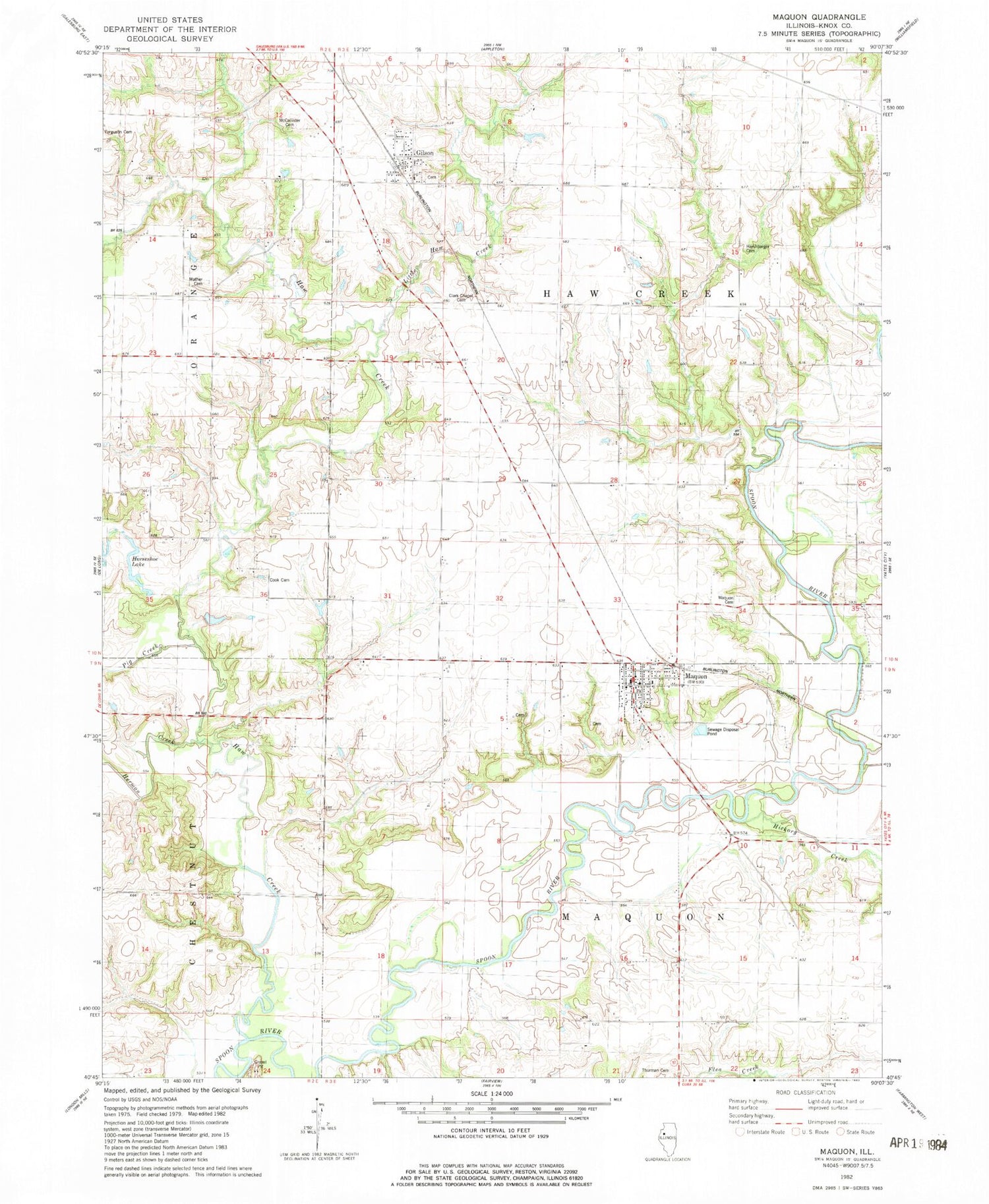
Classic USGS Maquon Illinois 7.5'x7.5' Topo Map
Couldn't load pickup availability
Historical USGS topographic quad map of Maquon in the state of Illinois. Map scale may vary for some years, but is generally around 1:24,000. Print size is approximately 24" x 27"
This quadrangle is in the following counties: Knox.
The map contains contour lines, roads, rivers, towns, and lakes. Printed on high-quality waterproof paper with UV fade-resistant inks, and shipped rolled.
Contains the following named places: Bennington School, Clark Chapel Cemetery, Clark Chapel School, Cook Cemetery, Cook School, Ferguson Cemetery, French Creek, Fruit Hill School, Gilson, Gilson Cemetery, Gilson Census Designated Place, Gilson Fire Department, Gilson Post Office, Harshbarger Cemetery, Haw Creek, Hazel Green School, Hermon Creek, Hickory Creek, Horseshoe Lake, Housh Cemetery, Libolt School, Little Haw Creek, Maquon, Maquon Cemetery, Maquon Fire Protection District, Maquon Post Office, Maquon United Methodist Church, Mather Cemetery, Mc Callister Cemetery, Ouderkirk Cemetery, Pig Creek, Rebstock School, Sumner School, Swigert School, Taylor Lake, Taylor Lake Dam, Thurman Cemetery, Township of Haw Creek, Township of Maquon, Union Grove Church, Village of Maquon, ZIP Codes: 61436, 61458