MyTopo
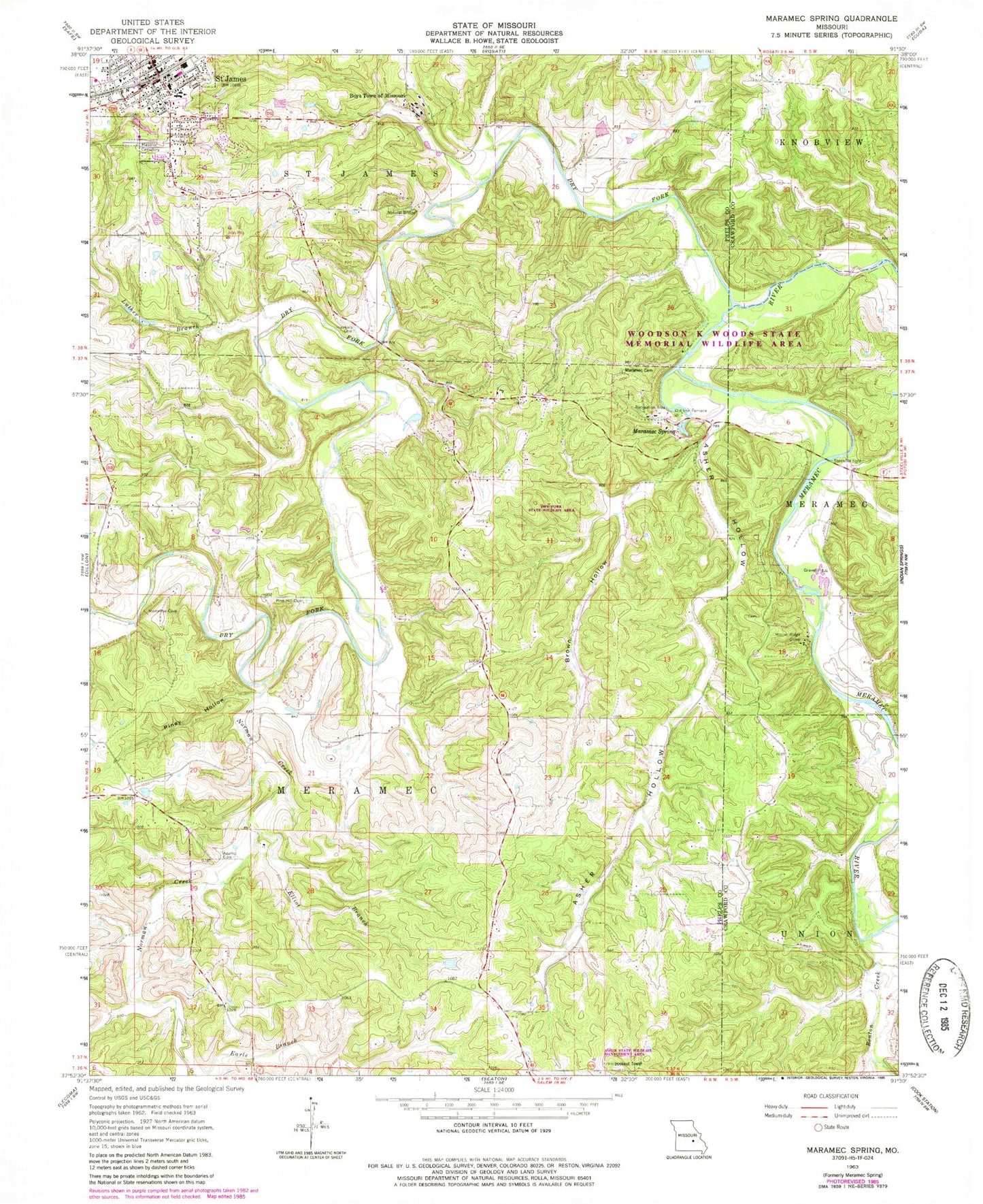
Classic USGS Maramec Spring Missouri 7.5'x7.5' Topo Map
Couldn't load pickup availability
Historical USGS topographic quad map of Maramec Spring in the state of Missouri. Map scale may vary for some years, but is generally around 1:24,000. Print size is approximately 24" x 27"
This quadrangle is in the following counties: Crawford, Phelps.
The map contains contour lines, roads, rivers, towns, and lakes. Printed on high-quality waterproof paper with UV fade-resistant inks, and shipped rolled.
Contains the following named places: Adams Cemetery, Adams School, Asher Hollow, Asher Hollow School, Asher Lookout Tower, Asher State Wildlife Management Area, Bedell Lake, Bedell Lake Dam, Benton Creek, Boys Town of Missouri, Brown Hollow, De Camp, De Camp Mine, Dry Fork, Dry Fork State Wildlife Area, Earle Branch, Elliot Branch, First Church of God, Gorman Cemetery, Green Airfield, Hawkins Cemetery, Howerton, Immaculate Conception Catholic Cemetery, Immaculate Conception Catholic Church, James Mine, Lake Scioto, Lake Scioto Dam, Luther Branch, Maramec Cemetery, Maramec Spring, McDole Cemetery, Meramec Springs, Mosselle Mine, Moty Lake, Moty Lake Dam, Mound Ridge Camp, Mount Pisgah Church, Norman Creek, Normans Hollow, Old Iron Furnace, Old Saint James Cemetery, Pine Hill Cemetery, Piney Hollow, Pinnacles Bluff Arch, Reed Bank Mine, Roster School, Saint James, Saint James Cemetery Corporation, Saint James City Police Department, Saint James Fire Protection District, Saint James Post Office, St James Natural Bridge, Swyers School, Township of Meramec, Tripoli Valley Dam, Tripoli Valley Lake, Vilean, Walnut Hill Lake, Walnut Hill Lake Dam, Wayman-Fuhring Lake Dam, Wolfe School, Zion Hill Church, Zion Hill School